Drone Survey Services in Waco, TX
From Magnolia Market's 1.5M annual visitors and Baylor's McLane Stadium to the $341M I-35 expansion and Brazos River waterfront redev, Waco is an I-35 corridor city where a tourism boom and heavy civil construction are driving diverse survey demand under manageable airspace.
Serving McLennan County & the Waco area
Request a Free Quote
Get Matched With a Local Surveyor
Drone Survey Services Available in Waco, TX
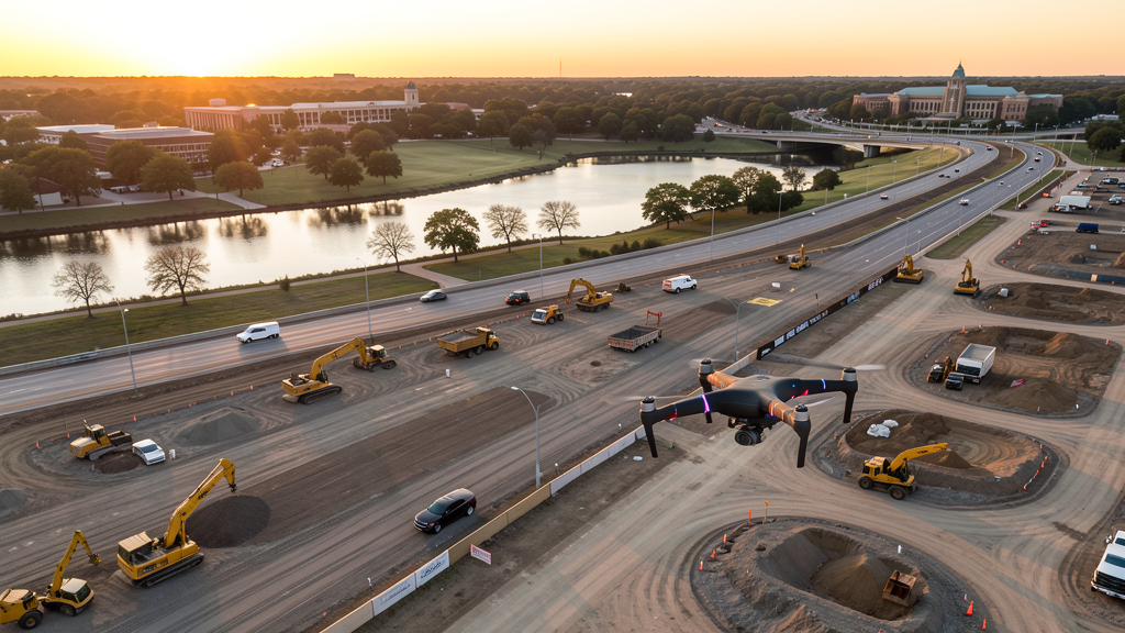
Waco is an I-35 corridor city of 140,000 between Austin and Dallas, experiencing a development boom driven by Magnolia Market tourism (1.5M annual visitors), Baylor University expansion, and the $341 million I-35 expansion through McLennan County. The Brazos River waterfront redevelopment, China Spring and Lorena residential growth, and the proposed Texas Central high-speed rail maintenance facility add diverse construction survey demand. ACT Class D airspace covers northwestern Waco, with most of the city in uncontrolled Class E.
Drone Surveys for Waco's Construction Market
Waco is experiencing a development boom driven by Magnolia Market (Fixer Upper TV show tourism), Baylor University campus expansion, and the I-35 expansion project through McLennan County. The Magnolia Market at the Silos draws 1.5 million annual visitors, generating hospitality, retail, and mixed-use development in the downtown and Silos district. Baylor University is constructing a new basketball facility, expanding the McLane Stadium entertainment district, and building new research and dormitory buildings. The $341 million I-35 expansion through Waco is a major heavy civil project generating continuous survey demand. The Brazos River waterfront redevelopment, including the Riverwalk expansion and the Washington Avenue bridge replacement, creates infrastructure survey work. The Waco Industrial Park and the Texas Central Partners high-speed rail maintenance facility (proposed) add industrial construction. McLennan County residential growth in the China Spring and Lorena areas continues to convert farmland to subdivisions.
Active Developers in the Area:
Typical Project Costs in Texas
Cost ranges are based on market data for Waco. Actual pricing depends on site size, complexity, and deliverables.
| Service Type | Low End | High End |
|---|---|---|
| Topographic Survey | $1,450 | $4,200 |
| Drone Inspection | $200 | $700 |
| LiDAR Scanning | $2,300 | $7,500 |
| Environmental Monitoring | $750 | $3,000 |
| Aerial Imagery | $150 | $400 |
| Construction Monitoring | $800 | $2,500 |
| Real Estate Photography | $125 | $350 |
| Roof Inspection | $175 | $650 |
Local Airspace & Regulations in Waco, TX
FAA Part 107 Requirements
All commercial drone operations in Texas require the pilot to hold an active FAA Part 107 Remote Pilot Certificate. Our network surveyors are verified Part 107 holders.
State Drone Laws
Texas Government Code Chapter 423 restricts drone use over critical infrastructure facilities, including oil and gas pipelines, refineries, power plants, and water treatment facilities. HB 1484 (2023) added protections for agricultural operations and expanded penalties for drone surveillance of private property. Commercial operators must hold a valid FAA Part 107 Remote Pilot Certificate. Texas does not require a separate state drone license, but operators flying near critical infrastructure must obtain authorization from the facility owner. The Texas Department of Public Safety maintains additional guidelines for drone operations near state facilities.
Local Ordinances
Waco does not issue a separate city-level drone permit for commercial operators. FAA Part 107 certification and LAANC authorization for ACT Class D airspace are the primary requirements. Commercial filming on city property requires a permit through the Waco Parks and Recreation Department. Drone takeoff and landing in city parks requires a special use permit, including Cameron Park, Indian Spring Park, and Riverwalk areas. Flights over Baylor University property require authorization from Baylor Public Safety. Flights near the Waco Mammoth National Monument are prohibited per National Park Service regulations.
Restricted Airspace
- Class D airspace around Waco Regional Airport (ACT) — located 5 miles northwest. ACT Class D covers northwestern Waco, including the McLennan Community College area and the Bosque Boulevard corridor. LAANC authorization required for commercial drone flights in this zone.
- Baylor University — campus drone flights require authorization from Baylor University Public Safety. Baylor has an active UAS program through their aviation sciences department. The McLane Stadium area on the Brazos River has stadium TFRs during Baylor football games prohibiting drone flights within 3 nautical miles up to 3,000 ft AGL.
- Magnolia Market at the Silos — large tourist destination with heavy foot traffic. Drone flights over the Silos district should follow Part 107.39 (no flight over people not directly involved in the operation). The area is a major tourist attraction drawing 1.5 million visitors annually.
- Brazos River corridor — the river flows through downtown Waco with active flood control infrastructure. Drone flights over the Brazos River should be coordinated with the Waco Public Works Department, especially during flood events. The river corridor has ongoing erosion and bank stabilization projects requiring survey work.
- Waco Mammoth National Monument — National Park Service property. Drone flights are prohibited within the monument boundaries per NPS regulations.
- Lake Waco — US Army Corps of Engineers managed reservoir. Drone flights over Lake Waco dam and spillway infrastructure should be coordinated with the USACE Waco Lake Office. The lake is a popular recreation area with heavy boat traffic on weekends.
- Severe weather: Waco is in the I-35 corridor tornado risk zone. The 1953 Waco tornado (F5) remains one of the deadliest in Texas history. Spring thunderstorms (April-June) can produce tornadoes, large hail, and flash flooding on the Brazos River. Post-storm roof inspection and flood damage documentation are significant drone survey use cases.
Airports in the area: undefined (undefined), undefined (undefined)
Why Hire Through Aerius View in Waco, TX?
FAA-Certified
Every surveyor holds an active Part 107 Remote Pilot Certificate.
Local to Waco
Surveyors who know the Texas airspace and local permitting.
No Cost to Quote
Submit your project at no charge. Pay the surveyor directly if you proceed.
Fast Turnaround
A local surveyor contacts you within 2 business days.
How Our Waco Matching Process Works
We're actively building our network of FAA-certified drone operators in Waco, TX. Here's exactly what happens when you submit a project request.
Submit Your Project
Tell us your site location, acreage, and what you need (topographic survey, LiDAR, inspection, etc.). Takes 60 seconds. No cost, no obligation.
We Match & Vet
We identify Part 107-certified operators in Texas with the right equipment for your project. Every pilot is verified for active certification, insurance, and relevant experience in Texas airspace.
You Get Quotes
Matched surveyors contact you within 2 business days with quotes. You compare pricing, timelines, and deliverables, then choose the right fit. You pay the surveyor directly, no markup.
What Deliverables Do You Get?
Every project includes professional-grade deliverables compatible with standard construction and engineering software:
- Orthomosaic maps (GeoTIFF) for site overview and documentation
- Point clouds (LAS/LAZ) for 3D modeling and volumetric analysis
- DEM/DSM terrain models for cut/fill and grade analysis
- Contour lines (DXF/DWG, CAD-ready) for Civil 3D and Revit
- Progress reports with side-by-side comparisons for construction monitoring
- Coordinate systems matched to your project datum (State Plane, UTM, or local)
Insurance & Liability Protection
Pilot Insurance Required
Every operator in our network must carry active liability insurance. Minimum coverage: $1,000,000 general liability. Proof of insurance is verified before any pilot joins the network.
FAA Part 107 Verified
We confirm each pilot's Remote Pilot Certificate is active and in good standing through the FAA Airmen Inquiry system. Expired certificates are flagged automatically.
Equipment Documentation
Pilots list their drone models, sensors (RGB, LiDAR, thermal, multispectral), and payload specs so we can match the right equipment to your project requirements.
Site Safety Coordination
Pilots coordinate with your site superintendent for safe operations on active construction sites, including flight plans that avoid worker areas and equipment zones.
Waco, TX Drone Survey FAQs
Do I need a permit for a drone survey in Waco?
Waco does not issue a separate city-level drone permit for commercial operators. FAA Part 107 certification is mandatory. LAANC authorization is required for flights in northwestern Waco within the ACT Class D zone. Drone takeoff and landing in city parks requires a special use permit. Flights over Baylor University require authorization from Baylor Public Safety. Flights near the Waco Mammoth National Monument are prohibited by NPS regulations.
How much does a drone survey cost in Waco?
Waco pricing is typically 10-15% below the Austin and DFW metro averages, reflecting the lower cost of living. Topographic surveys range from $1,450 to $4,200. LiDAR scanning runs $2,300 to $7,500. Roof inspections cost $175 to $650 per building. Construction monitoring is typically $800 to $2,500 per month for recurring flights at the I-35 expansion or Baylor campus sites.
Can I fly a drone near Magnolia Market at the Silos?
Magnolia Market is a major tourist destination drawing 1.5 million annual visitors. Drone flights over the Silos district should follow Part 107.39 (no flight over people not directly involved in the operation). The area has heavy pedestrian traffic, especially on weekends. Commercial survey flights should be scheduled during early morning hours before the venue opens and coordinated with Magnolia property management.
Are there stadium TFRs at Baylor's McLane Stadium?
Yes. McLane Stadium on the Brazos River has stadium TFRs during Baylor football games and ticketed events. Drone flights within 3 nautical miles up to 3,000 ft AGL are prohibited during events. The stadium area also has active boat traffic on the Brazos River and pedestrian traffic on the riverwalk. Always check the Baylor football schedule before planning survey flights near the stadium.
How does the I-35 expansion project affect drone survey demand in Waco?
The $341 million I-35 expansion through McLennan County is a major heavy civil project generating continuous demand for topographic surveys, construction monitoring, earthwork verification, and as-built documentation. TxDOT requires regular aerial progress documentation. Survey flights over the I-35 corridor should be coordinated with TxDOT contractors and maintain safe altitude above traffic.
What makes Waco unique for drone survey work?
Waco is an I-35 corridor city experiencing a tourism and development boom driven by Magnolia Market (1.5M annual visitors), Baylor University expansion, and the $341M I-35 project. The city offers Austin metro growth dynamics at lower cost, with less airspace complexity (only ACT Class D in the northwest). The Brazos River waterfront redevelopment and the proposed Texas Central high-speed rail add infrastructure survey demand. Waco's position between Austin and Dallas makes it a strategic I-35 corridor survey hub.
Nearby Cities
Are You a Drone Surveyor in Waco?
Get pre-qualified leads in your service area. No membership fees, no monthly minimums. First lead free.
Ready to Start Your Project in Waco, TX?
Get matched with a local, FAA-certified surveyor. No cost, no obligation.
Request a Free Quote