Drone Survey Services in Austin, TX
From Tesla's Gigafactory to Samsung's $17B semiconductor fab in Taylor, Austin's construction boom is reshaping Central Texas — and our local surveyors know the airspace, terrain, and regulations that come with it.
Serving Travis County & the Austin-Round Rock-Georgetown area
Request a Free Quote
Get Matched With a Local Surveyor
Drone Survey Services Available in Austin, TX
The Austin-Round Rock-Georgetown metro has been one of the fastest-growing in the US, expanding over 50% in a decade to 2.6 million residents. Major projects span semiconductor manufacturing, corporate campuses, and the $7.1B Project Connect light rail. For drone surveyors, this means sustained demand for topographic surveys, construction monitoring, and LiDAR mapping across a rapidly urbanizing Central Texas landscape.
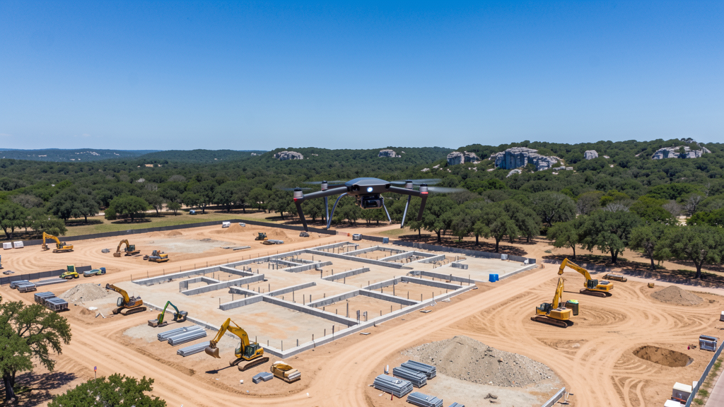
Drone Surveys for Austin's Construction Market
Austin is one of the fastest-growing construction markets in the United States, with the metro population expanding over 50% in a decade (1.7M to 2.6M). Major projects include Samsung's $17B+ semiconductor fab in Taylor, Tesla Gigafactory Texas ($1B+), Apple's $1B Austin campus, and the $7.1B Project Connect light rail system. The downtown high-rise boom continues with 31+ towers built or under construction. Master-planned communities in Williamson and Hays Counties drive steady demand for topographic surveys and construction monitoring. The SH 130 and I-35 corridors are active industrial and logistics development zones.
Active Developers in the Area:
Typical Project Costs in Texas
Cost ranges are based on market data for Austin-Round Rock-Georgetown. Actual pricing depends on site size, complexity, and deliverables.
| Service Type | Low End | High End |
|---|---|---|
| Topographic Survey | $1,500 | $5,000 |
| Drone Inspection | $250 | $800 |
| LiDAR Scanning | $3,000 | $12,000 |
| Environmental Monitoring | $1,000 | $5,000 |
| Aerial Imagery | $300 | $1,500 |
| Construction Monitoring | $500 | $2,500 |
| Real Estate Photography | $200 | $600 |
| Roof Inspection | $250 | $800 |
Local Airspace & Regulations in Austin, TX
FAA Part 107 Requirements
All commercial drone operations in Texas require the pilot to hold an active FAA Part 107 Remote Pilot Certificate. Our network surveyors are verified Part 107 holders.
State Drone Laws
Texas Government Code Chapter 423 restricts drone use over critical infrastructure facilities, including oil and gas pipelines, refineries, power plants, and water treatment facilities. HB 1484 (2023) added protections for agricultural operations and expanded penalties for drone surveillance of private property. Commercial operators must hold a valid FAA Part 107 Remote Pilot Certificate. Texas does not require a separate state drone license, but operators flying near critical infrastructure must obtain authorization from the facility owner. The Texas Department of Public Safety maintains additional guidelines for drone operations near state facilities.
Local Ordinances
Austin does not issue a separate city-level drone permit for commercial operators. FAA Part 107 certification and LAANC authorization for Class C/D airspace are the primary requirements. Commercial filming on city property requires a film permit through the Austin Film Commission. Austin Parks and Recreation (PARD) restricts drone takeoff/landing in designated park areas. TFR compliance is mandatory during major events (SXSW, ACL, F1). Written landowner permission is recommended for flights over private property.
Restricted Airspace
- Class C airspace around Austin-Bergstrom International (AUS) — 5 NM radius surface area with shelves to 10 NM, LAANC required
- Camp Mabry — Texas Army National Guard base in west-central Austin, restricted military airspace
- Camp Swift Training Center — active military training area in Bastrop County, ~30 miles east of Austin
- Class D airspace around Austin Executive Airport (EDC), LAANC required
- McKinney Falls State Park — drone use restricted under Texas Parks and Wildlife rules
- TFR zones for major events: SXSW, Austin City Limits, Formula 1 at Circuit of the Americas, VIP visits to Texas State Capitol
- Darrell K Royal-Texas Memorial Stadium / Moody Center — stadium TFRs during UT sporting events (3 NM, up to 3,000 ft AGL)
- Tesla Gigafactory Texas — critical infrastructure under TX HB 1643, drone flights below 400 ft AGL are a Class B misdemeanor without authorization
Airports in the area: undefined (undefined), undefined (undefined), undefined (undefined), undefined (undefined)
Why Hire Through Aerius View in Austin, TX?
FAA-Certified
Every surveyor holds an active Part 107 Remote Pilot Certificate.
Local to Austin
Surveyors who know the Texas airspace and local permitting.
No Cost to Quote
Submit your project at no charge. Pay the surveyor directly if you proceed.
Fast Turnaround
A local surveyor contacts you within 2 business days.
How Our Austin Matching Process Works
We're actively building our network of FAA-certified drone operators in Austin, TX. Here's exactly what happens when you submit a project request.
Submit Your Project
Tell us your site location, acreage, and what you need (topographic survey, LiDAR, inspection, etc.). Takes 60 seconds. No cost, no obligation.
We Match & Vet
We identify Part 107-certified operators in Texas with the right equipment for your project. Every pilot is verified for active certification, insurance, and relevant experience in Texas airspace.
You Get Quotes
Matched surveyors contact you within 2 business days with quotes. You compare pricing, timelines, and deliverables, then choose the right fit. You pay the surveyor directly, no markup.
What Deliverables Do You Get?
Every project includes professional-grade deliverables compatible with standard construction and engineering software:
- Orthomosaic maps (GeoTIFF) for site overview and documentation
- Point clouds (LAS/LAZ) for 3D modeling and volumetric analysis
- DEM/DSM terrain models for cut/fill and grade analysis
- Contour lines (DXF/DWG, CAD-ready) for Civil 3D and Revit
- Progress reports with side-by-side comparisons for construction monitoring
- Coordinate systems matched to your project datum (State Plane, UTM, or local)
Insurance & Liability Protection
Pilot Insurance Required
Every operator in our network must carry active liability insurance. Minimum coverage: $1,000,000 general liability. Proof of insurance is verified before any pilot joins the network.
FAA Part 107 Verified
We confirm each pilot's Remote Pilot Certificate is active and in good standing through the FAA Airmen Inquiry system. Expired certificates are flagged automatically.
Equipment Documentation
Pilots list their drone models, sensors (RGB, LiDAR, thermal, multispectral), and payload specs so we can match the right equipment to your project requirements.
Site Safety Coordination
Pilots coordinate with your site superintendent for safe operations on active construction sites, including flight plans that avoid worker areas and equipment zones.
Austin, TX Drone Survey FAQs
Do I need a permit to fly a drone commercially in Austin?
Austin does not issue a specific city-level drone permit. You must hold a valid FAA Part 107 Remote Pilot Certificate and obtain LAANC authorization to fly within the Class C airspace around Austin-Bergstrom International Airport (AUS). Commercial filming on city property may require a film permit through the Austin Film Commission.
How much does a drone survey cost in Austin?
Topographic surveys in the Austin metro typically range from $1,500 to $5,000 depending on acreage. Construction monitoring runs $500-$2,500 per month for recurring flights. Roof inspections cost $250-$800 per building. LiDAR surveys range $3,000-$12,000. Austin rates run about 10-20% above the Texas state average due to strong demand.
Can I fly my drone near Austin-Bergstrom International Airport?
Yes, with LAANC authorization. AUS has Class C controlled airspace extending approximately 5 NM radius at the surface with shelves to 10 NM. You must request and receive LAANC approval through an FAA-approved provider before flying. During major events like SXSW, ACL, or Formula 1, additional Temporary Flight Restrictions may apply.
Are there military no-drone zones in the Austin area?
Yes. Camp Mabry, a Texas Army National Guard base in west-central Austin, has restricted military airspace. Camp Swift Training Center in Bastrop County (~30 miles east) is an active training area. Under Texas HB 1643, flying over critical infrastructure like Tesla Gigafactory Texas below 400 ft is a Class B misdemeanor. Always check B4UFLY and FAA UAS Facility Maps before flying.
What is the typical turnaround time for drone survey deliverables in Austin?
Standard turnaround is 3-5 business days for aerial imagery and construction progress reports. Topographic surveys with photogrammetry take 5-7 business days. LiDAR processing with classification and contour generation takes 7-14 days depending on project size. Rush service (24-48 hours) is available at a 25-50% premium, especially for active construction sites along SH 130 and I-35.
Nearby Cities
Are You a Drone Surveyor in Austin?
Get pre-qualified leads in your service area. No membership fees, no monthly minimums. First lead free.
Ready to Start Your Project in Austin, TX?
Get matched with a local, FAA-certified surveyor. No cost, no obligation.
Request a Free Quote