Multispectral Imaging
Crop health analysis, NDVI mapping, and vegetation indices for agriculture. Detect plant stress before it is visible, optimize fertilizer and water inputs with prescription maps, and maximize yields with data-driven field management.
Request a Survey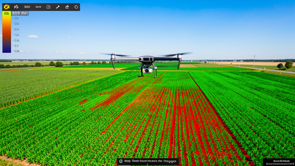
Cost range: $$1,200 – $$4,000
Turnaround: 2–5 business days
Coverage: 100+ acres per flight
Indices: NDVI, NDRE, GNDVI + more
Why Drone Multispectral Imaging?
Multispectral sensors capture light beyond what the human eye can see, revealing crop stress and variability that would otherwise go unnoticed until yield is already impacted.
Early Stress Detection
Multispectral sensors detect plant stress before it is visible to the human eye. Identify water, nutrient, pest, and disease issues weeks before they impact yield.
Variable Rate Input Maps
Generate prescription maps for targeted fertilizer, pesticide, and irrigation application. Reduce input costs by applying resources only where needed — not blanket across the field.
Comprehensive Vegetation Indices
NDVI, NDRE, GNDVI, SAVI, and more. Get the specific indices that matter for your crop and growth stage, delivered as easy-to-read color-coded maps.
Season-Long Monitoring
Track crop health throughout the growing season with scheduled flights. Compare indices week-over-week or month-over-month to measure treatment effectiveness and field performance.
Common Use Cases
- Crop health assessment for corn, soybeans, wheat, cotton, and specialty crops
- Variable rate application maps for fertilizer and pesticide optimization
- Irrigation management — identify water-stressed zones and drainage issues
- Pest and disease detection before visible symptoms appear in the field
- Yield prediction and harvest planning based on crop vigor data
- Research plots and trial monitoring for seed companies and agronomists
Multispectral Imaging FAQs
What is NDVI and how does it help my farm?
NDVI (Normalized Difference Vegetation Index) is a mathematical calculation using near-infrared and visible red light to measure plant health and vigor. Healthy plants reflect more near-infrared light and absorb more red light. NDVI maps highlight stressed areas in your field — from nutrient deficiencies to water stress to pest pressure — so you can act before yield is impacted.
What crops and growth stages benefit most from multispectral imaging?
Multispectral imaging is valuable across most crops — row crops (corn, soybeans, wheat), specialty crops (vineyards, orchards), and pasture. It is most useful from early vegetative stages through reproductive stages, when stress detection and intervention can still influence yield. For late-season monitoring, NDRE (red-edge) indices become more valuable than NDVI as canopies close.
How quickly will I receive my crop health maps?
Standard turnaround is 2-5 business days from flight to delivered maps. For time-sensitive applications (e.g., in-season scouting or pre-harvest assessment), expedited processing is available. We deliver geo-referenced maps compatible with John Deere, Trimble, Climate FieldView, and other precision agriculture platforms.
Can multispectral data integrate with my precision ag platform?
Yes. We deliver vegetation index maps as GeoTIFF files that import directly into most precision agriculture platforms including John Deere Operations Center, Trimble Ag, Climate FieldView, Granular, and AgLeader. Prescription shapefiles for variable rate application are available on request.
Ready to Analyze Your Fields?
Get matched with a local, FAA-certified surveyor. No cost, no obligation.
Request a Survey