Drone Survey Services in New Braunfels, TX
From Veramendi and Vintage Oaks to the I-35 expansion and the Guadalupe River corridor, New Braunfels is the fastest-growing city on the Austin-San Antonio I-35 stretch, where Hill Country terrain and master-planned communities drive diverse survey demand.
Serving Comal County & the San Antonio-New Braunfels area
Request a Free Quote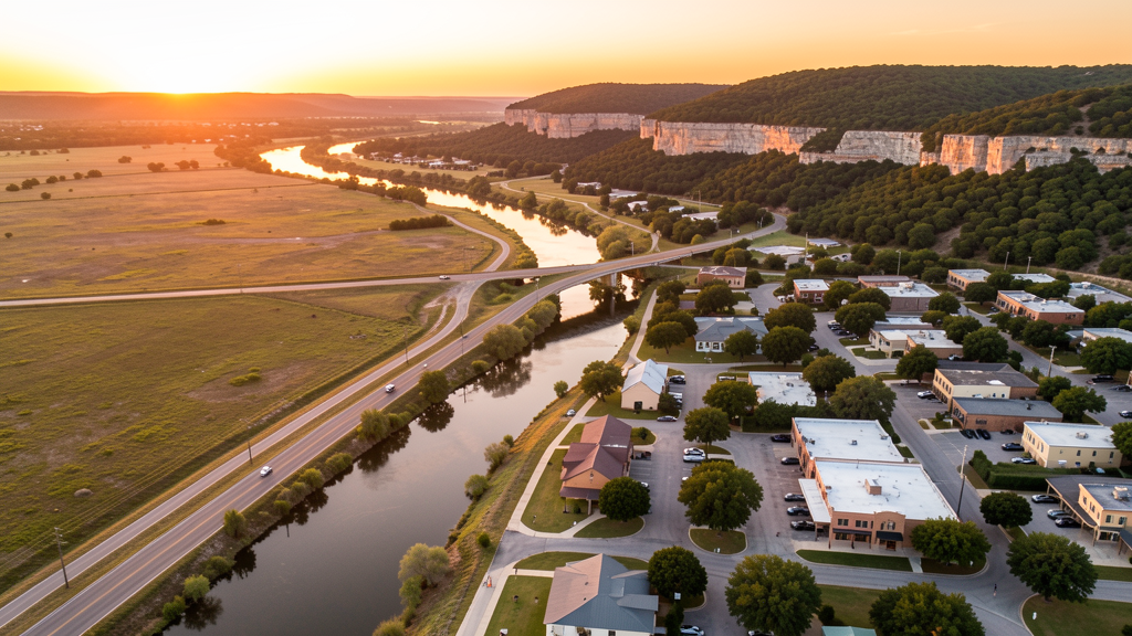
Get Matched With a Local Surveyor
Drone Survey Services Available in New Braunfels, TX
The San Antonio-New Braunfels metro is one of the fastest-growing in Texas, and New Braunfels anchors the I-35 corridor between Austin and San Antonio. Comal County was the sixth-fastest-growing county in the US from 2020-2023. Growth is driven by master-planned communities (Veramendi, Vintage Oaks, Voss Farms), outdoor tourism infrastructure (Schlitterbahn, Gruene, Guadalupe River), and the I-35 expansion project. The proximity to Randolph AFB and SAT Class C airspace creates moderate airspace complexity, while the Hill Country terrain in western Comal County makes LiDAR particularly valuable for survey work.
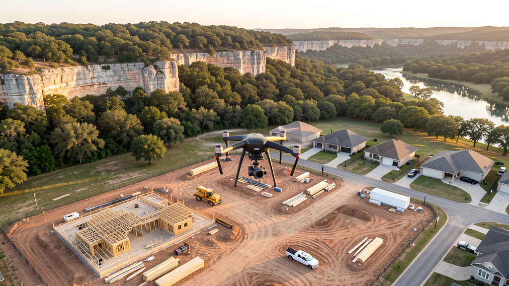
Drone Surveys for New Braunfels's Construction Market
New Braunfels sits on the I-35 corridor between Austin and San Antonio, one of the fastest-growing stretches in the United States. Comal County was the sixth-fastest-growing county in the US from 2020-2023. Master-planned communities are the primary growth driver: Veramendi (Johnson Development, 2,400 acres along the Guadalupe River), Vintage Oaks (Trendmaker Development, Hill Country luxury), and Voss Farms (east of I-35) generate sustained residential construction demand. The outdoor tourism economy, anchored by Schlitterbahn, Gruene Historic District, and Guadalupe River recreation, drives hospitality and commercial construction. The I-35 expansion project through Comal County is a major heavy civil undertaking. The new Texas Instruments semiconductor plant in nearby Lehi (I-35, 10 miles north) is driving ancillary commercial and residential development. The FA 46 bypass and the I-14 future corridor project add infrastructure construction demand.
Active Developers in the Area:
Typical Project Costs in Texas
Cost ranges are based on market data for San Antonio-New Braunfels. Actual pricing depends on site size, complexity, and deliverables.
| Service Type | Low End | High End |
|---|---|---|
| Topographic Survey | $1,600 | $5,000 |
| Drone Inspection | $225 | $800 |
| LiDAR Scanning | $2,800 | $9,500 |
| Environmental Monitoring | $850 | $3,500 |
| Aerial Imagery | $175 | $500 |
| Construction Monitoring | $900 | $2,800 |
| Real Estate Photography | $150 | $450 |
| Roof Inspection | $200 | $750 |
Local Airspace & Regulations in New Braunfels, TX
FAA Part 107 Requirements
All commercial drone operations in Texas require the pilot to hold an active FAA Part 107 Remote Pilot Certificate. Our network surveyors are verified Part 107 holders.
State Drone Laws
Texas Government Code Chapter 423 restricts drone use over critical infrastructure facilities, including oil and gas pipelines, refineries, power plants, and water treatment facilities. HB 1484 (2023) added protections for agricultural operations and expanded penalties for drone surveillance of private property. Commercial operators must hold a valid FAA Part 107 Remote Pilot Certificate. Texas does not require a separate state drone license, but operators flying near critical infrastructure must obtain authorization from the facility owner. The Texas Department of Public Safety maintains additional guidelines for drone operations near state facilities.
Local Ordinances
New Braunfels does not issue a separate city-level drone permit for commercial operators. FAA Part 107 certification and LAANC authorization for Class C airspace (SAT and AUS) are the primary requirements. Commercial filming on city property requires a permit through the New Braunfels Parks and Recreation Department. The city prohibits drone takeoff and landing in city parks without a special use permit, including Landa Park, Prince Solms Park, and Cypress Bend Park. Flights over the Guadalupe and Comal Rivers during peak tubing season (Memorial Day through Labor Day) are strongly discouraged due to the density of recreational users. Flights from private property (with owner permission) do not require a city permit but must comply with all FAA Part 107 rules and Texas Government Code Chapter 423 critical infrastructure restrictions. Canyon Lake dam and Corps of Engineers facilities are federal critical infrastructure.
Restricted Airspace
- Class C airspace around San Antonio International (SAT) — located 25 miles south. The northern shelves of SAT Class C extend into southern Comal County. LAANC authorization is required for commercial drone flights in southern New Braunfels, particularly along I-35 south of the Guadalupe River.
- Randolph Air Force Base (NZC) — located 20 miles southeast in Universal City. Randolph has Class C airspace and active military flight training operations, including T-6 Texan II and T-38 Talon jet traffic. Drone flights within 5 miles of Randolph require coordination with base operations. The base has joint-use Class C airspace with San Antonio International, creating a complex airspace environment in the southern portion of the metro.
- Class C airspace around Austin-Bergstrom (AUS) — located 40 miles north. The outer southern shelves of AUS Class C may extend into northern Comal County. Verify altitude shelves on FAA UAS Facility Maps for survey work in the Canyon Lake area and northern Comal County.
- Canyon Lake and Guadalupe River — managed by the US Army Corps of Engineers. Canyon Lake dam is critical infrastructure under TX Government Code Chapter 423. Drone flights over the dam and spillway require authorization. The Guadalupe River through New Braunfels is a major recreational tubing destination; drone flights over moving watercraft during peak summer recreation violate FAA Part 107 rules regarding flights over moving vehicles not under operator control.
- Gruene Historic District — while not formal restricted airspace, the density of tourists and outdoor events in Gruene means drone pilots should avoid weekend and holiday flights over the district. Commercial filming in Gruene requires a permit through the New Braunfels Historic Commission.
- Schlitterbahn Waterpark — large outdoor entertainment venue with seasonal operations. Drone flights over the waterpark during operating hours (May-August) are not advisable due to the density of guests and water attractions. Coordinate with park management for any off-season inspection work.
- Hill Country terrain and weather: western Comal County features significant elevation changes characteristic of the Texas Hill Country. Drone pilots must account for terrain-following altitude limits, as FAA Part 107 requires maintaining flight within 400 ft of the ground surface. Sudden weather changes, particularly spring thunderstorms and flash flooding in canyons, require real-time weather monitoring and flexible flight scheduling.
Airports in the area: undefined (undefined), undefined (undefined), undefined (undefined), undefined (undefined), undefined (undefined)
Why Hire Through Aerius View in New Braunfels, TX?
FAA-Certified
Every surveyor holds an active Part 107 Remote Pilot Certificate.
Local to New Braunfels
Surveyors who know the Texas airspace and local permitting.
No Cost to Quote
Submit your project at no charge. Pay the surveyor directly if you proceed.
Fast Turnaround
A local surveyor contacts you within 2 business days.
How Our New Braunfels Matching Process Works
We're actively building our network of FAA-certified drone operators in New Braunfels, TX. Here's exactly what happens when you submit a project request.
Submit Your Project
Tell us your site location, acreage, and what you need (topographic survey, LiDAR, inspection, etc.). Takes 60 seconds. No cost, no obligation.
We Match & Vet
We identify Part 107-certified operators in Texas with the right equipment for your project. Every pilot is verified for active certification, insurance, and relevant experience in Texas airspace.
You Get Quotes
Matched surveyors contact you within 2 business days with quotes. You compare pricing, timelines, and deliverables, then choose the right fit. You pay the surveyor directly, no markup.
What Deliverables Do You Get?
Every project includes professional-grade deliverables compatible with standard construction and engineering software:
- Orthomosaic maps (GeoTIFF) for site overview and documentation
- Point clouds (LAS/LAZ) for 3D modeling and volumetric analysis
- DEM/DSM terrain models for cut/fill and grade analysis
- Contour lines (DXF/DWG, CAD-ready) for Civil 3D and Revit
- Progress reports with side-by-side comparisons for construction monitoring
- Coordinate systems matched to your project datum (State Plane, UTM, or local)
Insurance & Liability Protection
Pilot Insurance Required
Every operator in our network must carry active liability insurance. Minimum coverage: $1,000,000 general liability. Proof of insurance is verified before any pilot joins the network.
FAA Part 107 Verified
We confirm each pilot's Remote Pilot Certificate is active and in good standing through the FAA Airmen Inquiry system. Expired certificates are flagged automatically.
Equipment Documentation
Pilots list their drone models, sensors (RGB, LiDAR, thermal, multispectral), and payload specs so we can match the right equipment to your project requirements.
Site Safety Coordination
Pilots coordinate with your site superintendent for safe operations on active construction sites, including flight plans that avoid worker areas and equipment zones.
New Braunfels, TX Drone Survey FAQs
Do I need a permit for a drone survey in New Braunfels?
New Braunfels does not issue a separate city-level drone permit for commercial operators. FAA Part 107 certification is mandatory. LAANC authorization is required for flights in southern New Braunfels within the SAT Class C shelves, and for flights near Randolph AFB (20 miles southeast). New Braunfels Regional Airport (ZCR) is uncontrolled Class E, so no LAANC is needed for flights near downtown and northern areas. Drone takeoff and landing in city parks requires a special use permit.
How much does a drone survey cost in New Braunfels and Comal County?
New Braunfels pricing falls between Austin and San Antonio metro averages. Topographic surveys typically range from $1,600 to $5,000, with Hill Country sites on the higher end due to terrain complexity. LiDAR scanning runs $2,800 to $9,500 for wooded or hilly sites in western Comal County. Roof inspections cost $200 to $750 per building. Construction monitoring is typically $900 to $2,800 per month for recurring flights at MPC sites like Veramendi and Vintage Oaks.
Can I fly a drone near Randolph Air Force Base?
Randolph Air Force Base (NZC) is located 20 miles southeast of New Braunfels and has Class C airspace with active military flight training. Drone flights within 5 miles of Randolph require coordination with base operations. The base has joint-use Class C airspace with San Antonio International, creating a complex airspace environment. For survey work in southern Comal County near I-35 and the FM 306 area, always check FAA UAS Facility Maps and B4UFLY for Randolph's airspace shelves.
Are there restrictions on flying drones over the Guadalupe River and Canyon Lake?
Yes. The Guadalupe River through New Braunfels is one of the most popular tubing destinations in Texas. During peak season (Memorial Day through Labor Day), the density of recreational users makes drone flights over the river impractical and potentially illegal under FAA Part 107 rules regarding flights over moving vehicles and vessels. Canyon Lake is managed by the US Army Corps of Engineers, and the dam is critical infrastructure under Texas law. Drone flights over the dam require authorization from the Corps of Engineers.
Does the Hill Country terrain affect drone survey operations in New Braunfels?
Yes. Western Comal County features significant elevation changes typical of the Texas Hill Country, with limestone bluffs, deep canyons, and cedar-covered hills. FAA Part 107 requires maintaining flight within 400 ft of the ground surface, which is challenging in hilly terrain. LiDAR is particularly valuable here, as photogrammetry alone struggles with the dense cedar and oak canopy. Pilots must account for terrain-following altitude, sudden weather changes, and flash flooding in canyons during spring thunderstorm season.
What makes New Braunfels unique for drone survey work?
New Braunfels sits on the I-35 corridor between Austin and San Antonio, one of the fastest-growing stretches in the US. Comal County was the sixth-fastest-growing county in the country from 2020-2023. The combination of master-planned community construction (Veramendi, Vintage Oaks), Hill Country terrain requiring LiDAR, outdoor tourism infrastructure, and proximity to both Randolph AFB military airspace and SAT Class C creates a unique mix of high construction demand and moderate airspace complexity. The new Texas Instruments semiconductor plant 10 miles north adds industrial survey demand.
Nearby Cities
Are You a Drone Surveyor in New Braunfels?
Get pre-qualified leads in your service area. No membership fees, no monthly minimums. First lead free.
Ready to Start Your Project in New Braunfels, TX?
Get matched with a local, FAA-certified surveyor. No cost, no obligation.
Request a Free Quote