Mining Surveying
Comprehensive mine site surveys, pit mapping, tailings monitoring, and safety inspections using drone photogrammetry and LiDAR. Reduce operational risk, improve efficiency, and maintain compliance with detailed aerial data — captured without putting personnel in harm's way.
Request a Survey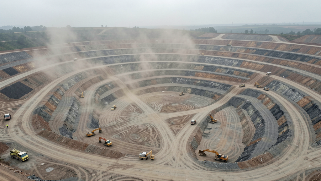
Cost range: $$2,000 – $$8,000
Turnaround: 3–7 business days
Coverage: Full mine site per mission
Accuracy: 1–5 cm with RTK
Why Drone Mining Surveys?
Drones transform mine site surveying by accessing hazardous areas safely, capturing comprehensive data faster, and delivering results compatible with your existing mine planning tools.
Safer Site Inspections
Drones access high-risk areas — open pits, high walls, and tailings dams — without putting personnel in danger. Inspect critical infrastructure remotely and reduce exposure risk.
Comprehensive Pit Mapping
Generate detailed 3D models of open-pit mines, track bench progress, and monitor wall stability with centimeter-level accuracy using drone photogrammetry and LiDAR.
Tailings Dam Monitoring
Regular aerial surveys of tailings storage facilities for volume tracking, seepage detection, and compliance reporting. Identify potential issues before they become incidents.
Efficient Volume Tracking
Monitor extraction volumes, stockpile changes, and overburden movement with automated comparison tools. Track material from pit to processing to stockyard.
Common Use Cases
- Open-pit mine surveying and bench progress monitoring
- Tailings dam volume tracking and structural integrity assessment
- Stockpile and ROM pad volume measurement for inventory reconciliation
- High wall and bench stability inspection without personnel exposure
- Mine site infrastructure inspection — conveyors, crushers, processing plants
- Reclamation and rehabilitation progress monitoring for closure planning
Mining Surveying FAQs
How do drones improve safety at mine sites?
Drones eliminate the need for surveyors to physically access hazardous areas like high walls, active benches, and tailings dams. Pilots can inspect slopes for signs of instability, map stockpiles, and monitor infrastructure — all from a safe distance. This reduces risk exposure and supports mine safety management plans.
What mining deliverables do you provide?
Deliverables include 3D point clouds (LAS/LAZ), digital elevation models, orthomosaic maps of the mine site, per-area volume reports, slope and bench geometry measurements, and time-series comparison reports showing changes between survey dates. All data is geo-referenced and compatible with mine planning software.
How frequently should mine sites be surveyed?
Active mine sites typically benefit from weekly or bi-weekly drone surveys for production tracking. Tailings dams and high-risk areas should be monitored monthly at minimum. We work with your team to establish a survey schedule that balances safety, compliance, and operational needs.
Can drone surveys integrate with our mine planning software?
Yes. We deliver data in standard formats (LAS/LAZ point clouds, GeoTIFF orthomosaics, DXF contours) that import directly into Surpac, Vulcan, Datamine, AutoCAD, and other common mine planning and GIS platforms. Custom format delivery is available on request.
Ready to Survey Your Mine Site?
Get matched with a local, FAA-certified surveyor. No cost, no obligation.
Request a Survey