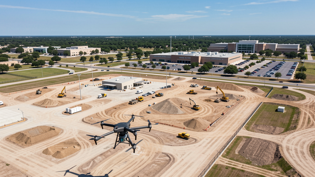
Drone Survey Services in San Antonio, TX
From Joint Base San Antonio — the DoD's largest joint base — and the 3,700-acre Alamo Ranch MPC to the Pearl Brewery district and the Medical Center/USAA complex, San Antonio's $20B+ construction market spans military, master-planned, and cultural redevelopment sectors across one of the most airspace-complex metros in Texas.
Serving Bexar County & the San Antonio-New Braunfels area
Request a Free Quote
Get Matched With a Local Surveyor
Drone Survey Services Available in San Antonio, TX
The San Antonio-New Braunfels metro (2.6M residents) is the third-largest in Texas and anchors a $20B+ construction market driven by three forces: Joint Base San Antonio (the DoD's largest joint base, comprising Lackland, Randolph, and Fort Sam Houston) generates continuous military construction; master-planned communities like Alamo Ranch (3,700+ acres), Stone Oak, and Cibolo Canyons convert ranchland to residential at scale; and the Pearl Brewery district, Southside Mission Reach, and Medical Center/USAA complex drive institutional and mixed-use redevelopment. The city's airspace is among the most complex in Texas, with SAT Class C, RND Class D, SKF military restricted, and JBSA installation zones requiring careful flight planning.
Drone Surveys for San Antonio's Construction Market
San Antonio is the seventh-largest city in the United States (1.5M residents, 2.6M metro) and anchors a $20B+ construction market — one of the largest in Texas. The city's growth is driven by three major sectors: military construction (Joint Base San Antonio — the DoD's largest joint base, comprising Lackland AFB, Randolph AFB, and Fort Sam Houston — generates continuous barracks, training facility, medical, and airfield construction), master-planned communities (Alamo Ranch on the far west side is one of the largest MPCs in the U.S. at 3,700+ acres; additional MPCs include Cibolo Canyons, Rogers Ranch, and Stone Oak on the north side), and institutional/commercial redevelopment (the Pearl Brewery district north of downtown has transformed 22 acres of historic brewery buildings into a mixed-use cultural district; the Southside redevelopment corridor along the Mission Reach of the San Antonio River is converting industrial land to residential and commercial; the Medical Center/USAA complex on the northwest side is one of the largest healthcare campuses in the country, generating continuous medical facility construction). The US 281 and Loop 1604 highway expansion projects, the Vista Ridge water pipeline, and the CPS Energy solar and grid modernization programs add heavy civil and utility survey demand. Toyota's Tundra truck manufacturing plant on the south side and the forthcoming Navistar truck plant add industrial construction.
Active Developers in the Area:
Typical Project Costs in Texas
Cost ranges are based on market data for San Antonio-New Braunfels. Actual pricing depends on site size, complexity, and deliverables.
| Service Type | Low End | High End |
|---|---|---|
| Topographic Survey | $1,400 | $4,500 |
| Drone Inspection | $200 | $750 |
| LiDAR Scanning | $2,400 | $8,500 |
| Environmental Monitoring | $800 | $3,200 |
| Aerial Imagery | $150 | $450 |
| Construction Monitoring | $850 | $2,600 |
| Real Estate Photography | $140 | $400 |
| Roof Inspection | $180 | $700 |
Local Airspace & Regulations in San Antonio, TX
FAA Part 107 Requirements
All commercial drone operations in Texas require the pilot to hold an active FAA Part 107 Remote Pilot Certificate. Our network surveyors are verified Part 107 holders.
State Drone Laws
Texas Government Code Chapter 423 restricts drone use over critical infrastructure facilities, including oil and gas pipelines, refineries, power plants, and water treatment facilities. HB 1484 (2023) added protections for agricultural operations and expanded penalties for drone surveillance of private property. Commercial operators must hold a valid FAA Part 107 Remote Pilot Certificate. Texas does not require a separate state drone license, but operators flying near critical infrastructure must obtain authorization from the facility owner. The Texas Department of Public Safety maintains additional guidelines for drone operations near state facilities.
Local Ordinances
San Antonio does not issue a separate city-level drone permit for commercial operators. FAA Part 107 certification and LAANC authorization for Class C (SAT) and Class D (RND) airspace are the primary requirements. The City of San Antonio prohibits drone takeoff and landing in city parks without a special use permit from the Parks and Recreation Department, including Brackenridge Park, McAllister Park, and Hardberger Park. Commercial filming on city property, including the River Walk and Alamo Plaza, requires a permit through the San Antonio Film Commission. Flights over Joint Base San Antonio installations (Lackland, Randolph, Fort Sam Houston) require DoD authorization — city permits do not cover military airspace. Flights from private property (with owner permission) do not require a city permit but must comply with all FAA Part 107 rules, Texas Government Code Chapter 423 critical infrastructure restrictions, and JBSA airspace restrictions.
Restricted Airspace
- Class C airspace around San Antonio International Airport (SAT) — located in north central San Antonio. LAANC authorization is required for commercial drone flights within the Class C shelves, which extend across much of the north-central, downtown, and northwest areas including the Medical Center, USAA complex, and Pearl Brewery district. The Class C surface area has a 5 nautical mile radius, with shelves extending to 10 nautical miles.
- Kelly Field (SKF) and Joint Base San Antonio-Lackland — military restricted airspace on the southwest side. Drone flights are prohibited without explicit FAA and DoD authorization. The Lackland AFB training areas and Kelly Field runway approaches create extensive restricted zones. Commercial operators must avoid all JBSA-Lackland airspace and coordinate with base operations for any flights within 5 nautical miles.
- Joint Base San Antonio-Randolph (RND) — located 15 miles northeast in Universal City. Randolph AFB has Class D airspace and restricted military operating areas. Drone flights within the RND Class D require LAANC authorization. The base is home to Air Education and Training Command and generates continuous military construction and survey demand.
- Joint Base San Antonio-Fort Sam Houston — located in central San Antonio. The post has restricted airspace and security zones around Brooks Medical Center, the BAMC complex, and training areas. Drone flights over the installation require DoD authorization. The Fort Sam Houston area is adjacent to the downtown and East Side neighborhoods.
- Stinson Municipal Airport (SKY) — located on the south side, uncontrolled Class E airspace. No LAANC required for most of south San Antonio. However, SKY has active general aviation traffic including flight training and vintage aircraft operations. Pilots should monitor CTAF and maintain visual separation, especially during weekend traffic and airshow events.
- San Antonio Missions National Historical Park and the Alamo — while not formal restricted airspace, these National Park Service and state historic sites have strict no-drone policies. Drone flights over the Alamo, San Antonio Missions (Mission Concepción, Mission San José, Mission San Juan, Mission Espada), and the San Antonio River Walk are prohibited by NPS regulations and city ordinance. Violations are actively enforced by park rangers and SAPD.
- Six Flags Fiesta Texas and SeaWorld San Antonio — theme park TFRs during events and peak operating season prohibit drone flights within 3 nautical miles up to 3,000 ft AGL. The Fiesta Texas area in northwest San Antonio near La Cantera and the SeaWorld area on the far west side are actively monitored during operating hours.
- Flash flooding and weather: San Antonio sits on the Balcones Escarpment and is crossed by the San Antonio River, Salado Creek, and Leon Creek — all prone to flash flooding during spring and fall thunderstorms. The city experienced severe flooding in 1998, 2002, and 2013. Post-flood survey work requires coordination with Bexar County Emergency Management. Summer heat (100°F+ days from June through September) limits flight windows to early morning and late evening. High humidity affects equipment and battery performance.
Airports in the area: undefined (undefined), undefined (undefined), undefined (undefined)
Why Hire Through Aerius View in San Antonio, TX?
FAA-Certified
Every surveyor holds an active Part 107 Remote Pilot Certificate.
Local to San Antonio
Surveyors who know the Texas airspace and local permitting.
No Cost to Quote
Submit your project at no charge. Pay the surveyor directly if you proceed.
Fast Turnaround
A local surveyor contacts you within 2 business days.
How Our San Antonio Matching Process Works
We're actively building our network of FAA-certified drone operators in San Antonio, TX. Here's exactly what happens when you submit a project request.
Submit Your Project
Tell us your site location, acreage, and what you need (topographic survey, LiDAR, inspection, etc.). Takes 60 seconds. No cost, no obligation.
We Match & Vet
We identify Part 107-certified operators in Texas with the right equipment for your project. Every pilot is verified for active certification, insurance, and relevant experience in Texas airspace.
You Get Quotes
Matched surveyors contact you within 2 business days with quotes. You compare pricing, timelines, and deliverables, then choose the right fit. You pay the surveyor directly, no markup.
What Deliverables Do You Get?
Every project includes professional-grade deliverables compatible with standard construction and engineering software:
- Orthomosaic maps (GeoTIFF) for site overview and documentation
- Point clouds (LAS/LAZ) for 3D modeling and volumetric analysis
- DEM/DSM terrain models for cut/fill and grade analysis
- Contour lines (DXF/DWG, CAD-ready) for Civil 3D and Revit
- Progress reports with side-by-side comparisons for construction monitoring
- Coordinate systems matched to your project datum (State Plane, UTM, or local)
Insurance & Liability Protection
Pilot Insurance Required
Every operator in our network must carry active liability insurance. Minimum coverage: $1,000,000 general liability. Proof of insurance is verified before any pilot joins the network.
FAA Part 107 Verified
We confirm each pilot's Remote Pilot Certificate is active and in good standing through the FAA Airmen Inquiry system. Expired certificates are flagged automatically.
Equipment Documentation
Pilots list their drone models, sensors (RGB, LiDAR, thermal, multispectral), and payload specs so we can match the right equipment to your project requirements.
Site Safety Coordination
Pilots coordinate with your site superintendent for safe operations on active construction sites, including flight plans that avoid worker areas and equipment zones.
San Antonio, TX Drone Survey FAQs
Do I need a permit for a drone survey in San Antonio?
San Antonio does not issue a separate city-level drone permit for commercial operators. FAA Part 107 certification is mandatory. LAANC authorization is required for flights within the SAT Class C airspace (north-central, downtown, and northwest areas) and the RND Class D zone (northeast near Universal City). South San Antonio near Stinson Municipal Airport (SKY) is uncontrolled Class E, where no LAANC is needed. Drone takeoff and landing in city parks requires a special use permit from San Antonio Parks and Recreation.
How much does a drone survey cost in San Antonio?
San Antonio pricing is competitive with other major Texas metros but slightly below Austin and Dallas. Topographic surveys typically range from $1,400 to $4,500. LiDAR scanning runs $2,400 to $8,500 for wooded, hilly, or military-adjacent sites. Roof inspections cost $180 to $700 per building. Construction monitoring is typically $850 to $2,600 per month for recurring flights at Alamo Ranch, the Medical Center, or JBSA construction sites.
Can I fly a drone near Joint Base San Antonio?
No. Joint Base San Antonio installations (Lackland AFB, Randolph AFB, Fort Sam Houston) have military restricted airspace. Drone flights are prohibited without explicit FAA and DoD authorization. The Kelly Field (SKF) runway approaches and Lackland training areas create extensive restricted zones on the southwest side. Randolph AFB (RND) has Class D airspace requiring LAANC authorization within 4 nautical miles. Fort Sam Houston in central San Antonio has security zones around BAMC and training areas. Always check FAA UAS Facility Maps and coordinate with JBSA base operations before any flights near military installations.
Are there no-fly zones around the Alamo and the San Antonio Missions?
Yes. The Alamo, San Antonio Missions National Historical Park (Mission Concepción, Mission San José, Mission San Juan, Mission Espada), and the San Antonio River Walk have strict no-drone policies enforced by the National Park Service, Texas General Land Office, and the City of San Antonio. Commercial filming in these areas requires permits through the San Antonio Film Commission. Drone flights over these historic and cultural sites are prohibited by NPS regulations and city ordinance — violations can result in federal citations and fines.
Does San Antonio's military presence affect drone operations?
Yes, significantly. San Antonio is home to Joint Base San Antonio — the largest joint base in the Department of Defense, comprising Lackland AFB (southwest), Randolph AFB (northeast, Class D), and Fort Sam Houston (central). The Kelly Field (SKF) restricted zone covers much of the southwest side. The SAT Class C airspace in north-central San Antonio adds LAANC requirements. Together, these controlled and restricted zones mean that a large portion of the city requires airspace authorization or is off-limits to drones. Always check FAA UAS Facility Maps before flying.
What makes San Antonio unique for drone survey work?
San Antonio combines a $20B+ construction market with the largest joint military base in the U.S., creating unique survey demand across three sectors: military construction (JBSA barracks, training facilities, medical complexes), master-planned communities (Alamo Ranch at 3,700+ acres is one of the largest MPCs in the country; Stone Oak and Cibolo Canyons on the north side), and institutional/cultural redevelopment (Pearl Brewery district, Southside Mission Reach, Medical Center/USAA complex). The city's mix of Class C (SAT), Class D (RND), military restricted (SKF, JBSA), and uncontrolled Class E (SKY) airspace makes it one of the most airspace-complex major cities in Texas — survey operators must carefully plan flight locations around multiple controlled and restricted zones.
Nearby Cities
Are You a Drone Surveyor in San Antonio?
Get pre-qualified leads in your service area. No membership fees, no monthly minimums. First lead free.
Ready to Start Your Project in San Antonio, TX?
Get matched with a local, FAA-certified surveyor. No cost, no obligation.
Request a Free Quote