Drone Survey Services in Evans, CO
Evans is a fast-growing Greeley suburb with residential subdivisions expanding along the US 85 corridor, driven by national homebuilders attracted by relatively affordable Weld County land.
Serving Weld County & the Greeley MSA area
Request a Free Quote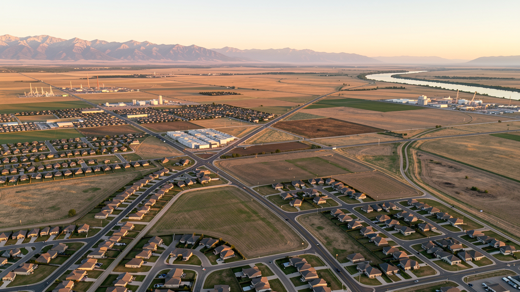
Get Matched With a Local Surveyor
Drone Survey Services Available in Evans, CO
Evans is a suburban community in Weld County directly adjacent to Greeley, benefiting from the Northern Colorado employment market while offering more affordable residential land. The city is growing at 3-4% annually with residential development from national homebuilders. The adjacent Greeley-Weld County Airport is untowered Class G, making most drone operations straightforward for Part 107 pilots.
Drone Surveys for Evans's Construction Market
Evans is a fast-growing suburb of Greeley in Weld County, with annual growth of approximately 3-4% driven by residential expansion and its proximity to the Greeley employment market. Major projects include residential subdivision development along the US 85 corridor, the Evans Riverside Park area improvements, and ongoing single-family home construction by national homebuilders. Infrastructure spending includes water system expansion and road improvements along 37th Street and US 85. The city benefits from relatively affordable land compared to the Denver metro.
Active Developers in the Area:

Typical Project Costs in Colorado
Cost ranges are based on market data for Greeley MSA. Actual pricing depends on site size, complexity, and deliverables.
| Service Type | Low End | High End |
|---|---|---|
| Topographic Survey | $950 | $3,800 |
| Drone Inspection | $700 | $2,600 |
| LiDAR Scanning | $2,100 | $7,200 |
| Environmental Monitoring | $1,300 | $4,400 |
| Aerial Imagery | $500 | $2,000 |
| Construction Monitoring | $850 | $3,400 |
| Real Estate Photography | $250 | $950 |
| Roof Inspection | $300 | $1,300 |
Local Airspace & Regulations in Evans, CO
FAA Part 107 Requirements
All commercial drone operations in Colorado require the pilot to hold an active FAA Part 107 Remote Pilot Certificate. Our network surveyors are verified Part 107 holders.
State Drone Laws
Colorado HB 1070 (2023) aligns state drone law with federal FAA Part 107 requirements. The law prohibits local municipalities from regulating drone flight paths or airspace, but allows cities to regulate takeoff and landing on public property. Colorado does not require a separate state-level drone license. Commercial drone operators must hold a valid FAA Part 107 Remote Pilot Certificate and comply with all federal regulations. The Colorado Department of Transportation has additional guidelines for drone operations near state highways and infrastructure.
Local Ordinances
Evans Municipal Code requires commercial drone operators to obtain a city business license with proof of FAA Part 107 certification. Drone takeoff and landing in city parks requires authorization from the Evans Parks and Recreation Department. Commercial filming permits are issued through the City Clerks Office. Evans does not have a standalone drone-specific ordinance but regulates through parks, nuisance, and business licensing provisions.
Restricted Airspace
- KGXY is untowered Class G, so no LAANC authorization required for most Evans operations. However, operators must yield right-of-way to manned aircraft and avoid the airport traffic pattern.
- Weld County oil and gas infrastructure: extensive well pads and compressor stations throughout the area. Operators should maintain safe distances and coordinate with facility operators.
- No national parks nearby. Rocky Mountain National Park is approximately 50 miles west.
- Pawnee National Grassland 25 miles northeast with USDA Forest Service management; drone operations generally permitted but check local restrictions.
- No military bases nearby. Buckley SFB is approximately 50 miles south.
Airports in the area: undefined (undefined), undefined (undefined), undefined (undefined)
Why Hire Through Aerius View in Evans, CO?
FAA-Certified
Every surveyor holds an active Part 107 Remote Pilot Certificate.
Local to Evans
Surveyors who know the Colorado airspace and local permitting.
No Cost to Quote
Submit your project at no charge. Pay the surveyor directly if you proceed.
Fast Turnaround
A local surveyor contacts you within 2 business days.
How Our Evans Matching Process Works
We're actively building our network of FAA-certified drone operators in Evans, CO. Here's exactly what happens when you submit a project request.
Submit Your Project
Tell us your site location, acreage, and what you need (topographic survey, LiDAR, inspection, etc.). Takes 60 seconds. No cost, no obligation.
We Match & Vet
We identify Part 107-certified operators in Colorado with the right equipment for your project. Every pilot is verified for active certification, insurance, and relevant experience in Colorado airspace.
You Get Quotes
Matched surveyors contact you within 2 business days with quotes. You compare pricing, timelines, and deliverables, then choose the right fit. You pay the surveyor directly, no markup.
What Deliverables Do You Get?
Every project includes professional-grade deliverables compatible with standard construction and engineering software:
- Orthomosaic maps (GeoTIFF) for site overview and documentation
- Point clouds (LAS/LAZ) for 3D modeling and volumetric analysis
- DEM/DSM terrain models for cut/fill and grade analysis
- Contour lines (DXF/DWG, CAD-ready) for Civil 3D and Revit
- Progress reports with side-by-side comparisons for construction monitoring
- Coordinate systems matched to your project datum (State Plane, UTM, or local)
Insurance & Liability Protection
Pilot Insurance Required
Every operator in our network must carry active liability insurance. Minimum coverage: $1,000,000 general liability. Proof of insurance is verified before any pilot joins the network.
FAA Part 107 Verified
We confirm each pilot's Remote Pilot Certificate is active and in good standing through the FAA Airmen Inquiry system. Expired certificates are flagged automatically.
Equipment Documentation
Pilots list their drone models, sensors (RGB, LiDAR, thermal, multispectral), and payload specs so we can match the right equipment to your project requirements.
Site Safety Coordination
Pilots coordinate with your site superintendent for safe operations on active construction sites, including flight plans that avoid worker areas and equipment zones.
Evans, CO Drone Survey FAQs
What airspace restrictions apply to drone operations in Evans?
Evans is adjacent to Greeley-Weld County Airport (GXY), which is an untowered GA airport with Class G airspace. No LAANC authorization is required for most drone operations in Evans. Operators must still yield right-of-way to manned aircraft and avoid the airport traffic pattern, which is about 2 miles northeast of downtown Evans.
Do I need a business license for commercial drone operations in Evans?
Yes. Evans requires commercial businesses operating within city limits to obtain a municipal business license. Drone operators must hold a valid FAA Part 107 Remote Pilot Certificate and carry appropriate liability insurance.
What construction projects are driving drone survey demand in Evans?
Residential subdivision development along the US 85 corridor, single-family home construction by national homebuilders including DR Horton and Richmond American, Evans Riverside Park area improvements, and water system expansion and road improvements along 37th Street are the primary drivers. The city 3-4% annual growth rate creates consistent demand for topographic surveys and construction monitoring.
How does oil and gas activity in Weld County affect drone operations near Evans?
Weld County has the highest density of oil and gas wells in Colorado. While Evans itself has less intensive oil and gas activity than surrounding unincorporated areas, operators flying east or north of the city should be aware of well pads, compressor stations, and pipeline corridors. Coordinate with facility operators when surveying near active sites.
Can I fly a drone in Evans city parks?
Drone takeoff and landing in Evans city parks requires authorization from the Parks and Recreation Department. Commercial operators must provide proof of FAA Part 107 certification and liability insurance. Contact the Parks Division for permit requirements before conducting surveys in park areas.
Nearby Cities
Are You a Drone Surveyor in Evans?
Get pre-qualified leads in your service area. No membership fees, no monthly minimums. First lead free.
Ready to Start Your Project in Evans, CO?
Get matched with a local, FAA-certified surveyor. No cost, no obligation.
Request a Free Quote