Drone Survey Services in Greeley, CO
From UCHealth hospital expansion to thousands of Weld County well pad surveys, Greeley combines healthcare campus growth with energy infrastructure inspection at a scale unique to Northern Colorado.
Serving Weld County & the Greeley MSA area
Request a Free Quote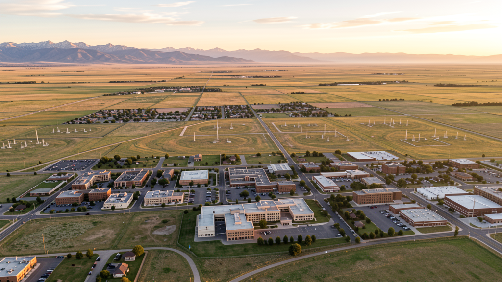
Get Matched With a Local Surveyor
Drone Survey Services Available in Greeley, CO
Greeley is the seat of Weld County and the largest city in the Northern Colorado region outside the Denver metro. Its economy is driven by agriculture, meat processing (JBS USA headquarters), the energy sector, and the University of Northern Colorado. Weld County leads Colorado in oil and gas production, creating a distinctive market for drone-based infrastructure inspection and environmental monitoring. The city is growing steadily as housing affordability pushes Denver metro workers northward.
Drone Surveys for Greeley's Construction Market
Greeley is experiencing strong growth of approximately 2.5-3.5% annually, driven by the energy sector, agricultural processing, and its role as the Weld County seat. Major construction includes the University of Northern Colorado campus improvements (Campus Commons project), UCHealth Greeley Hospital expansion, and significant residential development on the west and north sides. Weld County leads Colorado in oil and gas production, generating ongoing demand for pipeline surveying, well pad mapping, and environmental monitoring. Infrastructure spending includes US 34 corridor improvements and Greeley Water and Sewer system expansion.
Active Developers in the Area:

Typical Project Costs in Colorado
Cost ranges are based on market data for Greeley MSA. Actual pricing depends on site size, complexity, and deliverables.
| Service Type | Low End | High End |
|---|---|---|
| Topographic Survey | $1,000 | $4,000 |
| Drone Inspection | $750 | $2,800 |
| LiDAR Scanning | $2,200 | $7,500 |
| Environmental Monitoring | $1,400 | $4,800 |
| Aerial Imagery | $550 | $2,200 |
| Construction Monitoring | $900 | $3,800 |
| Real Estate Photography | $250 | $1,000 |
| Roof Inspection | $350 | $1,400 |
Local Airspace & Regulations in Greeley, CO
FAA Part 107 Requirements
All commercial drone operations in Colorado require the pilot to hold an active FAA Part 107 Remote Pilot Certificate. Our network surveyors are verified Part 107 holders.
State Drone Laws
Colorado HB 1070 (2023) aligns state drone law with federal FAA Part 107 requirements. The law prohibits local municipalities from regulating drone flight paths or airspace, but allows cities to regulate takeoff and landing on public property. Colorado does not require a separate state-level drone license. Commercial drone operators must hold a valid FAA Part 107 Remote Pilot Certificate and comply with all federal regulations. The Colorado Department of Transportation has additional guidelines for drone operations near state highways and infrastructure.
Local Ordinances
Greeley Municipal Code Chapter 10.20 prohibits drone takeoff and landing in city parks without prior authorization from Parks and Recreation. Greeley Municipal Code Chapter 5.06 requires commercial drone operators to obtain a city business license with proof of FAA Part 107 certification. Commercial drone photography on city property requires a film/production permit through the Greeley Culture, Parks, and Recreation Department with insurance documentation and Part 107 proof. Weld County does not have specific drone ordinances beyond FAA compliance, but oil and gas operators on private land may impose their own restrictions.
Restricted Airspace
- DEN Class B airspace does not extend to Greeley at typical drone operating altitudes (under 400 AGL). No LAANC authorization needed for most Greeley operations.
- Rocky Mountain National Park (40 miles southwest) prohibits drone operations within park boundaries under 36 CFR 1.5. Not a direct factor for Greeley but relevant for operators traveling from the area.
- Pawnee National Grassland (25 miles northeast) is USDA Forest Service managed; drone operations generally permitted but operators should check local signage. No formal TFR.
- Weld County oil and gas infrastructure: extensive well pads and compressor stations throughout Weld County are critical infrastructure but not formal TFR zones. Operators should maintain safe distances and coordinate with facility operators.
Airports in the area: undefined (undefined), undefined (undefined), undefined (undefined)
Why Hire Through Aerius View in Greeley, CO?
FAA-Certified
Every surveyor holds an active Part 107 Remote Pilot Certificate.
Local to Greeley
Surveyors who know the Colorado airspace and local permitting.
No Cost to Quote
Submit your project at no charge. Pay the surveyor directly if you proceed.
Fast Turnaround
A local surveyor contacts you within 2 business days.
How Our Greeley Matching Process Works
We're actively building our network of FAA-certified drone operators in Greeley, CO. Here's exactly what happens when you submit a project request.
Submit Your Project
Tell us your site location, acreage, and what you need (topographic survey, LiDAR, inspection, etc.). Takes 60 seconds. No cost, no obligation.
We Match & Vet
We identify Part 107-certified operators in Colorado with the right equipment for your project. Every pilot is verified for active certification, insurance, and relevant experience in Colorado airspace.
You Get Quotes
Matched surveyors contact you within 2 business days with quotes. You compare pricing, timelines, and deliverables, then choose the right fit. You pay the surveyor directly, no markup.
What Deliverables Do You Get?
Every project includes professional-grade deliverables compatible with standard construction and engineering software:
- Orthomosaic maps (GeoTIFF) for site overview and documentation
- Point clouds (LAS/LAZ) for 3D modeling and volumetric analysis
- DEM/DSM terrain models for cut/fill and grade analysis
- Contour lines (DXF/DWG, CAD-ready) for Civil 3D and Revit
- Progress reports with side-by-side comparisons for construction monitoring
- Coordinate systems matched to your project datum (State Plane, UTM, or local)
Insurance & Liability Protection
Pilot Insurance Required
Every operator in our network must carry active liability insurance. Minimum coverage: $1,000,000 general liability. Proof of insurance is verified before any pilot joins the network.
FAA Part 107 Verified
We confirm each pilot's Remote Pilot Certificate is active and in good standing through the FAA Airmen Inquiry system. Expired certificates are flagged automatically.
Equipment Documentation
Pilots list their drone models, sensors (RGB, LiDAR, thermal, multispectral), and payload specs so we can match the right equipment to your project requirements.
Site Safety Coordination
Pilots coordinate with your site superintendent for safe operations on active construction sites, including flight plans that avoid worker areas and equipment zones.
Greeley, CO Drone Survey FAQs
What airspace restrictions apply to drone operations near Greeley-Weld County Airport?
Greeley-Weld County Airport (GXY/KGXY) is an untowered GA airport with Class G airspace, meaning no specific airspace authorization via LAANC is required for drone operations in the vicinity. However, operators must yield right-of-way to manned aircraft and avoid the airport traffic pattern. The airport is about 4 miles southeast of downtown Greeley.
How does Weld County oil and gas activity create opportunities for drone surveying?
Weld County has the highest density of oil and gas wells in Colorado, with thousands of active well pads, compressor stations, and pipeline corridors throughout the county surrounding Greeley. This creates ongoing demand for drone-based pipeline surveying, well pad site mapping, environmental monitoring, and infrastructure inspection. Operators should coordinate with site operators and maintain safe standoff distances from equipment.
Do I need a business license for commercial drone operations in Greeley?
Yes. Under Greeley Municipal Code Chapter 5.06, commercial drone operators must obtain a city business license. The application requires proof of FAA Part 107 Remote Pilot Certification and proof of general liability insurance. Additional film permits may be required for commercial photography or videography on city property.
What major construction projects in Greeley drive drone survey demand?
Key projects include the UCHealth Greeley Hospital expansion, University of Northern Colorado campus improvements (Campus Commons building), residential subdivision development on the west and north sides, US 34 corridor improvements, and Greeley Water and Sewer infrastructure expansion. Downtown Greeley revitalization along 8th Avenue also generates demand for pre-construction surveying and progress monitoring.
Can I fly a drone over the University of Northern Colorado campus?
UNC campus policies require authorization from UNC Facilities Management and the UNC Police Department before operating a drone on campus property. There is no formal FAA TFR over the campus, but the university enforces its own restrictions for safety and security. Commercial operators should contact UNC risk management and provide proof of Part 107 certification and insurance before scheduling any flights.
Nearby Cities
Are You a Drone Surveyor in Greeley?
Get pre-qualified leads in your service area. No membership fees, no monthly minimums. First lead free.
Ready to Start Your Project in Greeley, CO?
Get matched with a local, FAA-certified surveyor. No cost, no obligation.
Request a Free Quote