Drone Survey Services in Loveland, CO
From the 20-year Centerra master-planned community buildout to I-25 corridor expansion, Loveland construction activity is anchored by one of Northern Colorado largest ongoing development projects.
Serving Larimer County & the Fort Collins-Loveland MSA area
Request a Free Quote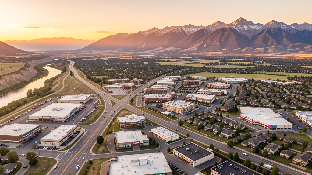
Get Matched With a Local Surveyor
Drone Survey Services Available in Loveland, CO
Loveland sits along the I-25 corridor between Denver and Fort Collins, strategically positioned as a growth hub in the Northern Colorado metro region. The city is best known for Centerra, the McWhinney-developed master-planned community that has been under continuous construction for over two decades and remains one of the largest active development projects in the state. Loveland combines relatively affordable housing with strong healthcare, manufacturing, and retail employment.
Drone Surveys for Loveland's Construction Market
Loveland is experiencing strong growth of approximately 2.5-3% annually, driven by the Centerra master-planned community (developed by McWhinney), residential expansion along the I-25 corridor, and healthcare campus development including UCHealth Medical Center of the Rockies. Major projects include continued buildout of Centarra (Promenade Shops expansion, residential neighborhoods, Chadwick Hotel), Medtronic manufacturing campus expansion, and I-25/US 34 interchange improvements. The city benefits from its position along I-25 between Denver and Fort Collins.
Active Developers in the Area:

Typical Project Costs in Colorado
Cost ranges are based on market data for Fort Collins-Loveland MSA. Actual pricing depends on site size, complexity, and deliverables.
| Service Type | Low End | High End |
|---|---|---|
| Topographic Survey | $1,100 | $4,200 |
| Drone Inspection | $750 | $2,900 |
| LiDAR Scanning | $2,300 | $7,800 |
| Environmental Monitoring | $1,450 | $4,900 |
| Aerial Imagery | $550 | $2,300 |
| Construction Monitoring | $950 | $3,900 |
| Real Estate Photography | $275 | $1,050 |
| Roof Inspection | $375 | $1,450 |
Local Airspace & Regulations in Loveland, CO
FAA Part 107 Requirements
All commercial drone operations in Colorado require the pilot to hold an active FAA Part 107 Remote Pilot Certificate. Our network surveyors are verified Part 107 holders.
State Drone Laws
Colorado HB 1070 (2023) aligns state drone law with federal FAA Part 107 requirements. The law prohibits local municipalities from regulating drone flight paths or airspace, but allows cities to regulate takeoff and landing on public property. Colorado does not require a separate state-level drone license. Commercial drone operators must hold a valid FAA Part 107 Remote Pilot Certificate and comply with all federal regulations. The Colorado Department of Transportation has additional guidelines for drone operations near state highways and infrastructure.
Local Ordinances
Loveland Municipal Code Chapter 9.40 prohibits drone takeoff and landing in city parks without prior authorization from Parks and Recreation. Loveland Municipal Code Chapter 5.04 requires commercial drone operators to obtain a city business license with proof of FAA Part 107 certification. Commercial drone photography on city property requires a film permit from the City Clerk Office with proof of insurance and Part 107 certification. The Centerra master-planned community has its own design guidelines and may require additional HOA or developer approval for drone operations within the development.
Restricted Airspace
- FNL Class D airspace: Northern Colorado Regional Airport has a Class D surface area extending approximately 4-5 nautical miles around the airport up to 5,000 feet MSL. Drone operations within this area require LAANC authorization. The Class D covers the southern portion of Loveland.
- Rocky Mountain National Park (15 miles southwest) prohibits drone operations within park boundaries under 36 CFR 1.5. The park is very close to Loveland, making it a significant consideration for operators working in the western part of the city.
- Estes Park and Roosevelt National Forest (20 miles west): US Forest Service lands have restrictions on drone takeoff and landing. Check local ranger district policies.
- Big Thompson River corridor: flood-prone area with ongoing stabilization work. Not a formal restricted airspace but operators should be aware of ongoing construction activity.
Airports in the area: undefined (undefined), undefined (undefined), undefined (undefined)
Why Hire Through Aerius View in Loveland, CO?
FAA-Certified
Every surveyor holds an active Part 107 Remote Pilot Certificate.
Local to Loveland
Surveyors who know the Colorado airspace and local permitting.
No Cost to Quote
Submit your project at no charge. Pay the surveyor directly if you proceed.
Fast Turnaround
A local surveyor contacts you within 2 business days.
How Our Loveland Matching Process Works
We're actively building our network of FAA-certified drone operators in Loveland, CO. Here's exactly what happens when you submit a project request.
Submit Your Project
Tell us your site location, acreage, and what you need (topographic survey, LiDAR, inspection, etc.). Takes 60 seconds. No cost, no obligation.
We Match & Vet
We identify Part 107-certified operators in Colorado with the right equipment for your project. Every pilot is verified for active certification, insurance, and relevant experience in Colorado airspace.
You Get Quotes
Matched surveyors contact you within 2 business days with quotes. You compare pricing, timelines, and deliverables, then choose the right fit. You pay the surveyor directly, no markup.
What Deliverables Do You Get?
Every project includes professional-grade deliverables compatible with standard construction and engineering software:
- Orthomosaic maps (GeoTIFF) for site overview and documentation
- Point clouds (LAS/LAZ) for 3D modeling and volumetric analysis
- DEM/DSM terrain models for cut/fill and grade analysis
- Contour lines (DXF/DWG, CAD-ready) for Civil 3D and Revit
- Progress reports with side-by-side comparisons for construction monitoring
- Coordinate systems matched to your project datum (State Plane, UTM, or local)
Insurance & Liability Protection
Pilot Insurance Required
Every operator in our network must carry active liability insurance. Minimum coverage: $1,000,000 general liability. Proof of insurance is verified before any pilot joins the network.
FAA Part 107 Verified
We confirm each pilot's Remote Pilot Certificate is active and in good standing through the FAA Airmen Inquiry system. Expired certificates are flagged automatically.
Equipment Documentation
Pilots list their drone models, sensors (RGB, LiDAR, thermal, multispectral), and payload specs so we can match the right equipment to your project requirements.
Site Safety Coordination
Pilots coordinate with your site superintendent for safe operations on active construction sites, including flight plans that avoid worker areas and equipment zones.
Loveland, CO Drone Survey FAQs
How does the Northern Colorado Regional Airport Class D airspace affect drone operations in Loveland?
The Northern Colorado Regional Airport (FNL/KFNL) has a Class D surface area extending approximately 4-5 nautical miles around the airport. The southern portion of Loveland falls within this Class D area, requiring LAANC authorization before conducting drone flights. Most of central and northern Loveland is outside the Class D surface area and does not require airspace authorization.
What is Centerra and why does it matter for drone surveying?
Centerra is a 3,000+ acre master-planned community developed by McWhinney, encompassing residential neighborhoods, the Promenade Shops at Centerra retail center, commercial office space, the Medical Center of the Rockies, and Chapungu Sculpture Park. It is one of the largest ongoing development projects in Northern Colorado and has been under continuous construction for over 20 years, creating sustained demand for drone-based construction progress monitoring and topographic mapping.
Can I fly a drone over Rocky Mountain National Park from Loveland?
No. Rocky Mountain National Park prohibits drone takeoff, landing, and operation within park boundaries under 36 CFR 1.5. The park is approximately 15 miles southwest of Loveland, making it a critical consideration for operators working in western Loveland near Big Thompson Canyon. Even if launching from private property outside the park, flying over park lands is prohibited.
What infrastructure projects in Loveland create drone survey opportunities?
Major infrastructure includes the I-25 express lanes expansion through the Loveland corridor, I-25/US 34 interchange improvements, ongoing Centerra buildout (residential, commercial, and hotel components), Medtronic manufacturing campus expansion, Medical Center of the Rockies additions, and Thompson School District new school construction. The Big Thompson River corridor also has ongoing flood mitigation and channel stabilization work.
Do I need a business license for commercial drone operations in Loveland?
Yes. Under Loveland Municipal Code Chapter 5.04, commercial drone operators must obtain a city business license. The application requires proof of FAA Part 107 Remote Pilot Certification and proof of general liability insurance. Additional film permits are required for commercial photography or videography on city property. Operators working within Centerra should also check with McWhinney property management for additional approvals.
Nearby Cities
Are You a Drone Surveyor in Loveland?
Get pre-qualified leads in your service area. No membership fees, no monthly minimums. First lead free.
Ready to Start Your Project in Loveland, CO?
Get matched with a local, FAA-certified surveyor. No cost, no obligation.
Request a Free Quote