Drone Survey Services in Fort Collins, CO
Fort Collins rapid growth, from the 1,800-acre Montava development to CSU campus expansion and the I-25 Express Lanes project, makes it one of Colorado most active drone survey markets with the least restrictive airspace on the Front Range.
Serving Larimer County & the Fort Collins-Loveland MSA area
Request a Free Quote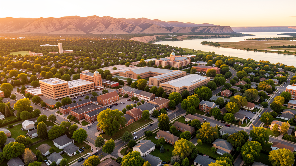
Get Matched With a Local Surveyor
Drone Survey Services Available in Fort Collins, CO
Fort Collins (pop. ~176,000) anchors the Fort Collins-Loveland MSA (pop. ~375,000) along Colorado fast-growing northern Front Range, with construction activity driven by CSU campus expansion, master-planned communities (Montava, Centerra spillover from Loveland), and major employer buildouts (Woodward, Anheuser-Busch, OtterBox). The city benefits from relatively simple airspace (primarily FNL Class D with full LAANC availability) but operators must manage wildfire-season TFRs and natural area restrictions.
Drone Surveys for Fort Collins's Construction Market
Fort Collins is one of the fastest-growing cities in Colorado, with substantial mixed-use development along the I-25 corridor, CSU campus expansion (new engineering building, stadium area development, on-campus housing), and major residential growth in north and southeast Fort Collins. The Montava community is a 1,800-acre master-planned development in northeast Fort Collins. The city is a hub for brewing, clean tech, and advanced manufacturing with Woodward Inc. headquarters campus expansion, Anheuser-Busch, and OtterBox. Infrastructure investment includes the I-25 Express Lanes project from Berthoud to Fort Collins and MAX bus rapid transit expansion.
Active Developers in the Area:

Typical Project Costs in Colorado
Cost ranges are based on market data for Fort Collins-Loveland MSA. Actual pricing depends on site size, complexity, and deliverables.
| Service Type | Low End | High End |
|---|---|---|
| Topographic Survey | $1,700 | $5,000 |
| Drone Inspection | $1,100 | $4,000 |
| LiDAR Scanning | $3,200 | $11,000 |
| Environmental Monitoring | $1,800 | $5,500 |
| Aerial Imagery | $750 | $2,800 |
| Construction Monitoring | $1,400 | $5,200 |
| Real Estate Photography | $400 | $1,600 |
| Roof Inspection | $300 | $1,100 |
Local Airspace & Regulations in Fort Collins, CO
FAA Part 107 Requirements
All commercial drone operations in Colorado require the pilot to hold an active FAA Part 107 Remote Pilot Certificate. Our network surveyors are verified Part 107 holders.
State Drone Laws
Colorado HB 1070 (2023) aligns state drone law with federal FAA Part 107 requirements. The law prohibits local municipalities from regulating drone flight paths or airspace, but allows cities to regulate takeoff and landing on public property. Colorado does not require a separate state-level drone license. Commercial drone operators must hold a valid FAA Part 107 Remote Pilot Certificate and comply with all federal regulations. The Colorado Department of Transportation has additional guidelines for drone operations near state highways and infrastructure.
Local Ordinances
Fort Collins prohibits drone takeoff and landing in designated natural areas and most city parks without prior approval from the Natural Areas Department. Colorado State University maintains its own drone policy requiring approval from CSU Facilities Management and CSU Police Department for campus flights. Poudre River natural areas along the Cache la Poudre River corridor restrict drone use. Horsetooth Reservoir area managed by Northern Water and Larimer County may have drone restrictions. Wildfire season TFRs are common in Larimer County during summer and fall.
Restricted Airspace
- Class D airspace around Northern Colorado Regional Airport (FNL) — located between Fort Collins and Loveland. LAANC available for most grids. Busiest GA airport in northern Colorado.
- Class D airspace around Greeley-Weld County Airport (GXY) — located east of Fort Collins in Greeley (Larimer/Weld County line). LAANC available.
- Rocky Mountain National Park — located 35 miles west of Fort Collins. All drone flights prohibited under NPS Policy Memorandum 14-05. Commercial operators serving Fort Collins must be aware for clients with western Larimer County projects.
- Cache La Poudre Wilderness Area and Roosevelt National Forest — immediately west of Fort Collins. FAA recommends maintaining 400 ft AGL or below over wilderness areas. Drone takeoff/landing from designated wilderness areas is restricted.
- Wildfire season TFRs — Larimer County frequently has temporary flight restrictions during wildfire events (Cameron Peak Fire 2020 was largest in Colorado history). Check NOTAMs during fire season (June-October).
Airports in the area: undefined (undefined), undefined (undefined)
Why Hire Through Aerius View in Fort Collins, CO?
FAA-Certified
Every surveyor holds an active Part 107 Remote Pilot Certificate.
Local to Fort Collins
Surveyors who know the Colorado airspace and local permitting.
No Cost to Quote
Submit your project at no charge. Pay the surveyor directly if you proceed.
Fast Turnaround
A local surveyor contacts you within 2 business days.
How Our Fort Collins Matching Process Works
We're actively building our network of FAA-certified drone operators in Fort Collins, CO. Here's exactly what happens when you submit a project request.
Submit Your Project
Tell us your site location, acreage, and what you need (topographic survey, LiDAR, inspection, etc.). Takes 60 seconds. No cost, no obligation.
We Match & Vet
We identify Part 107-certified operators in Colorado with the right equipment for your project. Every pilot is verified for active certification, insurance, and relevant experience in Colorado airspace.
You Get Quotes
Matched surveyors contact you within 2 business days with quotes. You compare pricing, timelines, and deliverables, then choose the right fit. You pay the surveyor directly, no markup.
What Deliverables Do You Get?
Every project includes professional-grade deliverables compatible with standard construction and engineering software:
- Orthomosaic maps (GeoTIFF) for site overview and documentation
- Point clouds (LAS/LAZ) for 3D modeling and volumetric analysis
- DEM/DSM terrain models for cut/fill and grade analysis
- Contour lines (DXF/DWG, CAD-ready) for Civil 3D and Revit
- Progress reports with side-by-side comparisons for construction monitoring
- Coordinate systems matched to your project datum (State Plane, UTM, or local)
Insurance & Liability Protection
Pilot Insurance Required
Every operator in our network must carry active liability insurance. Minimum coverage: $1,000,000 general liability. Proof of insurance is verified before any pilot joins the network.
FAA Part 107 Verified
We confirm each pilot's Remote Pilot Certificate is active and in good standing through the FAA Airmen Inquiry system. Expired certificates are flagged automatically.
Equipment Documentation
Pilots list their drone models, sensors (RGB, LiDAR, thermal, multispectral), and payload specs so we can match the right equipment to your project requirements.
Site Safety Coordination
Pilots coordinate with your site superintendent for safe operations on active construction sites, including flight plans that avoid worker areas and equipment zones.
Fort Collins, CO Drone Survey FAQs
Can I fly a drone over the Colorado State University campus in Fort Collins?
No, not without prior authorization. CSU maintains its own Unmanned Aircraft Systems Policy. Drone flights on campus require approval from CSU Facilities Management and the CSU Police Department. Research flights must follow additional CSU protocols. The campus is not in controlled airspace (FNL Class D does not extend over campus), but CSU policy applies regardless of airspace class.
Are there wildfire-related drone restrictions I should know about in Fort Collins?
Yes. Larimer County is in a high wildfire risk zone. During active wildfires, the FAA frequently issues Temporary Flight Restrictions (TFRs) covering wide areas of Larimer County. The Cameron Peak Fire (2020) was the largest wildfire in Colorado history and created extensive TFRs. Always check NOTAMs via B4UFLY or the FAA TFR list before flying during fire season (June-October). Flying in a TFR zone can result in federal penalties.
Can I fly a drone in Rocky Mountain National Park or the Roosevelt National Forest near Fort Collins?
Rocky Mountain National Park (35 miles west) prohibits all drone operations under NPS Policy Memorandum 14-05. The Roosevelt National Forest and Cache La Poudre Wilderness Area (immediately west of Fort Collins) allow drone flights under FAA Part 107 rules, but takeoff/landing from designated wilderness areas is restricted, and operators should maintain 400 ft AGL or below per FAA advisory guidance for wilderness overflights.
What is the Montava development and how does it affect drone survey demand in Fort Collins?
Montava is a 1,800-acre master-planned community under development in northeast Fort Collins by McWhinney (the developer behind Centerra in Loveland). It includes residential, mixed-use, schools, and 300+ acres of open space. Large master-planned communities like Montava require extensive topographic surveys, construction progress monitoring, environmental assessments, and infrastructure planning surveys, creating sustained drone survey demand in northern Fort Collins.
How does Fort Collins airspace compare to Colorado Springs and Aurora for commercial drone operations?
Fort Collins has significantly less restrictive airspace than Colorado Springs or Aurora. The primary controlled airspace is FNL Class D (Northern Colorado Regional Airport), with LAANC fully available. There is no Class B or Class C airspace, no military bases with overlapping restricted areas, and no permanent TFRs. The main operational challenges are wildfire-season TFRs, CSU campus policy, and natural area park restrictions, making Fort Collins one of the most drone-survey-friendly cities on the Colorado Front Range.
Nearby Cities
Are You a Drone Surveyor in Fort Collins?
Get pre-qualified leads in your service area. No membership fees, no monthly minimums. First lead free.
Ready to Start Your Project in Fort Collins, CO?
Get matched with a local, FAA-certified surveyor. No cost, no obligation.
Request a Free Quote