Drone Survey Services in The Woodlands, TX
From ExxonMobil's 385-acre campus and the Town Center corporate district to Harper's Preserve and Hughes Landing, The Woodlands is Houston's premier master-planned corporate-residential community, where IAH Class B airspace shapes every survey mission.
Serving Montgomery Co. & the Houston-The Woodlands-Sugar Land area
Request a Free Quote
Get Matched With a Local Surveyor
Drone Survey Services Available in The Woodlands, TX
The Houston-The Woodlands-Sugar Land metro is the largest or second-largest construction market in the US, and The Woodlands is its premier master-planned community. With 115,000+ residents and major corporate campuses (ExxonMobil, Chevron Phillips, Huntsman, McKesson), The Woodlands generates sustained demand for topographic surveys, construction monitoring, and LiDAR mapping. The IAH Class B airspace shelf covering most of the community makes LAANC authorization a critical part of every survey mission.
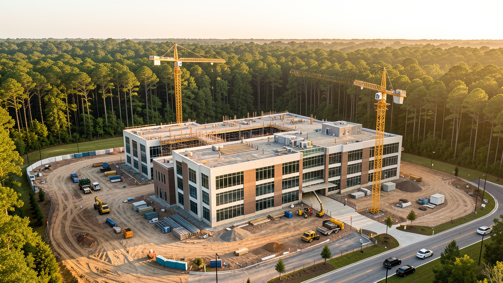
Drone Surveys for The Woodlands's Construction Market
The Woodlands is one of the most successful master-planned communities in US history, developed by The Howard Hughes Corporation from George Mitchell's original vision. The community has grown to 115,000+ residents and continues to expand with new residential villages (Harper's Preserve, Wend, Cleon). The Woodlands Town Center is the premier corporate office district in the Houston north metro, home to ExxonMobil (adjacent in Spring), Chevron Phillips Chemical, Huntsman Corporation, and McKesson. The Woodlands Research Forest technology corridor and the planned Hughes Landing mixed-use development on Lake Woodlands drive commercial construction. The I-45 corridor through The Woodlands is seeing continued medical expansion (Houston Methodist The Woodlands Hospital, Texas Children's Hospital). The Woodlands Resort and Convention Center expansion adds hospitality construction. The Grand Parkway (TX-99) segments north and south of The Woodlands have opened new development corridors.
Active Developers in the Area:
Typical Project Costs in Texas
Cost ranges are based on market data for Houston-The Woodlands-Sugar Land. Actual pricing depends on site size, complexity, and deliverables.
| Service Type | Low End | High End |
|---|---|---|
| Topographic Survey | $1,800 | $5,000 |
| Drone Inspection | $250 | $850 |
| LiDAR Scanning | $2,800 | $9,500 |
| Environmental Monitoring | $900 | $3,500 |
| Aerial Imagery | $175 | $550 |
| Construction Monitoring | $1,000 | $3,000 |
| Real Estate Photography | $175 | $500 |
| Roof Inspection | $225 | $800 |
Local Airspace & Regulations in The Woodlands, TX
FAA Part 107 Requirements
All commercial drone operations in Texas require the pilot to hold an active FAA Part 107 Remote Pilot Certificate. Our network surveyors are verified Part 107 holders.
State Drone Laws
Texas Government Code Chapter 423 restricts drone use over critical infrastructure facilities, including oil and gas pipelines, refineries, power plants, and water treatment facilities. HB 1484 (2023) added protections for agricultural operations and expanded penalties for drone surveillance of private property. Commercial operators must hold a valid FAA Part 107 Remote Pilot Certificate. Texas does not require a separate state drone license, but operators flying near critical infrastructure must obtain authorization from the facility owner. The Texas Department of Public Safety maintains additional guidelines for drone operations near state facilities.
Local Ordinances
The Woodlands is governed by The Woodlands Township, a special-purpose district rather than a traditional city. The Township does not issue a separate drone permit for commercial operators. FAA Part 107 certification and LAANC authorization for IAH Class B airspace are the primary requirements, and LAANC is required for nearly all commercial flights in The Woodlands due to the IAH Class B shelf. Commercial filming on Township property requires a permit through The Woodlands Parks and Recreation Department. The Township prohibits drone takeoff and landing in Township parks without a special use permit, including Town Green, Northshore Park, and Rob Fleming Park. Flights from private property (with owner permission) do not require a Township permit but must comply with all FAA Part 107 rules and Texas Government Code Chapter 423 critical infrastructure restrictions. The ExxonMobil campus 3 miles south is critical infrastructure where unauthorized flights are a state misdemeanor.
Restricted Airspace
- Class B airspace around George Bush Intercontinental (IAH) — the northern shelf of IAH Class B extends directly over The Woodlands, approximately 10-12 miles from the airport. LAANC authorization is required for nearly all commercial drone flights in The Woodlands. This is one of the most airspace-constrained communities in the Houston metro for drone operations.
- Class D airspace around David Wayne Hooks Memorial Airport (DWH) — located 12 miles west in Tomball. The eastern edge of DWH Class D may extend into western The Woodlands. Drone flights within 4 nautical miles require LAANC authorization. Verify exact boundaries on FAA UAS Facility Maps.
- Lone Star Executive Airport (CXO) — located 8 miles north in Conroe, uncontrolled Class E. No LAANC required for flights near CXO, but the airport has active general aviation traffic including corporate jets serving The Woodlands business community. Monitor CTAF and maintain visual separation.
- ExxonMobil Houston campus (Spring, 3 miles south) — 385-acre critical infrastructure campus with 10,000+ employees. Under TX Government Code Chapter 423, drone flights over the ExxonMobil campus without authorization are a state misdemeanor. The campus has active security and airspace monitoring. This is one of the most sensitive critical infrastructure sites in the Houston metro.
- The Woodlands Town Center and Waterway — dense mixed-use district with high-rise offices, retail, and the Cynthia Woods Mitchell Pavilion. While not formal restricted airspace, the density of pedestrians and outdoor events means drone pilots should coordinate with The Woodlands Township for any survey work in the Town Center area. Concert TFRs may apply during major events at the pavilion.
- Corporate campus security: The Woodlands hosts major corporate campuses including Chevron Phillips Chemical, Huntsman Corporation, Anadarko Petroleum (now Occidental), and McKesson. These facilities have active security monitoring and may be designated critical infrastructure. Always coordinate with corporate security before flying near campus facilities.
Airports in the area: undefined (undefined), undefined (undefined), undefined (undefined)
Why Hire Through Aerius View in The Woodlands, TX?
FAA-Certified
Every surveyor holds an active Part 107 Remote Pilot Certificate.
Local to The Woodlands
Surveyors who know the Texas airspace and local permitting.
No Cost to Quote
Submit your project at no charge. Pay the surveyor directly if you proceed.
Fast Turnaround
A local surveyor contacts you within 2 business days.
How Our The Woodlands Matching Process Works
We're actively building our network of FAA-certified drone operators in The Woodlands, TX. Here's exactly what happens when you submit a project request.
Submit Your Project
Tell us your site location, acreage, and what you need (topographic survey, LiDAR, inspection, etc.). Takes 60 seconds. No cost, no obligation.
We Match & Vet
We identify Part 107-certified operators in Texas with the right equipment for your project. Every pilot is verified for active certification, insurance, and relevant experience in Texas airspace.
You Get Quotes
Matched surveyors contact you within 2 business days with quotes. You compare pricing, timelines, and deliverables, then choose the right fit. You pay the surveyor directly, no markup.
What Deliverables Do You Get?
Every project includes professional-grade deliverables compatible with standard construction and engineering software:
- Orthomosaic maps (GeoTIFF) for site overview and documentation
- Point clouds (LAS/LAZ) for 3D modeling and volumetric analysis
- DEM/DSM terrain models for cut/fill and grade analysis
- Contour lines (DXF/DWG, CAD-ready) for Civil 3D and Revit
- Progress reports with side-by-side comparisons for construction monitoring
- Coordinate systems matched to your project datum (State Plane, UTM, or local)
Insurance & Liability Protection
Pilot Insurance Required
Every operator in our network must carry active liability insurance. Minimum coverage: $1,000,000 general liability. Proof of insurance is verified before any pilot joins the network.
FAA Part 107 Verified
We confirm each pilot's Remote Pilot Certificate is active and in good standing through the FAA Airmen Inquiry system. Expired certificates are flagged automatically.
Equipment Documentation
Pilots list their drone models, sensors (RGB, LiDAR, thermal, multispectral), and payload specs so we can match the right equipment to your project requirements.
Site Safety Coordination
Pilots coordinate with your site superintendent for safe operations on active construction sites, including flight plans that avoid worker areas and equipment zones.
The Woodlands, TX Drone Survey FAQs
Do I need a permit for a drone survey in The Woodlands?
The Woodlands Township does not issue a separate drone permit for commercial operators. However, FAA Part 107 certification and LAANC authorization are mandatory for nearly all commercial flights in The Woodlands because the IAH Class B airspace shelf extends directly over the community. Drone takeoff and landing in Township parks requires a special use permit. Flights from private property with owner permission do not require a Township permit.
How much does a drone survey cost in The Woodlands?
The Woodlands pricing is at the higher end of the Houston metro range due to the corporate office market and airspace complexity. Topographic surveys typically range from $1,800 to $5,000. LiDAR scanning runs $2,800 to $9,500 for wooded sites. Roof inspections cost $225 to $800 per building. Construction monitoring is typically $1,000 to $3,000 per month for recurring flights at corporate campus and MPC sites.
Can I fly a drone near the ExxonMobil Houston campus?
The ExxonMobil Houston campus in Spring, 3 miles south of The Woodlands, is a 385-acre critical infrastructure facility under Texas Government Code Chapter 423. Drone flights over the campus without authorization are a state misdemeanor. The campus has active security and airspace monitoring. For survey work near the ExxonMobil campus, coordinate with ExxonMobil security in advance and maintain a safe distance from the facility boundary.
How does IAH Class B airspace affect drone operations in The Woodlands?
The northern shelf of George Bush Intercontinental's Class B airspace extends directly over The Woodlands, approximately 10-12 miles from the airport. LAANC authorization is required for nearly all commercial drone flights in The Woodlands. This makes The Woodlands one of the most airspace-constrained communities in the Houston metro. Always check FAA UAS Facility Maps for the specific altitude shelves in your survey area, as they vary significantly across the community.
Are there restrictions on flying drones over The Woodlands Town Center?
The Woodlands Town Center and Waterway is a dense mixed-use district with high-rise offices, retail, and the Cynthia Woods Mitchell Pavilion. While not formal restricted airspace, the density of pedestrians and outdoor events means drone pilots should coordinate with The Woodlands Township for survey work in the Town Center. Concert TFRs may apply during major events at the pavilion. The Township encourages scheduling survey flights during early morning hours before Town Center activity peaks.
What makes The Woodlands unique for drone survey work?
The Woodlands is one of the most successful master-planned communities in US history, with 115,000+ residents and a premier corporate office district. The combination of corporate campus construction (ExxonMobil, Chevron Phillips, Huntsman, McKesson), residential village expansion, and the I-45 medical corridor creates diverse survey demand. However, the IAH Class B airspace shelf covering most of The Woodlands means nearly every commercial flight requires LAANC authorization, making airspace coordination a critical part of every survey mission.
Nearby Cities
Are You a Drone Surveyor in The Woodlands?
Get pre-qualified leads in your service area. No membership fees, no monthly minimums. First lead free.
Ready to Start Your Project in The Woodlands, TX?
Get matched with a local, FAA-certified surveyor. No cost, no obligation.
Request a Free Quote