Drone Survey Services in Spring, TX
Home to ExxonMobil's 385-acre, 10,000-employee campus and the Springwoods Village MPC, Spring sits 5 miles from IAH in one of the most airspace-complex zones in the Houston metro, where dual-LAANC requirements and critical infrastructure make every survey mission a coordination challenge.
Serving Harris County & the Houston-The Woodlands-Sugar Land area
Request a Free Quote
Get Matched With a Local Surveyor
Drone Survey Services Available in Spring, TX
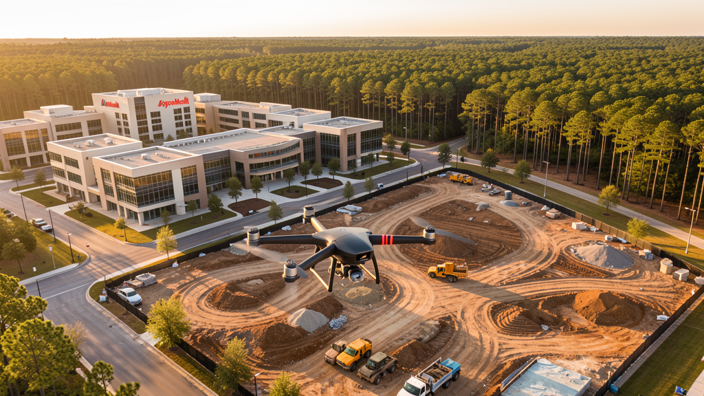
The Houston-The Woodlands-Sugar Land metro is the largest or second-largest construction market in the US, and Spring is its most airspace-complex submarket. Anchored by the 385-acre ExxonMobil Houston campus and the Springwoods Village MPC, Spring sits 5 miles west of IAH in overlapping Class B and Class D airspace. The I-45 and Grand Parkway corridors drive commercial and residential growth. For drone surveyors, Spring offers high-value corporate and residential contracts but requires careful LAANC coordination and ExxonMobil security coordination.
Drone Surveys for Spring's Construction Market
Spring is anchored by the ExxonMobil Houston campus, a 385-acre, 10,000-employee facility that is the largest single-tenant corporate campus in the Houston metro. The Springwoods Village MPC (2,000 acres) was developed specifically to support the ExxonMobil campus and continues to expand with residential, retail, and commercial construction. The I-45 corridor through Spring is a major commercial and retail development zone, with The Woodlands Mall and Market Street just to the north. The Grand Parkway (TX-99) interchange at I-45 has opened new development corridors east and west. The Spring Cypress and Klein areas along FM 1960 and Cypresswood Drive are seeing sustained residential infill development. Harris County Flood Control District infrastructure projects in the Spring Creek watershed generate heavy civil survey demand.
Active Developers in the Area:
Typical Project Costs in Texas
Cost ranges are based on market data for Houston-The Woodlands-Sugar Land. Actual pricing depends on site size, complexity, and deliverables.
| Service Type | Low End | High End |
|---|---|---|
| Topographic Survey | $1,800 | $5,000 |
| Drone Inspection | $250 | $850 |
| LiDAR Scanning | $2,800 | $9,500 |
| Environmental Monitoring | $900 | $3,500 |
| Aerial Imagery | $175 | $550 |
| Construction Monitoring | $1,000 | $3,000 |
| Real Estate Photography | $175 | $500 |
| Roof Inspection | $225 | $800 |
Local Airspace & Regulations in Spring, TX
FAA Part 107 Requirements
All commercial drone operations in Texas require the pilot to hold an active FAA Part 107 Remote Pilot Certificate. Our network surveyors are verified Part 107 holders.
State Drone Laws
Texas Government Code Chapter 423 restricts drone use over critical infrastructure facilities, including oil and gas pipelines, refineries, power plants, and water treatment facilities. HB 1484 (2023) added protections for agricultural operations and expanded penalties for drone surveillance of private property. Commercial operators must hold a valid FAA Part 107 Remote Pilot Certificate. Texas does not require a separate state drone license, but operators flying near critical infrastructure must obtain authorization from the facility owner. The Texas Department of Public Safety maintains additional guidelines for drone operations near state facilities.
Local Ordinances
Spring is an unincorporated community spanning Harris and Montgomery Counties, so there is no separate city-level drone permit. FAA Part 107 certification and LAANC authorization for IAH Class B and DWH Class D airspace are mandatory for virtually all commercial flights in Spring. The dual-LAANC requirement in central Spring makes it one of the most airspace-complex areas in the Houston metro. Commercial use of county parks requires a special use permit. Flights from private property (with owner permission) do not require a county permit but must comply with all FAA Part 107 rules and Texas Government Code Chapter 423 critical infrastructure restrictions. The ExxonMobil campus is critical infrastructure where unauthorized flights are a state misdemeanor.
Restricted Airspace
- Class B airspace around George Bush Intercontinental (IAH) — Spring sits just 5 miles west of IAH, placing nearly the entire community within the IAH Class B airspace. LAANC authorization is required for virtually all commercial drone flights in Spring. The airspace shelves vary significantly, with lower altitude limits closer to the airport. This is one of the most airspace-constrained areas in the Houston metro.
- Class D airspace around David Wayne Hooks Memorial Airport (DWH) — located 5 miles west in Tomball. The eastern edge of DWH Class D extends into western Spring. Drone flights within 4 nautical miles require LAANC authorization. This creates a dual-LAANC requirement for survey work in central Spring, where both IAH Class B and DWH Class D overlap.
- ExxonMobil Houston campus — the 385-acre campus is the largest single-tenant corporate campus in the Houston metro, housing 10,000+ employees. Under TX Government Code Chapter 423, drone flights over the campus without authorization are a state misdemeanor. The campus has active security, perimeter monitoring, and airspace surveillance. This is one of the most sensitive critical infrastructure sites for drone operations in Texas.
- Springwoods Village MPC — 2,000-acre master-planned community adjacent to the ExxonMobil campus. The density of corporate and residential construction creates crane and heavy equipment activity that requires coordination with site superintendents. FAA Part 107 requires yielding right-of-way to all manned aircraft, including construction helicopters.
- I-45 and Grand Parkway interchange construction — ongoing highway interchange improvements create heavy civil construction zones with active blasting, crane operations, and equipment movement. Coordinate with TxDOT contractors before flying near active highway construction.
- Hurricane and tropical weather: Spring is in a high-risk flood zone, having experienced catastrophic flooding during Hurricane Harvey in 2017. The Spring Creek and Cypress Creek watersheds affect the area. Drone operations during tropical storm warnings are restricted. Post-storm assessment flights require coordination with Montgomery County or Harris County Office of Emergency Management.
Airports in the area: undefined (undefined), undefined (undefined), undefined (undefined)
Why Hire Through Aerius View in Spring, TX?
FAA-Certified
Every surveyor holds an active Part 107 Remote Pilot Certificate.
Local to Spring
Surveyors who know the Texas airspace and local permitting.
No Cost to Quote
Submit your project at no charge. Pay the surveyor directly if you proceed.
Fast Turnaround
A local surveyor contacts you within 2 business days.
How Our Spring Matching Process Works
We're actively building our network of FAA-certified drone operators in Spring, TX. Here's exactly what happens when you submit a project request.
Submit Your Project
Tell us your site location, acreage, and what you need (topographic survey, LiDAR, inspection, etc.). Takes 60 seconds. No cost, no obligation.
We Match & Vet
We identify Part 107-certified operators in Texas with the right equipment for your project. Every pilot is verified for active certification, insurance, and relevant experience in Texas airspace.
You Get Quotes
Matched surveyors contact you within 2 business days with quotes. You compare pricing, timelines, and deliverables, then choose the right fit. You pay the surveyor directly, no markup.
What Deliverables Do You Get?
Every project includes professional-grade deliverables compatible with standard construction and engineering software:
- Orthomosaic maps (GeoTIFF) for site overview and documentation
- Point clouds (LAS/LAZ) for 3D modeling and volumetric analysis
- DEM/DSM terrain models for cut/fill and grade analysis
- Contour lines (DXF/DWG, CAD-ready) for Civil 3D and Revit
- Progress reports with side-by-side comparisons for construction monitoring
- Coordinate systems matched to your project datum (State Plane, UTM, or local)
Insurance & Liability Protection
Pilot Insurance Required
Every operator in our network must carry active liability insurance. Minimum coverage: $1,000,000 general liability. Proof of insurance is verified before any pilot joins the network.
FAA Part 107 Verified
We confirm each pilot's Remote Pilot Certificate is active and in good standing through the FAA Airmen Inquiry system. Expired certificates are flagged automatically.
Equipment Documentation
Pilots list their drone models, sensors (RGB, LiDAR, thermal, multispectral), and payload specs so we can match the right equipment to your project requirements.
Site Safety Coordination
Pilots coordinate with your site superintendent for safe operations on active construction sites, including flight plans that avoid worker areas and equipment zones.
Spring, TX Drone Survey FAQs
Do I need LAANC authorization for every drone flight in Spring?
Nearly yes. Spring sits just 5 miles west of George Bush Intercontinental (IAH), placing nearly the entire community within IAH Class B airspace. Additionally, the eastern edge of David Wayne Hooks Memorial Airport (DWH) Class D extends into western Spring. This means most commercial drone flights in Spring require LAANC authorization, and some areas have overlapping Class B and Class D requirements. Always check FAA UAS Facility Maps before flying.
How much does a drone survey cost in Spring?
Spring pricing is at the higher end of the Houston metro range due to airspace complexity. Topographic surveys typically range from $1,800 to $5,000. LiDAR scanning runs $2,800 to $9,500. Roof inspections cost $225 to $800 per building. Construction monitoring is typically $1,000 to $3,000 per month for recurring flights at Springwoods Village and adjacent MPC sites.
Can I fly a drone over the ExxonMobil Houston campus?
No. The ExxonMobil Houston campus is a 385-acre critical infrastructure facility under Texas Government Code Chapter 423. Drone flights over the campus without authorization from ExxonMobil are a state misdemeanor. The campus has active security, perimeter monitoring, and airspace surveillance. For survey work near the campus, coordinate with ExxonMobil security, maintain a safe distance from the facility boundary, and file a LAANC request well in advance.
How does the dual-LAANC requirement work in central Spring?
Central Spring falls within both the IAH Class B airspace and the DWH Class D airspace. For survey work in this overlap zone, you need to request LAANC authorization that accounts for both airspace boundaries. The FAA UAS Facility Maps show the altitude shelves for each controlled airspace. In practice, the lower of the two altitude limits applies. Use an FAA-approved LAANC provider (AirMap, DroneUp, etc.) to request authorization for the specific altitude and duration of your flight.
What is Springwoods Village and why is it significant for drone survey work?
Springwoods Village is a 2,000-acre master-planned community developed by Howard Hughes Corporation specifically to support the ExxonMobil Houston campus. It includes residential, retail, and commercial construction that continues to expand. The proximity to both the ExxonMobil critical infrastructure and IAH Class B airspace makes survey work here particularly complex, requiring careful airspace coordination, LAANC authorization, and coordination with ExxonMobil security for any flights near the campus boundary.
What makes Spring unique for drone survey work?
Spring has the most complex airspace environment of any community in the Houston metro. The combination of IAH Class B (5 miles east), DWH Class D (5 miles west), and the ExxonMobil critical infrastructure campus creates overlapping restrictions that require careful planning. However, this complexity also means less competition, as many drone operators avoid the area. The ExxonMobil campus and Springwoods Village MPC generate high-value corporate and residential survey contracts that reward surveyors who can navigate the airspace.
Nearby Cities
Are You a Drone Surveyor in Spring?
Get pre-qualified leads in your service area. No membership fees, no monthly minimums. First lead free.
Ready to Start Your Project in Spring, TX?
Get matched with a local, FAA-certified surveyor. No cost, no obligation.
Request a Free Quote