Drone Survey Services in Pflugerville, TX
From the SH 130 commercial corridor and Samsung fab spillover to Falcon Pointe, Blackhawk, and Avalon, Pflugerville has tripled in 15 years making it one of the fastest-growing Austin metro suburbs where industrial and residential survey demand are both surging.
Serving Travis County & the Austin-Round Rock-Georgetown area
Request a Free Quote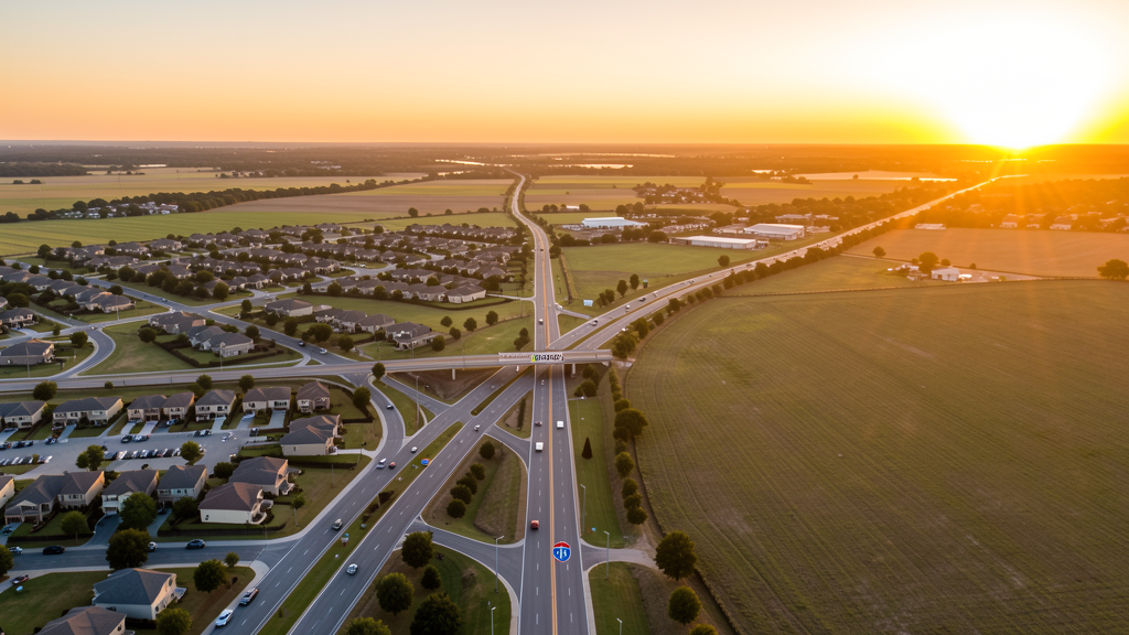
Get Matched With a Local Surveyor
Drone Survey Services Available in Pflugerville, TX
The Austin-Round Rock-Georgetown metro is one of the fastest-growing in the US, and Pflugerville is a key northeast suburb that has tripled from 22,000 to 67,000 residents in 15 years. The SH 130 toll corridor drives commercial and industrial development, while master-planned communities (Falcon Pointe, Blackhawk, Avalon) drive residential growth. The Samsung $17B fab in Taylor, 10 miles northeast, is generating supply chain spillover demand.
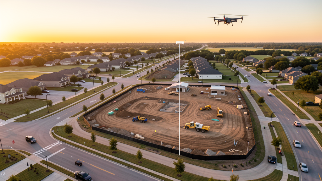
Drone Surveys for Pflugerville's Construction Market
Pflugerville is a fast-growing Austin metro suburb with a population that has tripled from 22,000 to 67,000 in 15 years. The city is anchored by the SH 130 toll corridor, which has attracted commercial and industrial development including the Pflugerville 130 Commerce Center and multiple logistics/distribution facilities. Master-planned communities including Falcon Pointe, Blackhawk, and Avalon are converting farmland to residential at a rapid pace. The Pecan Street Power Plant redev and the Stone Hill Town Center commercial corridor drive retail construction. The city's proximity to Samsung's $17B semiconductor fab in Taylor (10 miles northeast) is generating supply chain and residential spillover demand. The SH 45 toll road extension and I-35 improvements improve Austin connectivity.
Active Developers in the Area:
Typical Project Costs in Texas
Cost ranges are based on market data for Austin-Round Rock-Georgetown. Actual pricing depends on site size, complexity, and deliverables.
| Service Type | Low End | High End |
|---|---|---|
| Topographic Survey | $1,550 | $4,600 |
| Drone Inspection | $225 | $750 |
| LiDAR Scanning | $2,500 | $8,500 |
| Environmental Monitoring | $800 | $3,200 |
| Aerial Imagery | $175 | $450 |
| Construction Monitoring | $875 | $2,700 |
| Real Estate Photography | $150 | $400 |
| Roof Inspection | $200 | $700 |
Local Airspace & Regulations in Pflugerville, TX
FAA Part 107 Requirements
All commercial drone operations in Texas require the pilot to hold an active FAA Part 107 Remote Pilot Certificate. Our network surveyors are verified Part 107 holders.
State Drone Laws
Texas Government Code Chapter 423 restricts drone use over critical infrastructure facilities, including oil and gas pipelines, refineries, power plants, and water treatment facilities. HB 1484 (2023) added protections for agricultural operations and expanded penalties for drone surveillance of private property. Commercial operators must hold a valid FAA Part 107 Remote Pilot Certificate. Texas does not require a separate state drone license, but operators flying near critical infrastructure must obtain authorization from the facility owner. The Texas Department of Public Safety maintains additional guidelines for drone operations near state facilities.
Local Ordinances
Pflugerville does not issue a separate city-level drone permit for commercial operators. FAA Part 107 certification and LAANC authorization for AUS Class C and EDC Class D airspace are the primary requirements. Commercial filming on city property requires a permit through the Pflugerville Parks and Recreation Department. Drone takeoff and landing in city parks requires a special use permit, including Pfluger Park, Lake Pflugerville, and Gilleland Creek Park. Flights from private property (with owner permission) do not require a city permit but must comply with all FAA Part 107 rules and Texas Government Code Chapter 423 critical infrastructure restrictions.
Restricted Airspace
- Class C airspace around Austin-Bergstrom International (AUS) — located 18 miles south. The northern shelves of AUS Class C may extend into southern Pflugerville. LAANC authorization required for commercial drone flights south of SH 45.
- Class D airspace around Austin Executive Airport (EDC) — located 5 miles southeast. EDC Class D extends into eastern Pflugerville. LAANC authorization required for flights in the eastern half of the city, including the SH 130 corridor and Pfluger Park area.
- SH 130 toll corridor — while not formal restricted airspace, the high-speed tollway has active TxDOT traffic monitoring infrastructure. Drone flights over SH 130 should maintain safe altitude and avoid interfering with traffic monitoring systems.
- Pfluger Park and Lake Pflugerville — city park restrictions on drone takeoff and landing without a special use permit. Lake Pflugerville is a popular recreation area with heavy pedestrian and cyclist traffic on weekends.
- Colorado River floodplain — eastern Pflugerville borders the Colorado River floodplain. Post-flood survey work requires coordination with Travis County Emergency Management. The area is prone to flash flooding during spring thunderstorms.
- Severe weather: Pflugerville is in the Austin metro flash flood and tornado risk zone. Spring thunderstorms (April-June) produce heavy rain, large hail, and occasional tornadoes. Post-storm roof inspection and hail damage documentation is a significant drone survey use case.
Airports in the area: undefined (undefined), undefined (undefined), undefined (undefined)
Why Hire Through Aerius View in Pflugerville, TX?
FAA-Certified
Every surveyor holds an active Part 107 Remote Pilot Certificate.
Local to Pflugerville
Surveyors who know the Texas airspace and local permitting.
No Cost to Quote
Submit your project at no charge. Pay the surveyor directly if you proceed.
Fast Turnaround
A local surveyor contacts you within 2 business days.
How Our Pflugerville Matching Process Works
We're actively building our network of FAA-certified drone operators in Pflugerville, TX. Here's exactly what happens when you submit a project request.
Submit Your Project
Tell us your site location, acreage, and what you need (topographic survey, LiDAR, inspection, etc.). Takes 60 seconds. No cost, no obligation.
We Match & Vet
We identify Part 107-certified operators in Texas with the right equipment for your project. Every pilot is verified for active certification, insurance, and relevant experience in Texas airspace.
You Get Quotes
Matched surveyors contact you within 2 business days with quotes. You compare pricing, timelines, and deliverables, then choose the right fit. You pay the surveyor directly, no markup.
What Deliverables Do You Get?
Every project includes professional-grade deliverables compatible with standard construction and engineering software:
- Orthomosaic maps (GeoTIFF) for site overview and documentation
- Point clouds (LAS/LAZ) for 3D modeling and volumetric analysis
- DEM/DSM terrain models for cut/fill and grade analysis
- Contour lines (DXF/DWG, CAD-ready) for Civil 3D and Revit
- Progress reports with side-by-side comparisons for construction monitoring
- Coordinate systems matched to your project datum (State Plane, UTM, or local)
Insurance & Liability Protection
Pilot Insurance Required
Every operator in our network must carry active liability insurance. Minimum coverage: $1,000,000 general liability. Proof of insurance is verified before any pilot joins the network.
FAA Part 107 Verified
We confirm each pilot's Remote Pilot Certificate is active and in good standing through the FAA Airmen Inquiry system. Expired certificates are flagged automatically.
Equipment Documentation
Pilots list their drone models, sensors (RGB, LiDAR, thermal, multispectral), and payload specs so we can match the right equipment to your project requirements.
Site Safety Coordination
Pilots coordinate with your site superintendent for safe operations on active construction sites, including flight plans that avoid worker areas and equipment zones.
Pflugerville, TX Drone Survey FAQs
Do I need a permit for a drone survey in Pflugerville?
Pflugerville does not issue a separate city-level drone permit for commercial operators. FAA Part 107 certification is mandatory. LAANC authorization is required for flights in eastern Pflugerville within the EDC Class D zone and southern Pflugerville within the AUS Class C shelves. Drone takeoff and landing in city parks requires a special use permit from Pflugerville Parks and Recreation.
How much does a drone survey cost in Pflugerville?
Pflugerville pricing is similar to the Austin metro average. Topographic surveys typically range from $1,550 to $4,600. LiDAR scanning runs $2,500 to $8,500 for wooded or hilly sites. Roof inspections cost $200 to $700 per building. Construction monitoring is typically $875 to $2,700 per month for recurring flights at MPC sites like Falcon Pointe or Blackhawk.
How does the SH 130 corridor affect drone survey work in Pflugerville?
The SH 130 toll corridor is a major commercial and industrial development zone with logistics/distribution facilities, the Pflugerville 130 Commerce Center, and TxDOT infrastructure. Drone surveys for site selection, construction monitoring, and as-built documentation are in high demand. Flights over SH 130 should maintain safe altitude and avoid interfering with TxDOT traffic monitoring systems.
Is Pflugerville affected by the Samsung fab construction in Taylor?
Yes. Samsung's $17B semiconductor fab in Taylor is 10 miles northeast and is generating supply chain and residential spillover demand throughout northeast Travis County. Pflugerville is well-positioned for this growth due to its SH 130 frontage and available land. Survey demand for pre-construction site selection and residential development monitoring is increasing.
Can I fly a drone over Lake Pflugerville?
Lake Pflugerville is a city park and recreation area. Drone takeoff and landing requires a special use permit from Pflugerville Parks and Recreation. The lake has heavy pedestrian and cyclist traffic on weekends. Commercial survey flights for the City of Pflugerville or the Pflugerville Community Development Corporation should be scheduled during early morning hours and coordinated with park management.
What makes Pflugerville unique for drone survey work?
Pflugerville has tripled in population in 15 years, driven by the SH 130 commercial corridor and master-planned communities (Falcon Pointe, Blackhawk, Avalon). The city's proximity to the Samsung $17B fab in Taylor is generating supply chain spillover. The EDC Class D airspace covering eastern Pflugerville and AUS Class C shelves in the south make LAANC planning essential. The SH 130 logistics corridor creates industrial site survey demand distinct from the residential MPC survey work typical of the Austin metro.
Nearby Cities
Are You a Drone Surveyor in Pflugerville?
Get pre-qualified leads in your service area. No membership fees, no monthly minimums. First lead free.
Ready to Start Your Project in Pflugerville, TX?
Get matched with a local, FAA-certified surveyor. No cost, no obligation.
Request a Free Quote