Drone Survey Services in Georgetown, TX
Georgetown was the fastest-growing metro in America in 2023, where the I-35 corridor, Wolf Ranch, River Walk San Gabriel, and Sun City Texas are transforming Williamson County ranchland into one of Texas's most active construction zones.
Serving Williamson County & the Austin-Round Rock-Georgetown area
Request a Free Quote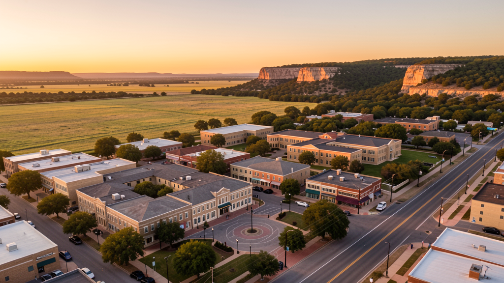
Get Matched With a Local Surveyor
Drone Survey Services Available in Georgetown, TX
The Austin-Round Rock-Georgetown metro is one of the fastest-growing in the United States, and Georgetown leads it, growing over 14% in a single year per 2023 Census data. Williamson County is the second-fastest-growing county in Texas. Major growth drivers include the Wolf Ranch and River Walk mixed-use developments, Sun City Texas retirement community expansion, and ranchland conversion along US 183 and FM 3405. For drone surveyors, this means sustained demand for topographic surveys, construction monitoring, and LiDAR mapping across the Hill Country terrain of western Williamson County.
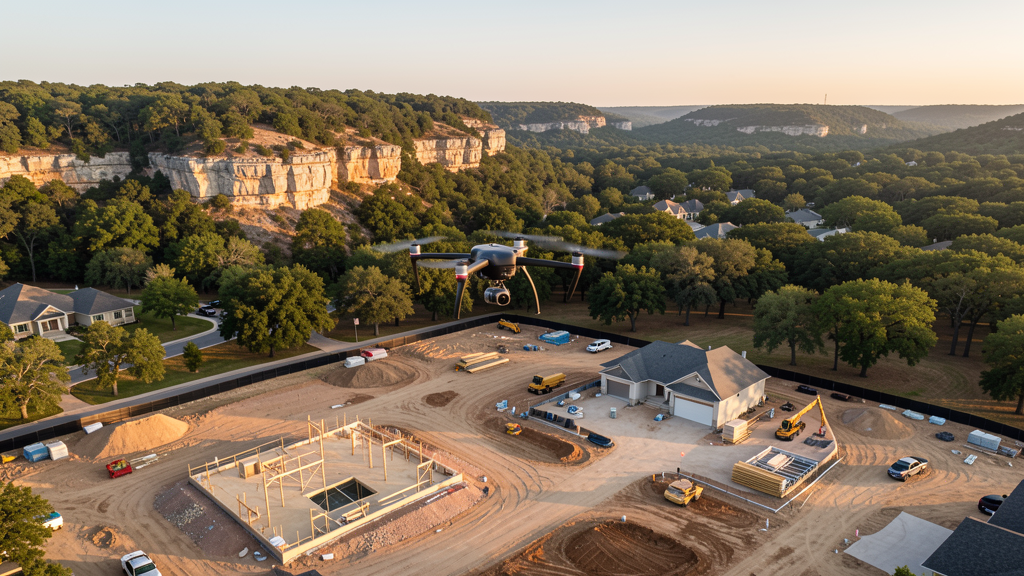
Drone Surveys for Georgetown's Construction Market
Georgetown was the fastest-growing metropolitan area in the United States in 2023 per the Census Bureau, with the population growing over 14% in a single year. Williamson County is the second-fastest-growing county in Texas behind Montgomery County. The I-35 corridor through Georgetown is seeing explosive mixed-use development, including the Wolf Ranch Town Center and the River Walk San Gabriel project, a 200-acre mixed-use development along the San Gabriel River. Sun City Texas, a 12,000-resident active adult community, continues to expand with new residential phases and amenity construction. Southwestern University's ongoing campus improvements and the expansion of St. David's Georgetown Hospital add institutional construction demand. The SH 130 toll road and the future I-14 corridor connect Georgetown to regional logistics and industrial development. Master-planned communities in northwest Georgetown along US 183 and FM 3405 are converting ranchland to residential at a rapid pace.
Active Developers in the Area:
Typical Project Costs in Texas
Cost ranges are based on market data for Austin-Round Rock-Georgetown. Actual pricing depends on site size, complexity, and deliverables.
| Service Type | Low End | High End |
|---|---|---|
| Topographic Survey | $1,600 | $4,800 |
| Drone Inspection | $225 | $800 |
| LiDAR Scanning | $2,600 | $9,000 |
| Environmental Monitoring | $850 | $3,500 |
| Aerial Imagery | $175 | $500 |
| Construction Monitoring | $900 | $2,800 |
| Real Estate Photography | $150 | $450 |
| Roof Inspection | $200 | $750 |
Local Airspace & Regulations in Georgetown, TX
FAA Part 107 Requirements
All commercial drone operations in Texas require the pilot to hold an active FAA Part 107 Remote Pilot Certificate. Our network surveyors are verified Part 107 holders.
State Drone Laws
Texas Government Code Chapter 423 restricts drone use over critical infrastructure facilities, including oil and gas pipelines, refineries, power plants, and water treatment facilities. HB 1484 (2023) added protections for agricultural operations and expanded penalties for drone surveillance of private property. Commercial operators must hold a valid FAA Part 107 Remote Pilot Certificate. Texas does not require a separate state drone license, but operators flying near critical infrastructure must obtain authorization from the facility owner. The Texas Department of Public Safety maintains additional guidelines for drone operations near state facilities.
Local Ordinances
Georgetown does not issue a separate city-level drone permit for commercial operators. FAA Part 107 certification and LAANC authorization for Class C airspace (AUS) and Class D airspace (EDC) are the primary requirements. Commercial filming on city property requires a permit through Georgetown Parks and Recreation. The city prohibits drone takeoff and landing in city parks without a special use permit, including Blue Hole Park, San Gabriel Park, and Garey Park. Flights from private property (with owner permission) do not require a city permit but must comply with all FAA Part 107 rules and Texas Government Code Chapter 423 critical infrastructure restrictions. Lake Georgetown dam and associated Corps of Engineers facilities are federal critical infrastructure.
Restricted Airspace
- Class C airspace around Austin-Bergstrom International (AUS) — located 25 miles south. The northern shelves of AUS Class C extend into southern Williamson County. LAANC authorization is required for commercial drone flights in the southern portion of Georgetown and along the I-35 corridor approaching Austin.
- Class D airspace around Austin Executive Airport (EDC) — located 15 miles south in Manor. Drone flights within 4 nautical miles require LAANC authorization. This affects survey work in south Georgetown near SH 29 and I-35.
- Georgetown Municipal Airport (GTU) — uncontrolled Class E airspace, no LAANC required for typical commercial drone operations. However, GTU has active general aviation traffic including corporate jets and flight training operations. Pilots should monitor CTAF and maintain visual separation. High traffic during weekdays, especially morning and evening commuting hours.
- Southwestern University — while not formal restricted airspace, the campus has active security monitoring. Drone flights over the campus and adjacent residential areas should be coordinated with university security, especially during academic sessions and sporting events.
- Lake Georgetown and San Gabriel River — popular recreational areas managed by the US Army Corps of Engineers. Drone flights over Lake Georgetown require coordination with the Corps of Engineers office. The dam structure is critical infrastructure under TX Government Code Chapter 423.
- Wolf Ranch and River Walk development zones — large active construction sites with crane operations. Drone pilots should coordinate with site superintendents and maintain safe distance from crane swing radius and lifting operations. FAA Part 107 requires yielding right-of-way to all manned aircraft, including helicopters used for construction support.
- Sun City Texas — large active adult community (12,000+ residents) with ongoing residential construction and amenity development. While not restricted airspace, the density of residential construction creates frequent crane and helicopter activity that requires coordination.
Airports in the area: undefined (undefined), undefined (undefined), undefined (undefined), undefined (undefined)
Why Hire Through Aerius View in Georgetown, TX?
FAA-Certified
Every surveyor holds an active Part 107 Remote Pilot Certificate.
Local to Georgetown
Surveyors who know the Texas airspace and local permitting.
No Cost to Quote
Submit your project at no charge. Pay the surveyor directly if you proceed.
Fast Turnaround
A local surveyor contacts you within 2 business days.
How Our Georgetown Matching Process Works
We're actively building our network of FAA-certified drone operators in Georgetown, TX. Here's exactly what happens when you submit a project request.
Submit Your Project
Tell us your site location, acreage, and what you need (topographic survey, LiDAR, inspection, etc.). Takes 60 seconds. No cost, no obligation.
We Match & Vet
We identify Part 107-certified operators in Texas with the right equipment for your project. Every pilot is verified for active certification, insurance, and relevant experience in Texas airspace.
You Get Quotes
Matched surveyors contact you within 2 business days with quotes. You compare pricing, timelines, and deliverables, then choose the right fit. You pay the surveyor directly, no markup.
What Deliverables Do You Get?
Every project includes professional-grade deliverables compatible with standard construction and engineering software:
- Orthomosaic maps (GeoTIFF) for site overview and documentation
- Point clouds (LAS/LAZ) for 3D modeling and volumetric analysis
- DEM/DSM terrain models for cut/fill and grade analysis
- Contour lines (DXF/DWG, CAD-ready) for Civil 3D and Revit
- Progress reports with side-by-side comparisons for construction monitoring
- Coordinate systems matched to your project datum (State Plane, UTM, or local)
Insurance & Liability Protection
Pilot Insurance Required
Every operator in our network must carry active liability insurance. Minimum coverage: $1,000,000 general liability. Proof of insurance is verified before any pilot joins the network.
FAA Part 107 Verified
We confirm each pilot's Remote Pilot Certificate is active and in good standing through the FAA Airmen Inquiry system. Expired certificates are flagged automatically.
Equipment Documentation
Pilots list their drone models, sensors (RGB, LiDAR, thermal, multispectral), and payload specs so we can match the right equipment to your project requirements.
Site Safety Coordination
Pilots coordinate with your site superintendent for safe operations on active construction sites, including flight plans that avoid worker areas and equipment zones.
Georgetown, TX Drone Survey FAQs
Do I need a permit for a drone survey in Georgetown?
Georgetown does not issue a separate city-level drone permit for commercial operators. FAA Part 107 certification is mandatory. LAANC authorization is required for flights in southern Georgetown within the AUS Class C shelves or the EDC Class D zone. Georgetown Municipal Airport (GTU) is uncontrolled Class E, so no LAANC is needed for flights near downtown and northern Georgetown. Drone takeoff and landing in city parks requires a special use permit from Georgetown Parks and Recreation.
How much does a drone survey cost in Georgetown and Williamson County?
Georgetown pricing is similar to the Austin metro average, with slight discounts for the lower overhead of operating outside the urban core. Topographic surveys typically range from $1,600 to $4,800. LiDAR scanning runs $2,600 to $9,000 for wooded Hill Country sites. Roof inspections cost $200 to $750 per building. Construction monitoring is typically $900 to $2,800 per month for recurring flights at master-planned community sites like Wolf Ranch and Santa Rita Ranch.
Can I fly a drone near Georgetown Municipal Airport?
Georgetown Municipal Airport (GTU) is uncontrolled Class E airspace, so LAANC authorization is not required for typical commercial drone operations. However, GTU has active general aviation traffic including corporate jets and flight training. You should monitor CTAF frequency, maintain visual separation from manned aircraft, and avoid peak traffic hours (7-9 AM and 4-6 PM). Always check FAA UAS Facility Maps for altitude restrictions in the GTU traffic pattern area.
Are there restrictions on flying drones over Lake Georgetown?
Lake Georgetown is managed by the US Army Corps of Engineers. Drone flights over the lake and dam structure require coordination with the Corps of Engineers office. The dam is designated critical infrastructure under Texas Government Code Chapter 423, making unauthorized drone flights a state misdemeanor. Recreational areas around the lake have restrictions on drone takeoff and landing. For survey work near the lake, contact the Georgetown Lake Office in advance.
Does Georgetown's status as the fastest-growing metro affect drone survey demand?
Yes. Georgetown was the fastest-growing metropolitan area in the US in 2023 per the Census Bureau, with population growth exceeding 14% in a single year. This drives sustained demand for topographic surveys on new residential developments, construction monitoring for active build sites, and LiDAR mapping for the Hill Country terrain that characterizes western Williamson County. The mix of Sun City retirement construction, Wolf Ranch mixed-use development, and ranchland conversion along US 183 creates year-round survey demand.
What makes Georgetown unique for drone survey work compared to Austin?
Georgetown offers the Austin metro growth dynamics with less airspace complexity. Georgetown Municipal Airport (GTU) is uncontrolled Class E, meaning most flights north of SH 29 do not require LAANC authorization, unlike Austin where AUS Class C covers much of the city. The Hill Country terrain in western Williamson County creates elevation changes that benefit from LiDAR survey, while the flat Blackland Prairie to the east is ideal for efficient photogrammetry. Sun City Texas generates consistent residential survey demand that is less seasonal than typical new-home construction.
Nearby Cities
Are You a Drone Surveyor in Georgetown?
Get pre-qualified leads in your service area. No membership fees, no monthly minimums. First lead free.
Ready to Start Your Project in Georgetown, TX?
Get matched with a local, FAA-certified surveyor. No cost, no obligation.
Request a Free Quote