Drone Survey Services in Cedar Park, TX
From the Bell Boulevard redevelopment and the H-E-B Center sports district to Twin Creeks and the US 183 tech corridor, Cedar Park is Williamson County's tech and sports city, where flat prairie meets Hill Country and simple airspace makes survey work efficient.
Serving Williamson County & the Austin-Round Rock-Georgetown area
Request a Free Quote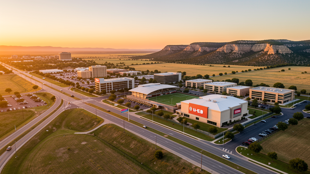
Get Matched With a Local Surveyor
Drone Survey Services Available in Cedar Park, TX
The Austin-Round Rock-Georgetown metro is one of the fastest-growing in the US, and Cedar Park is its tech and sports anchor in the northwest. With 87,000 residents along US 183 and RR 620, Cedar Park is driven by the Bell Boulevard redevelopment, the H-E-B Center sports district, tech employers (Corning, National Oilwell Varco, Bosch), and master-planned communities. Most of the city is in uncontrolled Class E airspace, making it one of the simplest cities in the Austin metro for drone operations. The terrain transition from flat prairie to Hill Country creates diverse survey conditions.
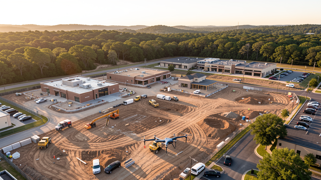
Drone Surveys for Cedar Park's Construction Market
Cedar Park is a tech and sports city of 87,000 residents in Williamson County, northwest of Austin along US 183 and RR 620. The Bell Boulevard redevelopment project is transforming the city's main commercial corridor into a mixed-use district with residential, retail, and office construction. The H-E-B Center at Cedar Park anchors the sports and entertainment district, home to the Texas Stars (AHL) and Austin Spurs (NBA G League). Major tech employers along the US 183 corridor include Corning Optical Communications, National Oilwell Varco, and Bosch. Master-planned communities including Ranch at Brushy Creek, Cypress Creek, and Twin Creeks drive residential construction. The Lakeline Mall area on the border with Austin is a major retail corridor. The Parmer Lane tech corridor extension into Cedar Park brings corporate campus development. Cedar Park Regional Medical Center expansion adds institutional construction demand.
Active Developers in the Area:
Typical Project Costs in Texas
Cost ranges are based on market data for Austin-Round Rock-Georgetown. Actual pricing depends on site size, complexity, and deliverables.
| Service Type | Low End | High End |
|---|---|---|
| Topographic Survey | $1,600 | $4,800 |
| Drone Inspection | $225 | $800 |
| LiDAR Scanning | $2,600 | $9,000 |
| Environmental Monitoring | $850 | $3,200 |
| Aerial Imagery | $175 | $500 |
| Construction Monitoring | $900 | $2,800 |
| Real Estate Photography | $150 | $450 |
| Roof Inspection | $200 | $750 |
Local Airspace & Regulations in Cedar Park, TX
FAA Part 107 Requirements
All commercial drone operations in Texas require the pilot to hold an active FAA Part 107 Remote Pilot Certificate. Our network surveyors are verified Part 107 holders.
State Drone Laws
Texas Government Code Chapter 423 restricts drone use over critical infrastructure facilities, including oil and gas pipelines, refineries, power plants, and water treatment facilities. HB 1484 (2023) added protections for agricultural operations and expanded penalties for drone surveillance of private property. Commercial operators must hold a valid FAA Part 107 Remote Pilot Certificate. Texas does not require a separate state drone license, but operators flying near critical infrastructure must obtain authorization from the facility owner. The Texas Department of Public Safety maintains additional guidelines for drone operations near state facilities.
Local Ordinances
Cedar Park does not issue a separate city-level drone permit for commercial operators. FAA Part 107 certification is the primary requirement. Most of Cedar Park falls outside controlled airspace (uncontrolled Class E near GTU), so LAANC authorization is rarely needed. Commercial filming on city property requires a permit through the Cedar Park Parks and Recreation Department. The city prohibits drone takeoff and landing in city parks without a special use permit, including Brushy Creek Lake Park, Heritage Oak Park, and Milburn Park. Flights from private property (with owner permission) do not require a city permit but must comply with all FAA Part 107 rules and Texas Government Code Chapter 423 critical infrastructure restrictions.
Restricted Airspace
- Class C airspace around Austin-Bergstrom International (AUS) — located 22 miles south. The outer shelves of AUS Class C may extend into far southern Cedar Park. Most of Cedar Park proper falls outside controlled airspace, making LAANC unnecessary for most survey work. Verify altitude shelves on FAA UAS Facility Maps for flights near the southern city limits along RR 620.
- Georgetown Municipal Airport (GTU) — located 12 miles east, uncontrolled Class E airspace. No LAANC required for flights in Cedar Park. GTU has active general aviation traffic; pilots should monitor CTAF and maintain visual separation.
- Cedar Park Center (H-E-B Center at Cedar Park) — stadium TFRs during Texas Stars (AHL hockey) and Austin Spurs (NBA G League) games prohibit drone flights within 3 nautical miles up to 3,000 ft AGL. The venue also hosts concerts and events that trigger temporary restrictions.
- Brushy Creek and Lake Creek — flood-prone waterways that affect central and eastern Cedar Park. The Brushy Creek Lake Park area is a popular recreational destination where drone takeoff and landing is restricted without a special use permit. Flash flooding during spring thunderstorms creates post-flood survey demand.
- Hill Country terrain: western Cedar Park along RR 620 and Anderson Mill Road features limestone hills, cedar-covered slopes, and elevation changes characteristic of the Texas Hill Country. Drone pilots must account for terrain-following altitude limits. The terrain makes LiDAR valuable for wooded sites where photogrammetry cannot penetrate the cedar canopy.
- Severe weather: Cedar Park is in the southern extent of Tornado Alley and experiences severe thunderstorms from March through June. The 2016 Brushy Creek tornado caused significant damage. Drone operations during severe weather warnings are prohibited. Summer temperatures above 100 degrees Fahrenheit reduce drone battery performance.
Airports in the area: undefined (undefined), undefined (undefined), undefined (undefined)
Why Hire Through Aerius View in Cedar Park, TX?
FAA-Certified
Every surveyor holds an active Part 107 Remote Pilot Certificate.
Local to Cedar Park
Surveyors who know the Texas airspace and local permitting.
No Cost to Quote
Submit your project at no charge. Pay the surveyor directly if you proceed.
Fast Turnaround
A local surveyor contacts you within 2 business days.
How Our Cedar Park Matching Process Works
We're actively building our network of FAA-certified drone operators in Cedar Park, TX. Here's exactly what happens when you submit a project request.
Submit Your Project
Tell us your site location, acreage, and what you need (topographic survey, LiDAR, inspection, etc.). Takes 60 seconds. No cost, no obligation.
We Match & Vet
We identify Part 107-certified operators in Texas with the right equipment for your project. Every pilot is verified for active certification, insurance, and relevant experience in Texas airspace.
You Get Quotes
Matched surveyors contact you within 2 business days with quotes. You compare pricing, timelines, and deliverables, then choose the right fit. You pay the surveyor directly, no markup.
What Deliverables Do You Get?
Every project includes professional-grade deliverables compatible with standard construction and engineering software:
- Orthomosaic maps (GeoTIFF) for site overview and documentation
- Point clouds (LAS/LAZ) for 3D modeling and volumetric analysis
- DEM/DSM terrain models for cut/fill and grade analysis
- Contour lines (DXF/DWG, CAD-ready) for Civil 3D and Revit
- Progress reports with side-by-side comparisons for construction monitoring
- Coordinate systems matched to your project datum (State Plane, UTM, or local)
Insurance & Liability Protection
Pilot Insurance Required
Every operator in our network must carry active liability insurance. Minimum coverage: $1,000,000 general liability. Proof of insurance is verified before any pilot joins the network.
FAA Part 107 Verified
We confirm each pilot's Remote Pilot Certificate is active and in good standing through the FAA Airmen Inquiry system. Expired certificates are flagged automatically.
Equipment Documentation
Pilots list their drone models, sensors (RGB, LiDAR, thermal, multispectral), and payload specs so we can match the right equipment to your project requirements.
Site Safety Coordination
Pilots coordinate with your site superintendent for safe operations on active construction sites, including flight plans that avoid worker areas and equipment zones.
Cedar Park, TX Drone Survey FAQs
Do I need a permit for a drone survey in Cedar Park?
Cedar Park does not issue a separate city-level drone permit for commercial operators. FAA Part 107 certification is mandatory. Most of Cedar Park falls outside controlled airspace (uncontrolled Class E near Georgetown Municipal Airport), so LAANC authorization is rarely needed for survey work. This makes Cedar Park one of the simplest cities in the Austin metro for drone operations. Drone takeoff and landing in city parks requires a special use permit.
How much does a drone survey cost in Cedar Park?
Cedar Park pricing is similar to the Austin metro average. Topographic surveys typically range from $1,600 to $4,800. LiDAR scanning runs $2,600 to $9,000 for wooded Hill Country sites. Roof inspections cost $200 to $750 per building. Construction monitoring is typically $900 to $2,800 per month for recurring flights at MPC sites like Ranch at Brushy Creek and Twin Creeks.
Are there no-fly zones around the H-E-B Center at Cedar Park?
Yes. The H-E-B Center at Cedar Park (home of the Texas Stars and Austin Spurs) has stadium TFRs during hockey games, basketball games, and concerts. Drone flights within 3 nautical miles up to 3,000 ft AGL are prohibited during events. The venue also hosts major concerts and community events. Always check the event schedule before scheduling survey flights near the center.
How does the Bell Boulevard redevelopment affect drone survey demand?
The Bell Boulevard redevelopment is Cedar Park's largest civic project, transforming the main commercial corridor into a mixed-use district with residential, retail, office, and civic construction. The project generates ongoing demand for topographic surveys, construction monitoring, and earthwork verification. The multi-phase nature of the project means multi-year survey contracts for firms that can demonstrate local expertise and navigate the Hill Country terrain transition in western Cedar Park.
Does Cedar Park's Hill Country terrain affect drone survey operations?
Western Cedar Park along RR 620 features limestone hills, cedar-covered slopes, and elevation changes. FAA Part 107 requires maintaining flight within 400 ft of the ground surface, which requires terrain-following flight planning in hilly areas. LiDAR is particularly valuable for wooded Hill Country sites where photogrammetry cannot penetrate the dense cedar canopy. Eastern Cedar Park transitions to flatter Blackland Prairie, allowing efficient photogrammetry.
What makes Cedar Park unique for drone survey work?
Cedar Park combines Austin metro growth dynamics with simple airspace (mostly uncontrolled Class E) and a terrain transition from flat prairie to Hill Country within one city. The Bell Boulevard redevelopment, tech corridor expansion along US 183, and master-planned communities (Twin Creeks, Ranch at Brushy Creek) create diverse survey demand. The H-E-B Center sports venue and the proximity to Austin's Lakeline tech corridor add commercial and institutional survey opportunities.
Nearby Cities
Are You a Drone Surveyor in Cedar Park?
Get pre-qualified leads in your service area. No membership fees, no monthly minimums. First lead free.
Ready to Start Your Project in Cedar Park, TX?
Get matched with a local, FAA-certified surveyor. No cost, no obligation.
Request a Free Quote