Drone Survey Services in Lubbock, TX
From Texas Tech University campus expansion and the Marsha Sharp Freeway to the Overton Park redevelopment and West Texas wind energy, Lubbock is the regional hub for the South Plains where medical, educational, and agricultural construction drive diverse survey demand.
Serving Lubbock County & the Lubbock area
Request a Free Quote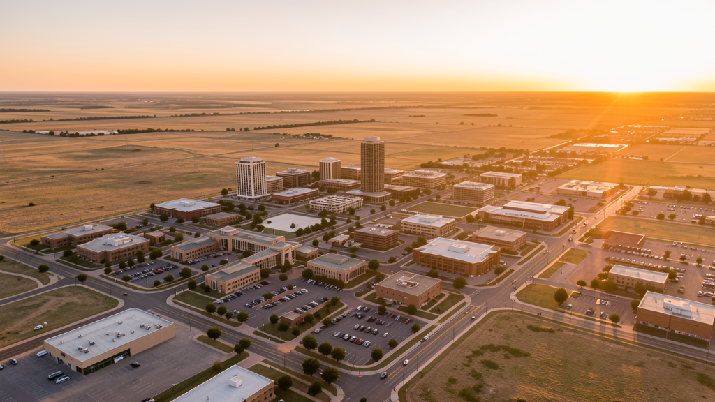
Get Matched With a Local Surveyor
Drone Survey Services Available in Lubbock, TX
Lubbock is the West Texas regional hub with 260,000 residents, anchored by Texas Tech University, the TTU Health Sciences Center, and Covenant Health System. The Marsha Sharp Freeway expansion, Overton Park redevelopment, and Loop 289 improvements drive construction survey demand. LBB Class C airspace covers northern Lubbock, with most of the city in uncontrolled Class E.
Drone Surveys for Lubbock's Construction Market
Lubbock is the West Texas medical, education, and retail hub, anchored by Texas Tech University (40,000+ students), the TTU Health Sciences Center, and the Covenant Health System. The Marsha Sharp Freeway (US 62/82) expansion through the city and the Loop 289 beltway improvements drive heavy civil construction. The Overton Park redevelopment district near downtown is transforming the area with mixed-use, residential, and retail development. The West Texas cotton industry and growing wind energy sector add agricultural and industrial survey demand. Lubbock's position as the largest city within 200 miles makes it the regional survey hub for the South Plains.
Active Developers in the Area:
Typical Project Costs in Texas
Cost ranges are based on market data for Lubbock. Actual pricing depends on site size, complexity, and deliverables.
| Service Type | Low End | High End |
|---|---|---|
| Topographic Survey | $1,400 | $4,000 |
| Drone Inspection | $200 | $700 |
| LiDAR Scanning | $2,200 | $7,000 |
| Environmental Monitoring | $700 | $2,800 |
| Aerial Imagery | $150 | $450 |
| Construction Monitoring | $750 | $2,400 |
| Real Estate Photography | $125 | $400 |
| Roof Inspection | $175 | $600 |
Local Airspace & Regulations in Lubbock, TX
FAA Part 107 Requirements
All commercial drone operations in Texas require the pilot to hold an active FAA Part 107 Remote Pilot Certificate. Our network surveyors are verified Part 107 holders.
State Drone Laws
Texas Government Code Chapter 423 restricts drone use over critical infrastructure facilities, including oil and gas pipelines, refineries, power plants, and water treatment facilities. HB 1484 (2023) added protections for agricultural operations and expanded penalties for drone surveillance of private property. Commercial operators must hold a valid FAA Part 107 Remote Pilot Certificate. Texas does not require a separate state drone license, but operators flying near critical infrastructure must obtain authorization from the facility owner. The Texas Department of Public Safety maintains additional guidelines for drone operations near state facilities.
Local Ordinances
Lubbock does not issue a separate city-level drone permit for commercial operators. FAA Part 107 certification and LAANC authorization for LBB Class C airspace are the primary requirements. Drone takeoff and landing in city parks requires a permit from the Lubbock Parks and Recreation Department. Flights over Texas Tech University campus require authorization from TTU Facilities.
Restricted Airspace
- Class C airspace around Lubbock Preston Smith International (LBB) — located 5 miles north. LBB Class C extends into northern Lubbock. LAANC authorization required for commercial drone flights north of Loop 289.
- Texas Tech University campus — drone flights require authorization from TTU Facilities. TTU has active research programs and a medical school campus with helicopter operations.
- Covenant Health System and UMC Health Center — active medical helicopter operations. Drone pilots should monitor CTAF and maintain awareness of helicopter traffic near hospitals.
- Severe weather: Lubbock is in the South Plains tornado risk zone. The 1970 Lubbock tornado (F5) devastated downtown. Spring thunderstorms (April-June) produce tornadoes, large hail, and damaging winds. Post-storm roof inspection and hail damage documentation is a major drone survey use case.
- High wind and dust storms (haboobs): West Texas experiences frequent high wind events and dust storms, especially during spring and early summer. These conditions create flight safety hazards and limit survey windows.
Airports in the area: undefined (undefined), undefined (undefined)
Why Hire Through Aerius View in Lubbock, TX?
FAA-Certified
Every surveyor holds an active Part 107 Remote Pilot Certificate.
Local to Lubbock
Surveyors who know the Texas airspace and local permitting.
No Cost to Quote
Submit your project at no charge. Pay the surveyor directly if you proceed.
Fast Turnaround
A local surveyor contacts you within 2 business days.
How Our Lubbock Matching Process Works
We're actively building our network of FAA-certified drone operators in Lubbock, TX. Here's exactly what happens when you submit a project request.
Submit Your Project
Tell us your site location, acreage, and what you need (topographic survey, LiDAR, inspection, etc.). Takes 60 seconds. No cost, no obligation.
We Match & Vet
We identify Part 107-certified operators in Texas with the right equipment for your project. Every pilot is verified for active certification, insurance, and relevant experience in Texas airspace.
You Get Quotes
Matched surveyors contact you within 2 business days with quotes. You compare pricing, timelines, and deliverables, then choose the right fit. You pay the surveyor directly, no markup.
What Deliverables Do You Get?
Every project includes professional-grade deliverables compatible with standard construction and engineering software:
- Orthomosaic maps (GeoTIFF) for site overview and documentation
- Point clouds (LAS/LAZ) for 3D modeling and volumetric analysis
- DEM/DSM terrain models for cut/fill and grade analysis
- Contour lines (DXF/DWG, CAD-ready) for Civil 3D and Revit
- Progress reports with side-by-side comparisons for construction monitoring
- Coordinate systems matched to your project datum (State Plane, UTM, or local)
Insurance & Liability Protection
Pilot Insurance Required
Every operator in our network must carry active liability insurance. Minimum coverage: $1,000,000 general liability. Proof of insurance is verified before any pilot joins the network.
FAA Part 107 Verified
We confirm each pilot's Remote Pilot Certificate is active and in good standing through the FAA Airmen Inquiry system. Expired certificates are flagged automatically.
Equipment Documentation
Pilots list their drone models, sensors (RGB, LiDAR, thermal, multispectral), and payload specs so we can match the right equipment to your project requirements.
Site Safety Coordination
Pilots coordinate with your site superintendent for safe operations on active construction sites, including flight plans that avoid worker areas and equipment zones.
Lubbock, TX Drone Survey FAQs
Do I need a permit for a drone survey in Lubbock?
Lubbock does not issue a separate city-level drone permit. FAA Part 107 certification is mandatory. LAANC authorization is required for controlled airspace. Drone takeoff and landing in city parks requires a permit.
How much does a drone survey cost in Lubbock?
Lubbock pricing reflects the regional market. Topographic surveys typically range from $1,400 to $4,000. LiDAR scanning runs $2,200 to $7,000. Roof inspections cost $175 to $600 per building.
What airspace restrictions affect drone operations in Lubbock?
See the airspace section above for specific Class B/C/D and military restrictions. Always check FAA UAS Facility Maps and LAANC grids before flying.
Are there seasonal considerations for drone surveys in Lubbock?
Spring thunderstorms (April-June) can produce severe weather including tornadoes and large hail. Post-storm roof inspection is a major use case. Summer heat may limit flight windows to early morning and evening. Always check NOTAMs and weather before flying.
Can I fly a drone over construction sites in Lubbock?
Drone flights over active construction sites require coordination with the site manager per FAA Part 107.39 (no flight over people not directly involved). Survey flights should be scheduled during non-peak construction hours.
What makes Lubbock unique for drone survey work?
From Texas Tech University campus expansion and the Marsha Sharp Freeway to the Overton Park redevelopment and West Texas wind energy, Lubbock is the regional hub for the South Plains where medical, educational, and agricultural construction drive diverse survey demand.
Nearby Cities
Are You a Drone Surveyor in Lubbock?
Get pre-qualified leads in your service area. No membership fees, no monthly minimums. First lead free.
Ready to Start Your Project in Lubbock, TX?
Get matched with a local, FAA-certified surveyor. No cost, no obligation.
Request a Free Quote