Drone Survey Services in Killeen, TX
From Fort Cavazos (Fort Hood) military construction and the III Armored Corps reactivation to the I-14 expansion and Texas A&M Central Texas campus, Killeen is a military-driven city where federal construction and residential growth drive intense survey demand under GRK Class D and military restricted airspace.
Serving Bell County & the Killeen-Temple area
Request a Free Quote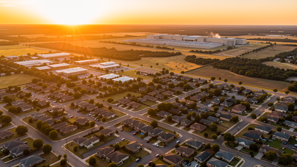
Get Matched With a Local Surveyor
Drone Survey Services Available in Killeen, TX
Killeen is anchored by Fort Cavazos (formerly Fort Hood) with 155,000 residents. The base with 40,000+ personnel generates massive military construction demand. The I-14/US 190 expansion, Texas A&M Central Texas campus, and west Killeen residential development add civilian construction. GRK Class D and Fort Cavazos military restricted airspace create unique airspace considerations.
Drone Surveys for Killeen's Construction Market
Killeen is anchored by Fort Cavazos (formerly Fort Hood), one of the largest US Army installations with 40,000+ military and civilian personnel. The base generates massive military construction demand including barracks, training facilities, hospital expansion, and infrastructure. The I-14/US 190 expansion through Killeen, the Clear Creek Road extension, and the West Killeen residential development drive civilian construction. The Killeen Medical Center and the Texas A&M Central Texas campus add institutional construction. The fort's transition to Fort Cavazos and the III Armored Corps reactivation drive new federal construction projects.
Active Developers in the Area:
Typical Project Costs in Texas
Cost ranges are based on market data for Killeen-Temple. Actual pricing depends on site size, complexity, and deliverables.
| Service Type | Low End | High End |
|---|---|---|
| Topographic Survey | $1,400 | $4,200 |
| Drone Inspection | $200 | $700 |
| LiDAR Scanning | $2,300 | $7,500 |
| Environmental Monitoring | $750 | $3,000 |
| Aerial Imagery | $150 | $450 |
| Construction Monitoring | $800 | $2,600 |
| Real Estate Photography | $125 | $400 |
| Roof Inspection | $175 | $600 |
Local Airspace & Regulations in Killeen, TX
FAA Part 107 Requirements
All commercial drone operations in Texas require the pilot to hold an active FAA Part 107 Remote Pilot Certificate. Our network surveyors are verified Part 107 holders.
State Drone Laws
Texas Government Code Chapter 423 restricts drone use over critical infrastructure facilities, including oil and gas pipelines, refineries, power plants, and water treatment facilities. HB 1484 (2023) added protections for agricultural operations and expanded penalties for drone surveillance of private property. Commercial operators must hold a valid FAA Part 107 Remote Pilot Certificate. Texas does not require a separate state drone license, but operators flying near critical infrastructure must obtain authorization from the facility owner. The Texas Department of Public Safety maintains additional guidelines for drone operations near state facilities.
Local Ordinances
Killeen does not issue a separate city-level drone permit for commercial operators. FAA Part 107 certification and LAANC authorization for GRK Class D airspace are the primary requirements. Flights near Fort Cavazos require DoD coordination. The base boundary has enhanced security monitoring. Drone takeoff and landing in city parks requires a permit.
Restricted Airspace
- Class D airspace around Killeen-Fort Hood Regional Airport (GRK) — located 8 miles south. LAANC authorization required for flights in southern Killeen.
- Fort Cavazos (formerly Fort Hood) — massive military installation (214,000 acres) directly west of Killeen. Military restricted airspace covers the installation. DoD coordination required for any flights near the base boundary. Fort Cavazos is one of the largest US Army installations with active armored vehicle training, artillery ranges, and helicopter operations.
- Severe weather: Central Texas tornado risk zone. Spring thunderstorms produce tornadoes, large hail, and flash flooding. Post-storm roof inspection and military facility damage documentation are significant survey use cases.
Airports in the area: undefined (undefined), undefined (undefined)
Why Hire Through Aerius View in Killeen, TX?
FAA-Certified
Every surveyor holds an active Part 107 Remote Pilot Certificate.
Local to Killeen
Surveyors who know the Texas airspace and local permitting.
No Cost to Quote
Submit your project at no charge. Pay the surveyor directly if you proceed.
Fast Turnaround
A local surveyor contacts you within 2 business days.
How Our Killeen Matching Process Works
We're actively building our network of FAA-certified drone operators in Killeen, TX. Here's exactly what happens when you submit a project request.
Submit Your Project
Tell us your site location, acreage, and what you need (topographic survey, LiDAR, inspection, etc.). Takes 60 seconds. No cost, no obligation.
We Match & Vet
We identify Part 107-certified operators in Texas with the right equipment for your project. Every pilot is verified for active certification, insurance, and relevant experience in Texas airspace.
You Get Quotes
Matched surveyors contact you within 2 business days with quotes. You compare pricing, timelines, and deliverables, then choose the right fit. You pay the surveyor directly, no markup.
What Deliverables Do You Get?
Every project includes professional-grade deliverables compatible with standard construction and engineering software:
- Orthomosaic maps (GeoTIFF) for site overview and documentation
- Point clouds (LAS/LAZ) for 3D modeling and volumetric analysis
- DEM/DSM terrain models for cut/fill and grade analysis
- Contour lines (DXF/DWG, CAD-ready) for Civil 3D and Revit
- Progress reports with side-by-side comparisons for construction monitoring
- Coordinate systems matched to your project datum (State Plane, UTM, or local)
Insurance & Liability Protection
Pilot Insurance Required
Every operator in our network must carry active liability insurance. Minimum coverage: $1,000,000 general liability. Proof of insurance is verified before any pilot joins the network.
FAA Part 107 Verified
We confirm each pilot's Remote Pilot Certificate is active and in good standing through the FAA Airmen Inquiry system. Expired certificates are flagged automatically.
Equipment Documentation
Pilots list their drone models, sensors (RGB, LiDAR, thermal, multispectral), and payload specs so we can match the right equipment to your project requirements.
Site Safety Coordination
Pilots coordinate with your site superintendent for safe operations on active construction sites, including flight plans that avoid worker areas and equipment zones.
Killeen, TX Drone Survey FAQs
Do I need a permit for a drone survey in Killeen?
Killeen does not issue a separate city-level drone permit for commercial operators. FAA Part 107 certification and LAANC authorization for GRK Class D airspace are the primary requirements. Flights near Fort Cavazos require DoD coordination. The base boundary has enhanced security monitoring. Drone takeoff and landing in city parks requires a permit.
How much does a drone survey cost in Killeen?
Killeen pricing reflects the regional market. Topographic surveys typically range from $1,350 to $4,000. LiDAR scanning runs $2,200 to $7,000. Roof inspections cost $150 to $600 per building.
How does Fort Cavazos affect drone operations in Killeen?
Fort Cavazos (formerly Fort Hood) is a massive 214,000-acre military installation directly west of Killeen. Military restricted airspace covers the installation. DoD coordination is required for any flights near the base boundary. The base has active armored vehicle training, artillery ranges, and helicopter operations. Always check NOTAMs for military training activity.
Are there seasonal considerations for drone surveys in Killeen?
Central Texas tornado risk zone. Spring thunderstorms (April-June) produce tornadoes, large hail, and flash flooding. Post-storm roof inspection and military facility damage documentation are significant use cases. Summer heat requires early morning flights.
Can I fly a drone over Fort Cavazos?
No. Fort Cavazos is a military installation with restricted airspace. DoD coordination is required for any flights within 5 nautical miles. The base conducts active training with armored vehicles, artillery, and helicopters. Always check NOTAMs and coordinate with the base operations office.
What makes Killeen unique for drone survey work?
From Fort Cavazos (Fort Hood) military construction and the III Armored Corps reactivation to the I-14 expansion and Texas A&M Central Texas campus, Killeen is a military-driven city where federal construction and residential growth drive intense survey demand under GRK Class D and military restricted airspace.
Nearby Cities
Are You a Drone Surveyor in Killeen?
Get pre-qualified leads in your service area. No membership fees, no monthly minimums. First lead free.
Ready to Start Your Project in Killeen, TX?
Get matched with a local, FAA-certified surveyor. No cost, no obligation.
Request a Free Quote