Drone Survey Services in League City, TX
From the NASA/Clear Lake aerospace corridor and Ellington Field military operations to UTMB Health Clear Lake and the I-45 expansion, League City is a fast-growing Houston bay-area suburb where military airspace, JSC security zones, and waterfront survey demand create unique complexity.
Serving Galveston County & the Houston-The Woodlands-Sugar Land area
Request a Free Quote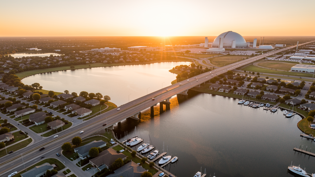
Get Matched With a Local Surveyor
Drone Survey Services Available in League City, TX
The Houston-The Woodlands-Sugar Land metro is one of the largest construction markets in the US, and League City is a key bay-area suburb in the NASA/Clear Lake corridor with 115,000 residents. Aerospace industry growth (NASA JSC, Boeing, Lockheed Martin), the UTMB Health Clear Lake hospital campus, waterfront MPCs, and the I-45/Grand Parkway expansions drive diverse survey demand. EFD military joint-use airspace and JSC security zones create unique airspace complexity.
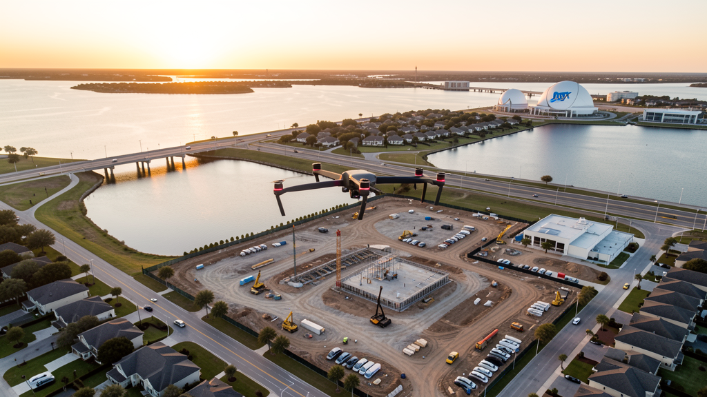
Drone Surveys for League City's Construction Market
League City is a fast-growing Houston metro suburb in the NASA/Clear Lake corridor with a population that has grown from 45,000 to 115,000 in 15 years. The city is anchored by the I-45/Gulf Freeway corridor, the Clear Lake Medical Center campus, and the Baybrook Mall retail hub. Aerospace industry growth at NASA Johnson Space Center and the surrounding Clear Lake aerospace cluster (Boeing, Lockheed Martin, Jacobs Engineering) drives commercial development. Master-planned communities including Magnolia Creek, South Shore Harbour, and Tuscan Lakes are the primary residential growth drivers. The University of Houston-Clear Lake campus expansion, the UTMB Health Clear Lake hospital campus, and the Baybrook Mall mixed-use expansion add institutional and commercial construction. The I-45 expansion project and the Grand Parkway (SH 99) extension through southern League City generate heavy civil survey demand. The city's position on Clear Lake creates waterfront residential and commercial survey demand unique to the Houston metro.
Active Developers in the Area:
Typical Project Costs in Texas
Cost ranges are based on market data for Houston-The Woodlands-Sugar Land. Actual pricing depends on site size, complexity, and deliverables.
| Service Type | Low End | High End |
|---|---|---|
| Topographic Survey | $1,600 | $4,800 |
| Drone Inspection | $225 | $800 |
| LiDAR Scanning | $2,600 | $8,800 |
| Environmental Monitoring | $850 | $3,400 |
| Aerial Imagery | $175 | $500 |
| Construction Monitoring | $900 | $2,800 |
| Real Estate Photography | $150 | $450 |
| Roof Inspection | $200 | $750 |
Local Airspace & Regulations in League City, TX
FAA Part 107 Requirements
All commercial drone operations in Texas require the pilot to hold an active FAA Part 107 Remote Pilot Certificate. Our network surveyors are verified Part 107 holders.
State Drone Laws
Texas Government Code Chapter 423 restricts drone use over critical infrastructure facilities, including oil and gas pipelines, refineries, power plants, and water treatment facilities. HB 1484 (2023) added protections for agricultural operations and expanded penalties for drone surveillance of private property. Commercial operators must hold a valid FAA Part 107 Remote Pilot Certificate. Texas does not require a separate state drone license, but operators flying near critical infrastructure must obtain authorization from the facility owner. The Texas Department of Public Safety maintains additional guidelines for drone operations near state facilities.
Local Ordinances
League City does not issue a separate city-level drone permit for commercial operators. FAA Part 107 certification and LAANC authorization for HOU Class C and EFD Class D airspace are the primary requirements. Commercial filming on city property requires a permit through the League City Parks and Recreation Department. Drone takeoff and landing in city parks requires a special use permit, including Hometown Heroes Park, League Park, and Rustic Oaks Park. Flights over Clear Lake and Galveston Bay should follow FAA maritime guidelines and avoid interfering with Coast Guard operations. Flights near NASA Johnson Space Center require coordination with NASA security.
Restricted Airspace
- Class C airspace around Houston Hobby (HOU) — located 8 miles north. HOU Class C shelves extend into northern League City. LAANC authorization required for commercial drone flights north of FM 518 and the I-45 corridor.
- Class D airspace around Ellington Airport (EFD) — located 5 miles east. EFD is a joint-use civilian/military airport with Texas Air National Guard operations. LAANC authorization required for flights in eastern League City. EFD has military T-6 Texan II and F-16 training flights creating significant low-altitude traffic.
- NASA Johnson Space Center — located 5 miles north. While not formal restricted airspace, JSC has enhanced security zones and no-drone buffer areas. Drone flights near JSC require coordination with NASA security. The JSC campus includes active testing facilities, astronaut training, and mission control.
- Clear Lake and Galveston Bay — drone flights over navigable waters require FAA Part 107 compliance with 14 CFR Part 91 airspace rules. Coast Guard patrol boats and recreational marine traffic create hazards for low-altitude flights.
- Baybrook Mall and League City Town Center — commercial areas with heavy pedestrian traffic. Drone flights should follow Part 107.39 (no flight over people not directly involved in the operation).
- University of Houston-Clear Lake (UHCL) — campus drone flights require authorization from UHCL facilities management. The campus is adjacent to JSC and has enhanced security considerations.
- Severe weather: League City is in the Houston metro hurricane risk zone and sits on Clear Lake, making it highly vulnerable to storm surge. Hurricane season (June-November) can produce high winds, tornadoes, and flooding. Post-hurricane roof inspection, flood damage documentation, and storm surge mapping are major drone survey use cases.
Airports in the area: undefined (undefined), undefined (undefined), undefined (undefined)
Why Hire Through Aerius View in League City, TX?
FAA-Certified
Every surveyor holds an active Part 107 Remote Pilot Certificate.
Local to League City
Surveyors who know the Texas airspace and local permitting.
No Cost to Quote
Submit your project at no charge. Pay the surveyor directly if you proceed.
Fast Turnaround
A local surveyor contacts you within 2 business days.
How Our League City Matching Process Works
We're actively building our network of FAA-certified drone operators in League City, TX. Here's exactly what happens when you submit a project request.
Submit Your Project
Tell us your site location, acreage, and what you need (topographic survey, LiDAR, inspection, etc.). Takes 60 seconds. No cost, no obligation.
We Match & Vet
We identify Part 107-certified operators in Texas with the right equipment for your project. Every pilot is verified for active certification, insurance, and relevant experience in Texas airspace.
You Get Quotes
Matched surveyors contact you within 2 business days with quotes. You compare pricing, timelines, and deliverables, then choose the right fit. You pay the surveyor directly, no markup.
What Deliverables Do You Get?
Every project includes professional-grade deliverables compatible with standard construction and engineering software:
- Orthomosaic maps (GeoTIFF) for site overview and documentation
- Point clouds (LAS/LAZ) for 3D modeling and volumetric analysis
- DEM/DSM terrain models for cut/fill and grade analysis
- Contour lines (DXF/DWG, CAD-ready) for Civil 3D and Revit
- Progress reports with side-by-side comparisons for construction monitoring
- Coordinate systems matched to your project datum (State Plane, UTM, or local)
Insurance & Liability Protection
Pilot Insurance Required
Every operator in our network must carry active liability insurance. Minimum coverage: $1,000,000 general liability. Proof of insurance is verified before any pilot joins the network.
FAA Part 107 Verified
We confirm each pilot's Remote Pilot Certificate is active and in good standing through the FAA Airmen Inquiry system. Expired certificates are flagged automatically.
Equipment Documentation
Pilots list their drone models, sensors (RGB, LiDAR, thermal, multispectral), and payload specs so we can match the right equipment to your project requirements.
Site Safety Coordination
Pilots coordinate with your site superintendent for safe operations on active construction sites, including flight plans that avoid worker areas and equipment zones.
League City, TX Drone Survey FAQs
Do I need a permit for a drone survey in League City?
League City does not issue a separate city-level drone permit for commercial operators. FAA Part 107 certification is mandatory. LAANC authorization is required for northern League City within HOU Class C and eastern League City within EFD Class D. The EFD zone is a joint civilian/military airport requiring extra coordination. Drone takeoff and landing in city parks requires a special use permit.
How much does a drone survey cost in League City?
League City pricing is consistent with the Houston metro average. Topographic surveys typically range from $1,600 to $4,800. LiDAR scanning runs $2,600 to $8,800. Roof inspections cost $200 to $750 per building. Construction monitoring is typically $900 to $2,800 per month for recurring flights at MPC sites or the I-45 corridor.
How does Ellington Airport affect drone operations in League City?
Ellington Airport (EFD) is located 5 miles east and is a joint-use civilian/military airport with Texas Air National Guard operations. The EFD Class D extends into eastern League City. LAANC authorization is required. EFD has military T-6 Texan II and F-16 training flights, creating significant low-altitude traffic. Always check NOTAMs for military training activity before flying.
Can I fly a drone near NASA Johnson Space Center?
JSC is located 5 miles north and has enhanced security zones. While not formal restricted airspace, drone flights near JSC require coordination with NASA security. The JSC campus includes active testing facilities, astronaut training, and mission control. The Clear Lake aerospace cluster (Boeing, Lockheed Martin, Jacobs) extends into League City, creating commercial survey demand but requiring security awareness.
Are there special rules for flying over Clear Lake and Galveston Bay?
Drone flights over navigable waters require FAA Part 107 compliance with maritime airspace rules. Coast Guard patrol boats and recreational marine traffic create hazards for low-altitude flights. Maintain visual line of sight and avoid interfering with marine traffic. Waterfront residential and commercial survey demand is unique to League City in the Houston metro.
What makes League City unique for drone survey work?
League City sits in the NASA/Clear Lake aerospace corridor, with aerospace industry growth (Boeing, Lockheed Martin, Jacobs), the UTMB Health Clear Lake hospital campus, and waterfront MPCs (South Shore Harbour, Tuscan Lakes). The EFD military joint-use airport and JSC security zones create unique airspace complexity. The I-45 expansion and Grand Parkway extension drive heavy civil survey demand. The city's position on Clear Lake creates waterfront survey demand unique to the Houston metro.
Nearby Cities
Are You a Drone Surveyor in League City?
Get pre-qualified leads in your service area. No membership fees, no monthly minimums. First lead free.
Ready to Start Your Project in League City, TX?
Get matched with a local, FAA-certified surveyor. No cost, no obligation.
Request a Free Quote