Drone Survey Services in Arlington, TX
From AT&T Stadium and Globe Life Field to the UTA campus expansion and the I-20 logistics corridor, Arlington is the DFW mid-cities entertainment capital where 100+ stadium TFR events per year make airspace planning essential for every survey mission.
Serving Tarrant County & the Dallas-Fort Worth-Arlington area
Request a Free Quote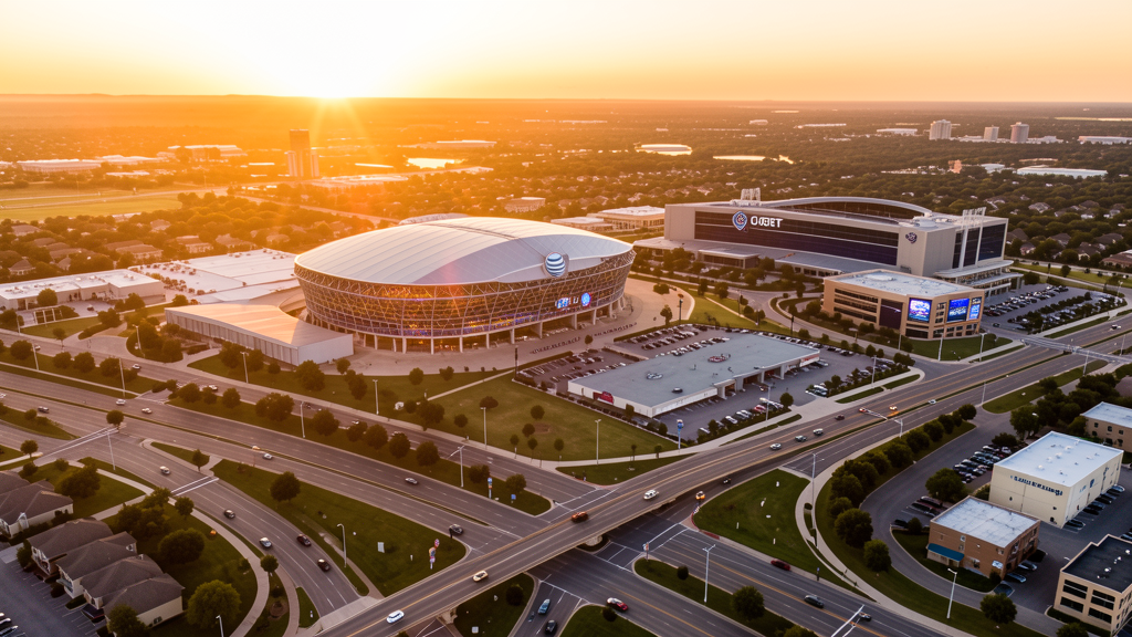
Get Matched With a Local Surveyor
Drone Survey Services Available in Arlington, TX
The Dallas-Fort Worth-Arlington metro is the 4th-largest US metro, and Arlington sits at its center as the entertainment capital. AT&T Stadium (Cowboys), Globe Life Field (Rangers), Six Flags Over Texas, and the Esports Stadium create 100+ stadium TFR events annually. The UTA campus expansion, Texas Live! complex, and south Arlington residential growth drive diverse construction survey demand. DFW Class B airspace covers most of the city, making LAANC authorization essential.
Drone Surveys for Arlington's Construction Market
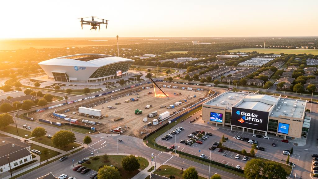
Arlington is the DFW mid-cities entertainment capital, with a construction market driven by the Entertainment District, the University of Texas at Arlington campus expansion, and residential growth in south and west Arlington. The Esports Stadium Arlington and Expo Center expansion, Texas Live! entertainment complex, and Live! by Loews hotel development continue the Entertainment District buildout. UTA is constructing new research facilities, dormitories, and a new engineering building. The I-20 and SH 360 corridor commercial development, including the Pioneer 360 mixed-use project, drives retail and office construction. South Arlington residential growth in the submarket near Burleson and Mansfield continues to convert ranchland to subdivisions. The city's position between Dallas and Fort Worth makes it a logistics and distribution hub, with warehouse construction along the I-20 and SH 360 corridors.
Active Developers in the Area:
Typical Project Costs in Texas
Cost ranges are based on market data for Dallas-Fort Worth-Arlington. Actual pricing depends on site size, complexity, and deliverables.
| Service Type | Low End | High End |
|---|---|---|
| Topographic Survey | $1,650 | $4,800 |
| Drone Inspection | $225 | $800 |
| LiDAR Scanning | $2,700 | $9,000 |
| Environmental Monitoring | $850 | $3,400 |
| Aerial Imagery | $175 | $500 |
| Construction Monitoring | $900 | $2,800 |
| Real Estate Photography | $150 | $450 |
| Roof Inspection | $200 | $750 |
Local Airspace & Regulations in Arlington, TX
FAA Part 107 Requirements
All commercial drone operations in Texas require the pilot to hold an active FAA Part 107 Remote Pilot Certificate. Our network surveyors are verified Part 107 holders.
State Drone Laws
Texas Government Code Chapter 423 restricts drone use over critical infrastructure facilities, including oil and gas pipelines, refineries, power plants, and water treatment facilities. HB 1484 (2023) added protections for agricultural operations and expanded penalties for drone surveillance of private property. Commercial operators must hold a valid FAA Part 107 Remote Pilot Certificate. Texas does not require a separate state drone license, but operators flying near critical infrastructure must obtain authorization from the facility owner. The Texas Department of Public Safety maintains additional guidelines for drone operations near state facilities.
Local Ordinances
Arlington does not issue a separate city-level drone permit for commercial operators. FAA Part 107 certification and LAANC authorization for DFW Class B airspace are the primary requirements for most of the city. The Arlington Police Department Aviation Unit operates helicopter patrols and should be notified of extended drone operations. Drone takeoff and landing in Arlington parks requires a permit from the Parks and Recreation Department, including River Legacy Park, Vandergriff Park, and Veterans Park. Flights over the Entertainment District (AT&T Stadium, Globe Life Field, Six Flags) require coordination with venue security and the Arlington Police Department during events.
Restricted Airspace
- Class B airspace around DFW International — DFW Class B shelves extend over most of northern and central Arlington. LAANC authorization required for all commercial drone flights north of I-20 and west of SH 360. This covers the Entertainment District, downtown, and the University of Texas at Arlington campus.
- AT&T Stadium (Dallas Cowboys) — stadium TFRs during Cowboys games, concerts, and ticketed events prohibit drone flights within 3 nautical miles up to 3,000 ft AGL. AT&T Stadium is one of the most active TFR venues in the US with 10+ NFL games, major concerts, and events year-round.
- Globe Life Field (Texas Rangers) — stadium TFRs during Rangers games and events prohibit drone flights within 3 nautical miles up to 3,000 ft AGL. The retractable roof stadium hosts 80+ MLB games plus concerts and events.
- Six Flags Over Texas and Hurricane Harbor — amusement park TFRs during operating hours prohibit drone flights within the park boundaries. The parks operate March through December with peak summer attendance.
- Esports Stadium Arlington & Expo Center — large venue with event-driven TFRs during major gaming tournaments and conventions.
- University of Texas at Arlington (UTA) — campus drone flights require authorization from the UTA Office of Information Technology. UTA has an active UAS research program and coordinates campus drone operations through their aviation department.
- Arlington Municipal Heliport (AHL) — active EMS and corporate helicopter traffic in downtown Arlington. Drone pilots should monitor CTAF and maintain awareness of helicopter traffic, especially near medical facilities.
- Severe weather: Arlington is in the DFW tornado risk zone. The 2012 Arlington tornado (EF-2) caused significant damage. Post-storm roof inspection and insurance damage documentation is a major drone survey use case.
Airports in the area: undefined (undefined), undefined (undefined), undefined (undefined)
Why Hire Through Aerius View in Arlington, TX?
FAA-Certified
Every surveyor holds an active Part 107 Remote Pilot Certificate.
Local to Arlington
Surveyors who know the Texas airspace and local permitting.
No Cost to Quote
Submit your project at no charge. Pay the surveyor directly if you proceed.
Fast Turnaround
A local surveyor contacts you within 2 business days.
How Our Arlington Matching Process Works
We're actively building our network of FAA-certified drone operators in Arlington, TX. Here's exactly what happens when you submit a project request.
Submit Your Project
Tell us your site location, acreage, and what you need (topographic survey, LiDAR, inspection, etc.). Takes 60 seconds. No cost, no obligation.
We Match & Vet
We identify Part 107-certified operators in Texas with the right equipment for your project. Every pilot is verified for active certification, insurance, and relevant experience in Texas airspace.
You Get Quotes
Matched surveyors contact you within 2 business days with quotes. You compare pricing, timelines, and deliverables, then choose the right fit. You pay the surveyor directly, no markup.
What Deliverables Do You Get?
Every project includes professional-grade deliverables compatible with standard construction and engineering software:
- Orthomosaic maps (GeoTIFF) for site overview and documentation
- Point clouds (LAS/LAZ) for 3D modeling and volumetric analysis
- DEM/DSM terrain models for cut/fill and grade analysis
- Contour lines (DXF/DWG, CAD-ready) for Civil 3D and Revit
- Progress reports with side-by-side comparisons for construction monitoring
- Coordinate systems matched to your project datum (State Plane, UTM, or local)
Insurance & Liability Protection
Pilot Insurance Required
Every operator in our network must carry active liability insurance. Minimum coverage: $1,000,000 general liability. Proof of insurance is verified before any pilot joins the network.
FAA Part 107 Verified
We confirm each pilot's Remote Pilot Certificate is active and in good standing through the FAA Airmen Inquiry system. Expired certificates are flagged automatically.
Equipment Documentation
Pilots list their drone models, sensors (RGB, LiDAR, thermal, multispectral), and payload specs so we can match the right equipment to your project requirements.
Site Safety Coordination
Pilots coordinate with your site superintendent for safe operations on active construction sites, including flight plans that avoid worker areas and equipment zones.
Arlington, TX Drone Survey FAQs
Do I need a permit for a drone survey in Arlington?
Arlington does not issue a separate city-level drone permit for commercial operators. FAA Part 107 certification is mandatory. LAANC authorization is required for most of Arlington because DFW Class B airspace shelves cover the city north of I-20. The Arlington Police Aviation Unit should be notified of extended drone operations. Drone takeoff and landing in city parks requires a permit.
How much does a drone survey cost in Arlington?
Arlington pricing is consistent with the DFW metro average. Topographic surveys typically range from $1,650 to $4,800. LiDAR scanning runs $2,700 to $9,000. Roof inspections cost $200 to $750 per building. Construction monitoring is typically $900 to $2,800 per month for recurring flights at the Entertainment District or UTA campus.
Can I fly a drone near AT&T Stadium and Globe Life Field?
Both venues have active stadium TFRs during events. AT&T Stadium has TFRs for Cowboys games, concerts, and ticketed functions. Globe Life Field has TFRs for Rangers games and events. Drone flights within 3 nautical miles up to 3,000 ft AGL are prohibited during events. The Entertainment District is one of the most TFR-active areas in the US with 100+ events per year. Always check the FAA TFR list before scheduling flights near these venues.
How does DFW Class B airspace affect drone operations in Arlington?
DFW Class B airspace shelves extend over most of northern and central Arlington, north of I-20 and west of SH 360. LAANC authorization is required for all commercial drone flights in this area. The Class B coverage includes downtown, the Entertainment District, UTA campus, and the I-30 commercial corridor. Southern Arlington, south of I-20, falls outside DFW Class B and may not require LAANC.
Can I fly a drone at the University of Texas at Arlington campus?
UTA has an active UAS research program and requires campus drone authorization through their Office of Information Technology. All drone flights on UTA property require prior approval, proof of Part 107 certification, and coordination with campus security. The campus is also within DFW Class B airspace, requiring LAANC authorization.
What makes Arlington unique for drone survey work?
Arlington is the DFW mid-cities entertainment capital with AT&T Stadium, Globe Life Field, Six Flags Over Texas, and the Esports Stadium. The city has 100+ stadium TFR events per year, making TFR planning essential for every survey job. The UTA campus expansion, Texas Live! entertainment complex, and south Arlington residential growth create diverse survey demand. The city's position between Dallas and Fort Worth makes it a logistics hub with warehouse construction along the I-20 corridor.
Nearby Cities
Are You a Drone Surveyor in Arlington?
Get pre-qualified leads in your service area. No membership fees, no monthly minimums. First lead free.
Ready to Start Your Project in Arlington, TX?
Get matched with a local, FAA-certified surveyor. No cost, no obligation.
Request a Free Quote