Drone Survey Services in Spokane, WA
From the $400 million South Falls development to the $150 million University District health sciences campus and 1,800+ new residential units, Spokane is experiencing its largest construction cycle in decades, driving relentless demand for drone survey and construction monitoring along the I-90 corridor.
Serving Spokane County & the Spokane area
Request a Free Quote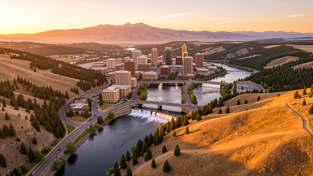
Get Matched With a Local Surveyor
Drone Survey Services Available in Spokane, WA
Spokane anchors the Inland Northwest as the largest city between Seattle and Minneapolis, serving as the commercial and healthcare hub for a 2.5 million person region spanning eastern Washington, north Idaho, and western Montana. The city combines a revitalizing downtown with rapid residential growth in South Hill and North Side neighborhoods. GEG Class C and SFF Class D airspace cover the urban core, while Fairchild AFB creates military airspace considerations to the southwest. The proximity to Coeur d Alene and Post Falls, Idaho creates a cross-state metro region with shared construction market dynamics.
Drone Surveys for Spokane's Construction Market
Spokane is experiencing a major downtown revitalization with the $400 million South Falls development project, the expansion of the Spokane Convention Center, and the $150 million University District health sciences campus. The city is also investing in the $100 million North Bank redevelopment along the Spokane River. Residential permitting exceeded 1,800 new housing units in 2023-2024, driven by growth in the South Hill and North Side neighborhoods. The Spokane Transit Authority is expanding its bus rapid transit line along the Division Street corridor. Major infrastructure includes the Boltz Road interchange on I-90 and the North Spokane Corridor project.
Active Developers in the Area:

Typical Project Costs in Washington
Cost ranges are based on market data for Spokane. Actual pricing depends on site size, complexity, and deliverables.
| Service Type | Low End | High End |
|---|---|---|
| Topographic Survey | $1,400 | $5,200 |
| Drone Inspection | $900 | $3,400 |
| LiDAR Scanning | $3,200 | $9,000 |
| Environmental Monitoring | $1,600 | $5,500 |
| Aerial Imagery | $550 | $2,200 |
| Construction Monitoring | $1,100 | $4,000 |
| Real Estate Photography | $350 | $1,500 |
| Roof Inspection | $450 | $1,700 |
Local Airspace & Regulations in Spokane, WA
FAA Part 107 Requirements
All commercial drone operations in Washington require the pilot to hold an active FAA Part 107 Remote Pilot Certificate. Our network surveyors are verified Part 107 holders.
State Drone Laws
Washington regulates drones through multiple statutes. ESSB 6001 (2015) requires law enforcement to obtain a warrant before using drones for surveillance, with exceptions for emergency response, search and rescue, and forest fire management. RCW 9A.44.115 extends voyeurism laws to drone-based image capture of private premises. RCW 46.60.130 prohibits drone interference with manned aircraft and emergency response operations. Washington does not require a separate state-level drone license for commercial operators, but all commercial drone pilots must hold a valid FAA Part 107 Remote Pilot Certificate. The state preempts local regulation of drone flight paths and navigable airspace (RCW 47.68), though cities may regulate takeoff and landing on public property they own. Washington State Parks prohibit drone takeoff and landing without a permit (WAC 352-32). Commercial operators near military installations (JBLM, Fairchild AFB, Naval Air Station Whidbey Island) must coordinate with base operations.
Local Ordinances
Spokane City Code requires a Special Use Permit for commercial drone operations taking off or landing on city-owned property, including Riverfront Park, Manito Park, and Liberty Park. The permit costs $50 with a 7-day processing period through Spokane Parks and Recreation. Flights from private property require owner permission and FAA Part 107 compliance. Washington ESSB 6001 requires law enforcement to obtain warrants for surveillance drone use. Washington State Parks (WAC 352-32) prohibit drone operations without a permit. Idaho border is 20 miles east, and operators flying near the state line should be aware of Idaho drone regulations as well.
Restricted Airspace
- Class C airspace around GEG extends 5 nautical miles, surface to 4,000 ft AGL. Central Spokane falls within the GEG Class C inner core requiring LAANC authorization for all commercial drone flights.
- Fairchild Air Force Base (SKA) Class D airspace 8 miles southwest. Active military training operations including KC-135 refueling missions. Drone flights within 5 NM of SKA require coordination with base operations. NOTAMs frequently issued.
- Felts Field (SFF) Class D airspace covers the east side of Spokane. Commercial drone flights within 4 NM of SFF require LAANC authorization.
- Riverfront Park and Spokane Falls are city parks. Spokane City Code prohibits drone takeoff and landing in parks without a Special Use Permit from Spokane Parks and Recreation.
- Mount Spokane State Park 15 miles northeast. Washington State Parks prohibit drone takeoff and landing without a permit (WAC 352-32). Seasonal fire TFRs common July through October.
- Spokane International Airport is a major FedEx air cargo hub. Extended approach and departure corridors create additional airspace considerations for drone operations along the I-90 corridor.
Airports in the area: undefined (undefined), undefined (undefined), undefined (undefined)
Why Hire Through Aerius View in Spokane, WA?
FAA-Certified
Every surveyor holds an active Part 107 Remote Pilot Certificate.
Local to Spokane
Surveyors who know the Washington airspace and local permitting.
No Cost to Quote
Submit your project at no charge. Pay the surveyor directly if you proceed.
Fast Turnaround
A local surveyor contacts you within 2 business days.
How Our Spokane Matching Process Works
We're actively building our network of FAA-certified drone operators in Spokane, WA. Here's exactly what happens when you submit a project request.
Submit Your Project
Tell us your site location, acreage, and what you need (topographic survey, LiDAR, inspection, etc.). Takes 60 seconds. No cost, no obligation.
We Match & Vet
We identify Part 107-certified operators in Washington with the right equipment for your project. Every pilot is verified for active certification, insurance, and relevant experience in Washington airspace.
You Get Quotes
Matched surveyors contact you within 2 business days with quotes. You compare pricing, timelines, and deliverables, then choose the right fit. You pay the surveyor directly, no markup.
What Deliverables Do You Get?
Every project includes professional-grade deliverables compatible with standard construction and engineering software:
- Orthomosaic maps (GeoTIFF) for site overview and documentation
- Point clouds (LAS/LAZ) for 3D modeling and volumetric analysis
- DEM/DSM terrain models for cut/fill and grade analysis
- Contour lines (DXF/DWG, CAD-ready) for Civil 3D and Revit
- Progress reports with side-by-side comparisons for construction monitoring
- Coordinate systems matched to your project datum (State Plane, UTM, or local)
Insurance & Liability Protection
Pilot Insurance Required
Every operator in our network must carry active liability insurance. Minimum coverage: $1,000,000 general liability. Proof of insurance is verified before any pilot joins the network.
FAA Part 107 Verified
We confirm each pilot's Remote Pilot Certificate is active and in good standing through the FAA Airmen Inquiry system. Expired certificates are flagged automatically.
Equipment Documentation
Pilots list their drone models, sensors (RGB, LiDAR, thermal, multispectral), and payload specs so we can match the right equipment to your project requirements.
Site Safety Coordination
Pilots coordinate with your site superintendent for safe operations on active construction sites, including flight plans that avoid worker areas and equipment zones.
Spokane, WA Drone Survey FAQs
Do I need LAANC authorization to fly a drone in Spokane?
Yes. Central Spokane falls within the GEG Class C airspace inner core. All commercial drone flights require FAA LAANC authorization. Use the Aloft or DroneUp LAANC apps to request instant approval for altitudes up to 400 ft AGL.
What military airspace restrictions affect drone flights near Spokane?
Fairchild Air Force Base (SKA) is 8 miles southwest with Class D airspace and active KC-135 refueling training. Drone flights within 5 NM require coordination with base operations. NOTAMs are frequently issued during training exercises.
Can I fly a drone over Spokane parks?
Not without a permit. Spokane City Code prohibits drone takeoff and landing from city parks including Riverfront Park, Manito Park, and Liberty Park without a Special Use Permit from Spokane Parks and Recreation ($50 fee, 7-day processing).
What major construction projects are driving drone survey demand in Spokane?
The $400 million South Falls development, $150 million University District health sciences campus, $100 million North Bank riverfront redevelopment, and 1,800+ new residential units permitted in 2023-2024 are the largest projects driving demand.
How much does a drone LiDAR survey cost in Spokane?
LiDAR survey pricing in Spokane ranges from $3,200 to $9,000 depending on acreage, point density requirements, and deliverable complexity. Turnaround is generally 5-10 business days. Standard topographic surveys are less expensive at $1,400 to $5,200.
Nearby Cities
Are You a Drone Surveyor in Spokane?
Get pre-qualified leads in your service area. No membership fees, no monthly minimums. First lead free.
Ready to Start Your Project in Spokane, WA?
Get matched with a local, FAA-certified surveyor. No cost, no obligation.
Request a Free Quote