Drone Survey Services in Parker, CO
Parker is a fast-expanding Douglas County suburb where master-planned communities like Idyllwild and steady commercial buildout along Parker Road keep aerial survey crews in constant demand.
Serving Douglas County & the Denver-Aurora-Lakewood MSA area
Request a Free Quote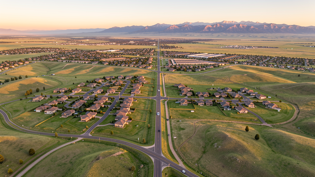
Get Matched With a Local Surveyor
Drone Survey Services Available in Parker, CO
Parker is the second-largest municipality in Douglas County, one of the wealthiest counties in the United States by median household income. The town sits southeast of the Denver Tech Center and benefits from proximity to Centennial Airport, making it attractive for executive and professional residents. With rapid residential expansion on its eastern and southern edges and ongoing commercial development along the Parker Road corridor, Parker represents a growing but still underserved market for professional drone survey services.
Drone Surveys for Parker's Construction Market
Parker is a rapidly growing suburban community in Douglas County with annual population growth averaging 2-3 percent. The town has seen significant residential subdivision expansion on its eastern and southern boundaries, including master-planned communities like Idyllwild and Crossroads. Infrastructure investment along Parker Road (SH-83) and Lincoln Avenue continues to support new commercial and retail development, with building permit values consistently exceeding $200 million annually as the town builds out its commercial base alongside residential growth.
Active Developers in the Area:

Typical Project Costs in Colorado
Cost ranges are based on market data for Denver-Aurora-Lakewood MSA. Actual pricing depends on site size, complexity, and deliverables.
| Service Type | Low End | High End |
|---|---|---|
| Topographic Survey | $1,100 | $4,000 |
| Drone Inspection | $700 | $2,800 |
| LiDAR Scanning | $3,000 | $8,500 |
| Environmental Monitoring | $1,500 | $5,800 |
| Aerial Imagery | $500 | $2,400 |
| Construction Monitoring | $800 | $3,000 |
| Real Estate Photography | $300 | $1,000 |
| Roof Inspection | $350 | $1,300 |
Local Airspace & Regulations in Parker, CO
FAA Part 107 Requirements
All commercial drone operations in Colorado require the pilot to hold an active FAA Part 107 Remote Pilot Certificate. Our network surveyors are verified Part 107 holders.
State Drone Laws
Colorado HB 1070 (2023) aligns state drone law with federal FAA Part 107 requirements. The law prohibits local municipalities from regulating drone flight paths or airspace, but allows cities to regulate takeoff and landing on public property. Colorado does not require a separate state-level drone license. Commercial drone operators must hold a valid FAA Part 107 Remote Pilot Certificate and comply with all federal regulations. The Colorado Department of Transportation has additional guidelines for drone operations near state highways and infrastructure.
Local Ordinances
Parker Municipal Code Chapter 9.12 prohibits drone takeoff/landing from town-owned parks, trails, open space, and facilities without prior written authorization from the Parks and Recreation Director. Parker Municipal Code 9.12.030 requires commercial drone operators to notify the Parker Police Department Communications Center at least 24 hours before conducting commercial operations from public property. Parker Municipal Code 9.12.050 prohibits drone operation over emergency response scenes with fines up to $1,000. Film permits require $50 fee, $1M liability insurance, and proof of Part 107 certification submitted 10 business days in advance.
Restricted Airspace
- APA Class D covers a 5-nm radius around Centennial Airport. Northwestern portions of Parker may fall within or very near the southern edge of this Class D zone. LAANC authorization is required for operations within the Class D lateral boundaries.
- Buckley SFB Class D airspace is approximately 15 miles north of Parker. While Parker is generally outside this zone, operators flying in northern areas near the Aurora border should verify boundaries. Buckley also generates occasional TFRs.
- DEN Class B airspace shelves extend over the region at higher altitudes (generally above 8,000-10,000 MSL). Standard Part 107 drone operations at 400 feet AGL remain well below these shelves.
- Pike National Forest (15-20 miles west) prohibits drone operations under Forest Service policy without special use permits. Rueter-Hess Reservoir southwest of Parker may have restrictions imposed by Parker Water and Sanitation District for security reasons.
Airports in the area: undefined (undefined), undefined (undefined), undefined (undefined), undefined (undefined)
Why Hire Through Aerius View in Parker, CO?
FAA-Certified
Every surveyor holds an active Part 107 Remote Pilot Certificate.
Local to Parker
Surveyors who know the Colorado airspace and local permitting.
No Cost to Quote
Submit your project at no charge. Pay the surveyor directly if you proceed.
Fast Turnaround
A local surveyor contacts you within 2 business days.
How Our Parker Matching Process Works
We're actively building our network of FAA-certified drone operators in Parker, CO. Here's exactly what happens when you submit a project request.
Submit Your Project
Tell us your site location, acreage, and what you need (topographic survey, LiDAR, inspection, etc.). Takes 60 seconds. No cost, no obligation.
We Match & Vet
We identify Part 107-certified operators in Colorado with the right equipment for your project. Every pilot is verified for active certification, insurance, and relevant experience in Colorado airspace.
You Get Quotes
Matched surveyors contact you within 2 business days with quotes. You compare pricing, timelines, and deliverables, then choose the right fit. You pay the surveyor directly, no markup.
What Deliverables Do You Get?
Every project includes professional-grade deliverables compatible with standard construction and engineering software:
- Orthomosaic maps (GeoTIFF) for site overview and documentation
- Point clouds (LAS/LAZ) for 3D modeling and volumetric analysis
- DEM/DSM terrain models for cut/fill and grade analysis
- Contour lines (DXF/DWG, CAD-ready) for Civil 3D and Revit
- Progress reports with side-by-side comparisons for construction monitoring
- Coordinate systems matched to your project datum (State Plane, UTM, or local)
Insurance & Liability Protection
Pilot Insurance Required
Every operator in our network must carry active liability insurance. Minimum coverage: $1,000,000 general liability. Proof of insurance is verified before any pilot joins the network.
FAA Part 107 Verified
We confirm each pilot's Remote Pilot Certificate is active and in good standing through the FAA Airmen Inquiry system. Expired certificates are flagged automatically.
Equipment Documentation
Pilots list their drone models, sensors (RGB, LiDAR, thermal, multispectral), and payload specs so we can match the right equipment to your project requirements.
Site Safety Coordination
Pilots coordinate with your site superintendent for safe operations on active construction sites, including flight plans that avoid worker areas and equipment zones.
Parker, CO Drone Survey FAQs
Do I need LAANC authorization to fly a drone in Parker?
It depends on the specific location. Northwestern portions of Parker may fall within the Class D airspace surrounding Centennial Airport (APA), located approximately 8 miles northwest. Operators should check the FAA UAS Facility Maps and Denver sectional chart. Much of central and eastern Parker is in uncontrolled Class G airspace, where LAANC authorization is not required.
What does the Town of Parker require for commercial drone operations on public property?
Under Parker Municipal Code Chapter 9.12, commercial operators must obtain written authorization from the Parks and Recreation Director for takeoff/landing from town property, notify the Parker Police Communications Center at least 24 hours in advance, and obtain a Special Use Permit ($50 fee, $1M liability insurance) for any filming activity. Proof of FAA Part 107 certification is required.
Are there areas in Parker where drones are completely prohibited?
Yes. All town-designated open space parcels and the Sulphur Gulch Trail system prohibit drone use under Parker Municipal Code Chapter 9.08 unless authorized for municipal purposes. The Rueter-Hess Reservoir area may have restrictions imposed by the Parker Water and Sanitation District. Operators should also avoid emergency response scenes per Code 9.12.050.
How does Buckley Space Force Base affect drone operations near Parker?
Buckley Space Force Base is approximately 15 miles north of Parker and has a Class D airspace area. While most of Parker is outside the Buckley Class D lateral boundaries, operators flying in northern areas near the Aurora border should verify airspace limits. Buckley also generates occasional TFRs during VIP movements or military exercises; checking NOTAMs before each flight is recommended.
What residential and commercial projects in Parker are driving drone survey demand?
Major master-planned communities including Idyllwild (1,500+ planned units by Kaanapali Land Development) and Crossroads are driving residential survey demand. Commercial development along the Parker Road (SH-83) corridor and downtown revitalization along Mainstreet create ongoing needs for topographic mapping, construction monitoring, and progress documentation.
Are You a Drone Surveyor in Parker?
Get pre-qualified leads in your service area. No membership fees, no monthly minimums. First lead free.
Ready to Start Your Project in Parker, CO?
Get matched with a local, FAA-certified surveyor. No cost, no obligation.
Request a Free Quote