Drone Survey Services in Castle Rock, CO
Castle Rock is a booming I-25 corridor town where rapid residential subdivision growth and retail expansion along the Promenade drive nonstop demand for aerial survey and mapping.
Serving Douglas County & the Denver-Aurora-Lakewood MSA area
Request a Free Quote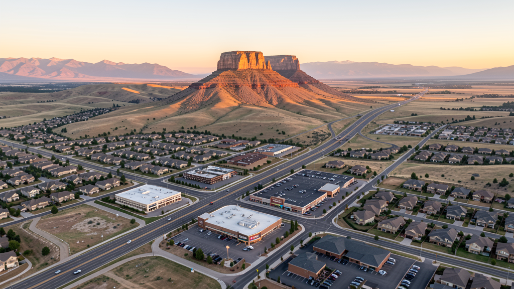
Get Matched With a Local Surveyor
Drone Survey Services Available in Castle Rock, CO
Castle Rock is the county seat of Douglas County, one of the wealthiest counties in the United States by median household income. The town sits midway between Denver and Colorado Springs along I-25, making it a natural residential and commercial growth corridor. With master-planned communities like the Meadows, Terrain, and Crystal Valley Ranch expanding rapidly, Castle Rock represents one of the strongest construction markets in the Denver metro region for drone survey services.
Drone Surveys for Castle Rock's Construction Market
Castle Rock is one of the fastest-growing municipalities in the Denver metro area, with population growth exceeding 3 percent annually in recent years. Major projects include the ongoing expansion of the Promenade at Castle Rock, numerous residential subdivisions on the town perimeter, and infrastructure improvements along I-25 and the Meadows Parkway corridor. The town has seen significant commercial investment along the I-25 corridor, with retail, medical office, and light industrial developments driving permit valuations well above $400 million annually.
Active Developers in the Area:

Typical Project Costs in Colorado
Cost ranges are based on market data for Denver-Aurora-Lakewood MSA. Actual pricing depends on site size, complexity, and deliverables.
| Service Type | Low End | High End |
|---|---|---|
| Topographic Survey | $1,100 | $4,200 |
| Drone Inspection | $750 | $3,000 |
| LiDAR Scanning | $3,200 | $9,000 |
| Environmental Monitoring | $1,600 | $6,000 |
| Aerial Imagery | $550 | $2,500 |
| Construction Monitoring | $850 | $3,200 |
| Real Estate Photography | $300 | $1,100 |
| Roof Inspection | $375 | $1,400 |
Local Airspace & Regulations in Castle Rock, CO
FAA Part 107 Requirements
All commercial drone operations in Colorado require the pilot to hold an active FAA Part 107 Remote Pilot Certificate. Our network surveyors are verified Part 107 holders.
State Drone Laws
Colorado HB 1070 (2023) aligns state drone law with federal FAA Part 107 requirements. The law prohibits local municipalities from regulating drone flight paths or airspace, but allows cities to regulate takeoff and landing on public property. Colorado does not require a separate state-level drone license. Commercial drone operators must hold a valid FAA Part 107 Remote Pilot Certificate and comply with all federal regulations. The Colorado Department of Transportation has additional guidelines for drone operations near state highways and infrastructure.
Local Ordinances
Castle Rock Municipal Code Chapter 8.08 prohibits drone takeoff/landing from town-owned parks, trails, open space, and facilities without prior authorization from the Parks and Recreation Director. Commercial operators must register with the Town Clerk for a $25 fee and carry proof of FAA Part 107 certification. Film permits require $1 million general liability insurance and a $75 daily fee. Open Space Preservation Ordinance (Section 17.52) prohibits drone use on all town-preserved open space parcels unless authorized for municipal or scientific purposes.
Restricted Airspace
- APA Class D covers a 5-nm radius from Centennial Airport. Northern areas of Castle Rock may be within or near the southern edge of this zone. LAANC authorization is required for controlled airspace within the Class D lateral boundaries.
- COS Class C airspace may extend into southern portions of Castle Rock depending on exact shelf configuration. The outer shelf typically starts above 7,000 MSL, well above the 400-foot AGL Part 107 ceiling.
- Pike National Forest (15 miles west) where drone restrictions apply under USDA Forest Service policy. No national park lands within town limits.
- VIP TFRs centered on Denver may extend to a 30-nm radius that can include Castle Rock. Colorado Springs VIP TFRs (when active) can also affect southern portions.
Airports in the area: undefined (undefined), undefined (undefined), undefined (undefined), undefined (undefined)
Why Hire Through Aerius View in Castle Rock, CO?
FAA-Certified
Every surveyor holds an active Part 107 Remote Pilot Certificate.
Local to Castle Rock
Surveyors who know the Colorado airspace and local permitting.
No Cost to Quote
Submit your project at no charge. Pay the surveyor directly if you proceed.
Fast Turnaround
A local surveyor contacts you within 2 business days.
How Our Castle Rock Matching Process Works
We're actively building our network of FAA-certified drone operators in Castle Rock, CO. Here's exactly what happens when you submit a project request.
Submit Your Project
Tell us your site location, acreage, and what you need (topographic survey, LiDAR, inspection, etc.). Takes 60 seconds. No cost, no obligation.
We Match & Vet
We identify Part 107-certified operators in Colorado with the right equipment for your project. Every pilot is verified for active certification, insurance, and relevant experience in Colorado airspace.
You Get Quotes
Matched surveyors contact you within 2 business days with quotes. You compare pricing, timelines, and deliverables, then choose the right fit. You pay the surveyor directly, no markup.
What Deliverables Do You Get?
Every project includes professional-grade deliverables compatible with standard construction and engineering software:
- Orthomosaic maps (GeoTIFF) for site overview and documentation
- Point clouds (LAS/LAZ) for 3D modeling and volumetric analysis
- DEM/DSM terrain models for cut/fill and grade analysis
- Contour lines (DXF/DWG, CAD-ready) for Civil 3D and Revit
- Progress reports with side-by-side comparisons for construction monitoring
- Coordinate systems matched to your project datum (State Plane, UTM, or local)
Insurance & Liability Protection
Pilot Insurance Required
Every operator in our network must carry active liability insurance. Minimum coverage: $1,000,000 general liability. Proof of insurance is verified before any pilot joins the network.
FAA Part 107 Verified
We confirm each pilot's Remote Pilot Certificate is active and in good standing through the FAA Airmen Inquiry system. Expired certificates are flagged automatically.
Equipment Documentation
Pilots list their drone models, sensors (RGB, LiDAR, thermal, multispectral), and payload specs so we can match the right equipment to your project requirements.
Site Safety Coordination
Pilots coordinate with your site superintendent for safe operations on active construction sites, including flight plans that avoid worker areas and equipment zones.
Castle Rock, CO Drone Survey FAQs
Does Castle Rock fall under any controlled airspace requiring LAANC authorization?
Northern portions of Castle Rock may be within or adjacent to the Class D airspace surrounding Centennial Airport (APA), located approximately 12 miles north. Operators should check the current FAA UAS Facility Maps and sectional charts. Most of central and southern Castle Rock is in uncontrolled Class G airspace, making it relatively accessible for drone operations.
What restrictions does the town of Castle Rock place on drone flights in parks?
Under Castle Rock Municipal Code Chapter 8.08, drone takeoff and landing from town-owned parks, trails, open space, and facilities is prohibited without prior authorization from the Parks and Recreation Director. Commercial operators must also register with the Town Clerk for a $25 fee and carry proof of FAA Part 107 certification. Film permits require $1 million in general liability insurance and a $75 daily fee.
Can I fly a drone over the Promenade at Castle Rock or the Outlets?
The Promenade at Castle Rock and the Castle Rock Outlets are private commercial properties. Drone flights over these areas require permission from the property management company. Flying from adjacent public sidewalks or parking areas may also trigger municipal code restrictions on takeoff/landing from town property.
How does the proximity to Colorado Springs Airport affect drone operations in southern Castle Rock?
Colorado Springs Airport (COS) has Class C airspace that extends outward with shelves starting at various altitudes. While most of Castle Rock is north of the Class C surface area, the outer shelf may extend over southern portions of town at altitudes above the standard 400-foot AGL drone ceiling. Pilots should consult the Colorado Springs sectional chart.
What construction trends in Castle Rock make it a strong market for drone survey services?
Castle Rock has consistently ranked among the fastest-growing towns in Colorado, with annual building permit values exceeding $400 million. Major residential subdivisions like the Meadows, Terrain, and Crystal Valley Ranch, along with commercial development along the I-25 corridor and the Promenade expansion, create sustained demand for topographic surveying, construction monitoring, and progress documentation.
Are You a Drone Surveyor in Castle Rock?
Get pre-qualified leads in your service area. No membership fees, no monthly minimums. First lead free.
Ready to Start Your Project in Castle Rock, CO?
Get matched with a local, FAA-certified surveyor. No cost, no obligation.
Request a Free Quote