Drone Survey Services in Louisville, CO
Louisville is rebuilding after the Marshall Fire while simultaneously adding the mixed-use Confluence development, making it one of the most active mid-size construction markets in Boulder County.
Serving Boulder County & the Denver-Aurora-Lakewood MSA area
Request a Free Quote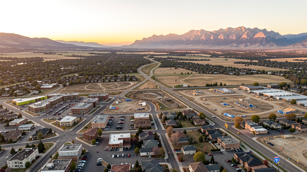
Get Matched With a Local Surveyor
Drone Survey Services Available in Louisville, CO
Louisville sits along the US 36 corridor between Denver and Boulder and consistently ranks among the top small cities in the US for livability. The construction market is driven by the Confluence mixed-use redevelopment, Marshall Fire rebuilds, and downtown streetscape investment. Most of the city sits in Class G/E beneath the Denver Class B outer shelf.
Drone Surveys for Louisville's Construction Market
Louisville is a fast-growing Boulder County suburb with approximately 4% annual construction growth driven by the Confluence development at the former StorageTek campus and the continued rebuild from the 2021 Marshall Fire that destroyed more than 500 homes. Major projects include Confluence Phase II (mixed-use, McStain Neighborhood), South Boulder Road corridor redevelopment, and multiple fire-rebuild subdivisions in the Coal Creek Ranch and Marshall area. The city is investing in downtown streetscape, Recreation Center expansion, and US 36 pedestrian crossings.
Active Developers in the Area:

Typical Project Costs in Colorado
Cost ranges are based on market data for Denver-Aurora-Lakewood MSA. Actual pricing depends on site size, complexity, and deliverables.
| Service Type | Low End | High End |
|---|---|---|
| Topographic Survey | $1,900 | $7,000 |
| Drone Inspection | $1,300 | $4,800 |
| LiDAR Scanning | $3,800 | $13,500 |
| Environmental Monitoring | $2,100 | $7,800 |
| Aerial Imagery | $950 | $3,800 |
| Construction Monitoring | $1,600 | $5,200 |
| Real Estate Photography | $750 | $3,000 |
| Roof Inspection | $650 | $2,600 |
Local Airspace & Regulations in Louisville, CO
FAA Part 107 Requirements
All commercial drone operations in Colorado require the pilot to hold an active FAA Part 107 Remote Pilot Certificate. Our network surveyors are verified Part 107 holders.
State Drone Laws
Colorado HB 1070 (2023) aligns state drone law with federal FAA Part 107 requirements. The law prohibits local municipalities from regulating drone flight paths or airspace, but allows cities to regulate takeoff and landing on public property. Colorado does not require a separate state-level drone license. Commercial drone operators must hold a valid FAA Part 107 Remote Pilot Certificate and comply with all federal regulations. The Colorado Department of Transportation has additional guidelines for drone operations near state highways and infrastructure.
Local Ordinances
Louisville Municipal Code Chapter 9.50 prohibits takeoff and landing of drones in city parks, open space, and trails without a permit. Section 9.50.030 requires commercial operators to carry FAA Part 107 certificate and $1M liability insurance. Parks and Recreation drone permit fee is approximately $50 per day. Film permit Ordinance 1448 requires commercial drone filming on city property to obtain a Film Permit from the City Clerks Office. Historic Downtown Overlay requires additional review for filming.
Restricted Airspace
- KBJC Class D surface area reaches toward the southwest edge of Louisville. Operators near US 36 or McCaslin corridor must coordinate with BJC Tower and use LAANC.
- KDEN Class B western shelf at 10,000 MSL reaches toward Louisville but low-altitude Part 107 flights are below the floor.
- Rocky Flats National Wildlife Refuge approximately 3 miles south. USFWS prohibits drone operations over refuge lands under 50 CFR 27.34.
- Rocky Mountain National Park TFR approximately 35 miles northwest prohibits commercial UAS over NPS lands.
- Coal Creek and Rock Creek corridors have local open-space drone restrictions.
Airports in the area: undefined (undefined), undefined (undefined), undefined (undefined)
Why Hire Through Aerius View in Louisville, CO?
FAA-Certified
Every surveyor holds an active Part 107 Remote Pilot Certificate.
Local to Louisville
Surveyors who know the Colorado airspace and local permitting.
No Cost to Quote
Submit your project at no charge. Pay the surveyor directly if you proceed.
Fast Turnaround
A local surveyor contacts you within 2 business days.
How Our Louisville Matching Process Works
We're actively building our network of FAA-certified drone operators in Louisville, CO. Here's exactly what happens when you submit a project request.
Submit Your Project
Tell us your site location, acreage, and what you need (topographic survey, LiDAR, inspection, etc.). Takes 60 seconds. No cost, no obligation.
We Match & Vet
We identify Part 107-certified operators in Colorado with the right equipment for your project. Every pilot is verified for active certification, insurance, and relevant experience in Colorado airspace.
You Get Quotes
Matched surveyors contact you within 2 business days with quotes. You compare pricing, timelines, and deliverables, then choose the right fit. You pay the surveyor directly, no markup.
What Deliverables Do You Get?
Every project includes professional-grade deliverables compatible with standard construction and engineering software:
- Orthomosaic maps (GeoTIFF) for site overview and documentation
- Point clouds (LAS/LAZ) for 3D modeling and volumetric analysis
- DEM/DSM terrain models for cut/fill and grade analysis
- Contour lines (DXF/DWG, CAD-ready) for Civil 3D and Revit
- Progress reports with side-by-side comparisons for construction monitoring
- Coordinate systems matched to your project datum (State Plane, UTM, or local)
Insurance & Liability Protection
Pilot Insurance Required
Every operator in our network must carry active liability insurance. Minimum coverage: $1,000,000 general liability. Proof of insurance is verified before any pilot joins the network.
FAA Part 107 Verified
We confirm each pilot's Remote Pilot Certificate is active and in good standing through the FAA Airmen Inquiry system. Expired certificates are flagged automatically.
Equipment Documentation
Pilots list their drone models, sensors (RGB, LiDAR, thermal, multispectral), and payload specs so we can match the right equipment to your project requirements.
Site Safety Coordination
Pilots coordinate with your site superintendent for safe operations on active construction sites, including flight plans that avoid worker areas and equipment zones.
Louisville, CO Drone Survey FAQs
Does Louisville require a permit for drone takeoff in parks?
Yes. Louisville Municipal Code Section 9.50 prohibits takeoff, landing, or operation in city parks, open space, and trails without a Parks and Recreation drone permit at approximately $50 per day. Commercial operators must also carry FAA Part 107 certification and $1M liability insurance per Section 9.50.030.
How close is the BJC Class D and do I need LAANC?
The Rocky Mountain Metropolitan Airport (BJC) Class D surface area reaches toward the southwest edge of Louisville. Operators near US 36 or McCaslin should check the BJC LAANC grid. Most of central and eastern Louisville sits in Class G/E and does not require LAANC.
Are there restrictions related to Rocky Flats?
Yes. The Rocky Flats National Wildlife Refuge lies approximately 3 miles south of Louisville. USFWS prohibits drone operations over refuge lands under 50 CFR 27.34. Operators near the southern city limit or the Coal Creek trail should check refuge boundaries before launch.
What about fire-rebuild drone surveys?
The 2021 Marshall Fire destroyed more than 550 homes in Louisville. Ongoing rebuilds in Coal Creek Ranch, Marshall, and Rock Creek require topographic and as-built surveys. Operators should coordinate with the Boulder County Building Department and watch for active construction TFRs during framing and roofing phases.
Do I need a film permit for real estate drone video?
Yes. Commercial drone filming on city property including right-of-way requires a Film Permit (Ord. 1448) from the City Clerks Office. Filming in the historic downtown overlay requires additional design review. Flights over private property with owner consent do not require the city permit.
Nearby Cities
Are You a Drone Surveyor in Louisville?
Get pre-qualified leads in your service area. No membership fees, no monthly minimums. First lead free.
Ready to Start Your Project in Louisville, CO?
Get matched with a local, FAA-certified surveyor. No cost, no obligation.
Request a Free Quote