Drone Survey Services in Broomfield, CO
Broomfield is a fast-growing tech and energy employment hub along the US-36 corridor where corporate campus buildouts in Interlocken and FlatIron keep drone survey teams busy year-round.
Serving Broomfield County & the Denver-Aurora-Lakewood MSA area
Request a Free Quote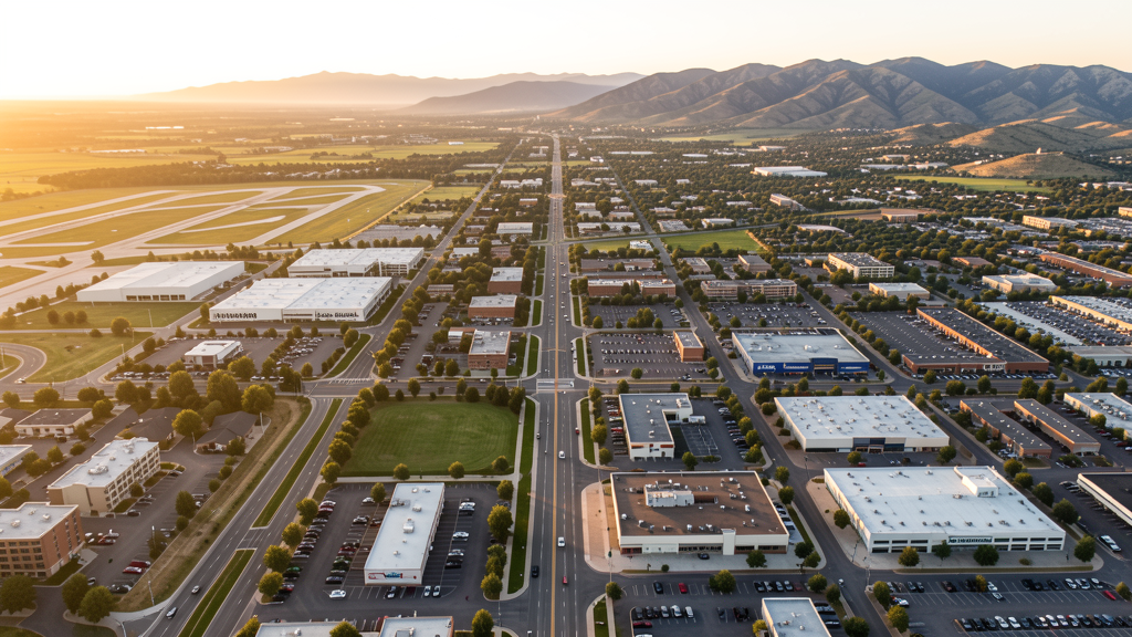
Get Matched With a Local Surveyor
Drone Survey Services Available in Broomfield, CO
Broomfield sits at the crossroads of the northwest Denver metro corridor along US-36, serving as a bridge between Denver and Boulder. The city has positioned itself as a technology and energy industry center, with major employers including Ball Corporation, Vail Resorts, and SomaLogic driving commercial real estate demand. Continued investment in the FlatIron and Interlocken districts sustains a healthy construction climate.
Drone Surveys for Broomfield's Construction Market
Broomfield is part of the northwest Denver corridor and has experienced sustained commercial and residential growth driven by its position along US-36. The city has seen major investment in corporate campuses, particularly in the FlatIron and Interlocken areas, with technology and energy companies expanding their footprints. Infrastructure spending includes road widening on 120th Avenue and US-36 express lanes. The city continues to approve new mixed-use developments at a steady pace, with building permit values exceeding $300 million annually in recent years.
Active Developers in the Area:

Typical Project Costs in Colorado
Cost ranges are based on market data for Denver-Aurora-Lakewood MSA. Actual pricing depends on site size, complexity, and deliverables.
| Service Type | Low End | High End |
|---|---|---|
| Topographic Survey | $1,200 | $4,500 |
| Drone Inspection | $800 | $3,200 |
| LiDAR Scanning | $3,500 | $9,500 |
| Environmental Monitoring | $1,800 | $6,500 |
| Aerial Imagery | $600 | $2,800 |
| Construction Monitoring | $900 | $3,500 |
| Real Estate Photography | $350 | $1,200 |
| Roof Inspection | $400 | $1,500 |
Local Airspace & Regulations in Broomfield, CO
FAA Part 107 Requirements
All commercial drone operations in Colorado require the pilot to hold an active FAA Part 107 Remote Pilot Certificate. Our network surveyors are verified Part 107 holders.
State Drone Laws
Colorado HB 1070 (2023) aligns state drone law with federal FAA Part 107 requirements. The law prohibits local municipalities from regulating drone flight paths or airspace, but allows cities to regulate takeoff and landing on public property. Colorado does not require a separate state-level drone license. Commercial drone operators must hold a valid FAA Part 107 Remote Pilot Certificate and comply with all federal regulations. The Colorado Department of Transportation has additional guidelines for drone operations near state highways and infrastructure.
Local Ordinances
Broomfield Municipal Code Chapter 9.08 prohibits drone takeoff/landing from city-owned parks, open space, and city facilities without prior written authorization from the City Manager. Violations are a municipal offense with fines up to $1,000. Broomfield Municipal Code 9.08.030 restricts drone operation over city property without a permit. Commercial drone filming on public property requires a Special Event/Film Permit through Parks and Recreation, submitted 14 days in advance with $50 filing fee and proof of FAA Part 107 certification. Open Space regulations under Chapter 9.04 prohibit drone use on all designated open space parcels unless authorized for scientific or municipal purposes.
Restricted Airspace
- DEN Class B airspace shelves extend over portions of eastern Broomfield at altitudes above 8,000-10,000 MSL. Low-altitude drone operations (sub-400 ft AGL) generally remain well below Class B shelves.
- Rocky Mountain Metropolitan Airport (BJC) Class D covers a 5-nm radius around BJC up to 8,000 MSL. Drone operations within this area require LAANC authorization. BJC is a busy reliever airport with significant helicopter and fixed-wing traffic.
- Rocky Flats National Wildlife Refuge immediately south of Broomfield is federal land where drone operations are prohibited without special use permits from USFWS under 50 CFR 27.34.
- Buckley Space Force Base (18 miles southeast) has associated restricted airspace and TFRs that can affect the broader Denver metro area, particularly during VIP movements.
Airports in the area: undefined (undefined), undefined (undefined), undefined (undefined), undefined (undefined)
Why Hire Through Aerius View in Broomfield, CO?
FAA-Certified
Every surveyor holds an active Part 107 Remote Pilot Certificate.
Local to Broomfield
Surveyors who know the Colorado airspace and local permitting.
No Cost to Quote
Submit your project at no charge. Pay the surveyor directly if you proceed.
Fast Turnaround
A local surveyor contacts you within 2 business days.
How Our Broomfield Matching Process Works
We're actively building our network of FAA-certified drone operators in Broomfield, CO. Here's exactly what happens when you submit a project request.
Submit Your Project
Tell us your site location, acreage, and what you need (topographic survey, LiDAR, inspection, etc.). Takes 60 seconds. No cost, no obligation.
We Match & Vet
We identify Part 107-certified operators in Colorado with the right equipment for your project. Every pilot is verified for active certification, insurance, and relevant experience in Colorado airspace.
You Get Quotes
Matched surveyors contact you within 2 business days with quotes. You compare pricing, timelines, and deliverables, then choose the right fit. You pay the surveyor directly, no markup.
What Deliverables Do You Get?
Every project includes professional-grade deliverables compatible with standard construction and engineering software:
- Orthomosaic maps (GeoTIFF) for site overview and documentation
- Point clouds (LAS/LAZ) for 3D modeling and volumetric analysis
- DEM/DSM terrain models for cut/fill and grade analysis
- Contour lines (DXF/DWG, CAD-ready) for Civil 3D and Revit
- Progress reports with side-by-side comparisons for construction monitoring
- Coordinate systems matched to your project datum (State Plane, UTM, or local)
Insurance & Liability Protection
Pilot Insurance Required
Every operator in our network must carry active liability insurance. Minimum coverage: $1,000,000 general liability. Proof of insurance is verified before any pilot joins the network.
FAA Part 107 Verified
We confirm each pilot's Remote Pilot Certificate is active and in good standing through the FAA Airmen Inquiry system. Expired certificates are flagged automatically.
Equipment Documentation
Pilots list their drone models, sensors (RGB, LiDAR, thermal, multispectral), and payload specs so we can match the right equipment to your project requirements.
Site Safety Coordination
Pilots coordinate with your site superintendent for safe operations on active construction sites, including flight plans that avoid worker areas and equipment zones.
Broomfield, CO Drone Survey FAQs
Can I fly a drone near Rocky Mountain Metropolitan Airport in Broomfield?
Rocky Mountain Metropolitan Airport (BJC) has a Class D airspace surface area extending 5 nautical miles from the airport up to 8,000 feet MSL. Drone pilots operating within this area must obtain LAANC authorization. BJC is a busy reliever airport with significant helicopter and fixed-wing traffic, so maintaining visual line of sight and monitoring CTAF frequency 118.6 is strongly recommended.
Does Broomfield require a permit for commercial drone photography in city parks?
Yes. Under Broomfield Municipal Code Chapter 9.08, takeoff and landing of drones from city-owned parks, open space, and facilities requires prior written authorization from the City Manager. Commercial operators must also obtain a Film/Special Event Permit from Parks and Recreation at least 14 days in advance, with proof of FAA Part 107 certification and a $50 application fee.
Are there areas in Broomfield where drones are completely prohibited?
Rocky Flats National Wildlife Refuge, located immediately south of Broomfield, is federal land managed by the U.S. Fish and Wildlife Service. Drone operations are prohibited on refuge lands without a special use permit. Additionally, all Broomfield-designated open space parcels prohibit drone use under Chapter 9.04 of the municipal code.
How does Denver International Airport Class B airspace affect drone flights in Broomfield?
The DEN Class B airspace has shelves that extend over eastern portions of Broomfield at altitudes starting around 8,000-10,000 feet MSL. Since drone operations under Part 107 are limited to 400 feet AGL, most flights in Broomfield remain well below the Class B floor. However, pilots should check the Sectional Chart for specific shelf altitudes.
What major construction projects in Broomfield are driving drone survey demand?
Ongoing development in the Interlocken and FlatIron business districts, including corporate campus expansions for technology and energy companies, plus infrastructure improvements along US-36 and 120th Avenue, are generating consistent demand for construction monitoring, topographic surveying, and progress documentation. The city continues to approve new mixed-use developments.
Nearby Cities
Are You a Drone Surveyor in Broomfield?
Get pre-qualified leads in your service area. No membership fees, no monthly minimums. First lead free.
Ready to Start Your Project in Broomfield, CO?
Get matched with a local, FAA-certified surveyor. No cost, no obligation.
Request a Free Quote