Drone Survey Services in Los Lunas, NM
Rio Grande valley with Meta data center campus and Sandia Mountain views to the east
Serving Valencia County & the Albuquerque Metropolitan Area area
Request a Free Quote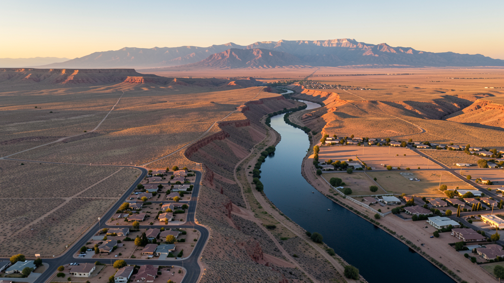
Get Matched With a Local Surveyor
Drone Survey Services Available in Los Lunas, NM
Los Lunas is the fastest-growing community in the Albuquerque metro, driven by the Meta data center campus, residential subdivision development, and healthcare expansion. Data center construction creates specialized industrial drone survey demand.
Drone Surveys for Los Lunas's Construction Market
Los Lunas is one of the fastest-growing communities in the Albuquerque metro area. Major construction includes the Facebook (Meta) data center campus, residential subdivision development, and the Los Lunas Medical Center. The village is expanding its commercial corridor along Interstate 25. Transportation infrastructure includes the Interstate 25 interchange improvements.
Active Developers in the Area:
- Meta Platforms (Facebook) — Data center campus construction and expansion phases
- Presbyterian Healthcare — Los Lunas Medical Center construction and expansion
- Residential developers — Subdivision development along the I-25 corridor

Typical Project Costs in New Mexico
Cost ranges are based on market data for Albuquerque Metropolitan Area. Actual pricing depends on site size, complexity, and deliverables.
| Service Type | Low End | High End |
|---|---|---|
| Topographic Survey | $1,400 | $6,500 |
| Drone Inspection | $500 | $2,800 |
| LiDAR Scanning | $2,200 | $11,000 |
| Environmental Monitoring | $1,100 | $5,500 |
| Aerial Imagery | $300 | $1,800 |
| Construction Monitoring | $650 | $3,200 |
| Real Estate Photography | $250 | $1,400 |
| Roof Inspection | $300 | $1,600 |
Local Airspace & Regulations in Los Lunas, NM
FAA Part 107 Requirements
All commercial drone operations in New Mexico require the pilot to hold an active FAA Part 107 Remote Pilot Certificate. Our network surveyors are verified Part 107 holders.
State Drone Laws
New Mexico enacted SB 240 (2021), the UAS Act, which established a state UAS Advisory Commission under the New Mexico Department of Transportation and preempted local municipalities from enacting their own drone flight regulations. The law prohibits weaponization of drones and restricts surveillance of private property without consent. New Mexico hosts extensive restricted military airspace — including White Sands Missile Range, Kirtland Air Force Base, Cannon Air Force Base (home to the 27th Special Operations Wing MQ-9 Reaper drone operations), Holloman Air Force Base (F-16 and MQ-9 training), and Los Alamos National Laboratory — each with active no-drone zones. Spaceport America near Truth or Consequences has restricted airspace during launch operations. Commercial operators must hold a valid FAA Part 107 Remote Pilot Certificate. The state does not require a separate state drone license, but operators flying near military installations, national laboratories, or tribal lands must coordinate with the controlling agency. New Mexico's high desert terrain and density altitude considerations affect drone performance at elevations above 5,000 feet.
Local Ordinances
Los Lunas follows FAA Part 107 regulations. The village does not have additional municipal drone ordinances. Isleta Pueblo tribal lands to the north require authorization from the tribal government for drone flights over tribal land.
Restricted Airspace
- Within Albuquerque Class C airspace outer shelf
- Isleta Pueblo tribal lands to the north require authorization
Airports in the area: Albuquerque International Sunport (ABQ), Double Eagle II Airport (AEG)
Why Hire Through Aerius View in Los Lunas, NM?
FAA-Certified
Every surveyor holds an active Part 107 Remote Pilot Certificate.
Local to Los Lunas
Surveyors who know the New Mexico airspace and local permitting.
No Cost to Quote
Submit your project at no charge. Pay the surveyor directly if you proceed.
Fast Turnaround
A local surveyor contacts you within 2 business days.
How Our Los Lunas Matching Process Works
We're actively building our network of FAA-certified drone operators in Los Lunas, NM. Here's exactly what happens when you submit a project request.
Submit Your Project
Tell us your site location, acreage, and what you need (topographic survey, LiDAR, inspection, etc.). Takes 60 seconds. No cost, no obligation.
We Match & Vet
We identify Part 107-certified operators in New Mexico with the right equipment for your project. Every pilot is verified for active certification, insurance, and relevant experience in New Mexico airspace.
You Get Quotes
Matched surveyors contact you within 2 business days with quotes. You compare pricing, timelines, and deliverables, then choose the right fit. You pay the surveyor directly, no markup.
What Deliverables Do You Get?
Every project includes professional-grade deliverables compatible with standard construction and engineering software:
- Orthomosaic maps (GeoTIFF) for site overview and documentation
- Point clouds (LAS/LAZ) for 3D modeling and volumetric analysis
- DEM/DSM terrain models for cut/fill and grade analysis
- Contour lines (DXF/DWG, CAD-ready) for Civil 3D and Revit
- Progress reports with side-by-side comparisons for construction monitoring
- Coordinate systems matched to your project datum (State Plane, UTM, or local)
Insurance & Liability Protection
Pilot Insurance Required
Every operator in our network must carry active liability insurance. Minimum coverage: $1,000,000 general liability. Proof of insurance is verified before any pilot joins the network.
FAA Part 107 Verified
We confirm each pilot's Remote Pilot Certificate is active and in good standing through the FAA Airmen Inquiry system. Expired certificates are flagged automatically.
Equipment Documentation
Pilots list their drone models, sensors (RGB, LiDAR, thermal, multispectral), and payload specs so we can match the right equipment to your project requirements.
Site Safety Coordination
Pilots coordinate with your site superintendent for safe operations on active construction sites, including flight plans that avoid worker areas and equipment zones.
Los Lunas, NM Drone Survey FAQs
Can I fly a drone near the Meta data center in Los Lunas?
The Meta (Facebook) data center campus is private industrial property. While not in restricted military airspace, Meta likely has security policies regarding drone overflights. Coordinate with Meta security before any flights near the campus perimeter. The data center is one of the largest construction projects in New Mexico.
Is Los Lunas in Albuquerque controlled airspace?
Los Lunas falls within the outer shelf of Albuquerque International Sunport Class C airspace. Drone operators need LAANC authorization. Check the LAANC grid for authorization levels in your specific flight area.
What construction projects are driving drone survey demand in Los Lunas?
The Meta data center campus is the largest construction project, requiring ongoing site survey, progress monitoring, and infrastructure inspection. Residential subdivision development along the I-25 corridor creates steady topographic survey demand. The Los Lunas Medical Center construction adds healthcare facility survey needs.
Are there tribal land restrictions near Los Lunas?
Isleta Pueblo tribal lands lie north of Los Lunas. Drone operations over tribal lands require authorization from the Isleta Pueblo tribal government. Always check tribal boundary maps and contact the appropriate tribal office before flying near reservation boundaries.
How does Los Lunas elevation affect drone flying?
Los Lunas sits at approximately 5,000 feet elevation in the Rio Grande valley. The elevation reduces drone performance compared to sea level. Summer temperatures above 95 degrees compound the density altitude effect. Plan for shorter flight times in hot conditions.
What makes Los Lunas unique for drone survey?
Los Lunas has one of the largest data center construction projects in the US (Meta), creating specialized industrial survey demand. The rapid residential growth along the I-25 corridor provides steady topographic and construction monitoring work. The proximity to Albuquerque creates cross-market opportunities.
Nearby Cities
Are You a Drone Surveyor in Los Lunas?
Get pre-qualified leads in your service area. No membership fees, no monthly minimums. First lead free.
Ready to Start Your Project in Los Lunas, NM?
Get matched with a local, FAA-certified surveyor. No cost, no obligation.
Request a Free Quote