Drone Survey Services in Santa Fe, NM
High desert plateau at 7,200 feet with Sangre de Cristo Mountains backdrop
Serving Santa Fe County & the Santa Fe Metropolitan Area area
Request a Free Quote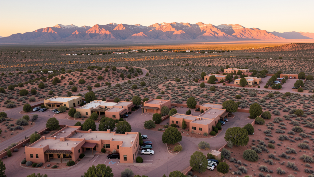
Get Matched With a Local Surveyor
Drone Survey Services Available in Santa Fe, NM
Santa Fe construction is defined by strict building codes, historic preservation requirements, and luxury residential development. The high elevation creates operational challenges for drone pilots, requiring aircraft with sufficient lift margin.
Drone Surveys for Santa Fe's Construction Market
Santa Fe construction is driven by tourism infrastructure, second-home development, and government facilities. Major projects include the Santa Fe County courthouse expansion, hospitality development along the Railyard District, and high-end residential construction in the Las Campanas area. The city building height restrictions preserve historic views, creating demand for low-altitude aerial survey work.
Active Developers in the Area:
- Las Campanas Development — Luxury residential and golf course community
- Santa Fe County — Courthouse expansion and government facility upgrades
- Railyard District developers — Mixed-use development in the historic railyard area

Typical Project Costs in New Mexico
Cost ranges are based on market data for Santa Fe Metropolitan Area. Actual pricing depends on site size, complexity, and deliverables.
| Service Type | Low End | High End |
|---|---|---|
| Topographic Survey | $1,800 | $8,000 |
| Drone Inspection | $600 | $3,200 |
| LiDAR Scanning | $2,800 | $13,000 |
| Environmental Monitoring | $1,400 | $7,000 |
| Aerial Imagery | $400 | $2,200 |
| Construction Monitoring | $750 | $3,800 |
| Real Estate Photography | $300 | $2,000 |
| Roof Inspection | $350 | $2,000 |
Local Airspace & Regulations in Santa Fe, NM
FAA Part 107 Requirements
All commercial drone operations in New Mexico require the pilot to hold an active FAA Part 107 Remote Pilot Certificate. Our network surveyors are verified Part 107 holders.
State Drone Laws
New Mexico enacted SB 240 (2021), the UAS Act, which established a state UAS Advisory Commission under the New Mexico Department of Transportation and preempted local municipalities from enacting their own drone flight regulations. The law prohibits weaponization of drones and restricts surveillance of private property without consent. New Mexico hosts extensive restricted military airspace — including White Sands Missile Range, Kirtland Air Force Base, Cannon Air Force Base (home to the 27th Special Operations Wing MQ-9 Reaper drone operations), Holloman Air Force Base (F-16 and MQ-9 training), and Los Alamos National Laboratory — each with active no-drone zones. Spaceport America near Truth or Consequences has restricted airspace during launch operations. Commercial operators must hold a valid FAA Part 107 Remote Pilot Certificate. The state does not require a separate state drone license, but operators flying near military installations, national laboratories, or tribal lands must coordinate with the controlling agency. New Mexico's high desert terrain and density altitude considerations affect drone performance at elevations above 5,000 feet.
Local Ordinances
Santa Fe adheres to FAA Part 107 rules. The city requires a film permit for commercial drone photography in the historic downtown and plaza areas. Flights over Santa Fe National Forest require US Forest Service authorization. The proximity to Los Alamos National Laboratory creates additional restricted zones to the northwest.
Restricted Airspace
- Class D airspace around Santa Fe Regional Airport (SAF)
- Santa Fe National Forest flight restrictions north of city
- Bandelier National Monument no-drone zone northwest
- Los Alamos National Laboratory restricted airspace nearby to the northwest
Airports in the area: Santa Fe Regional Airport (SAF)
Why Hire Through Aerius View in Santa Fe, NM?
FAA-Certified
Every surveyor holds an active Part 107 Remote Pilot Certificate.
Local to Santa Fe
Surveyors who know the New Mexico airspace and local permitting.
No Cost to Quote
Submit your project at no charge. Pay the surveyor directly if you proceed.
Fast Turnaround
A local surveyor contacts you within 2 business days.
How Our Santa Fe Matching Process Works
We're actively building our network of FAA-certified drone operators in Santa Fe, NM. Here's exactly what happens when you submit a project request.
Submit Your Project
Tell us your site location, acreage, and what you need (topographic survey, LiDAR, inspection, etc.). Takes 60 seconds. No cost, no obligation.
We Match & Vet
We identify Part 107-certified operators in New Mexico with the right equipment for your project. Every pilot is verified for active certification, insurance, and relevant experience in New Mexico airspace.
You Get Quotes
Matched surveyors contact you within 2 business days with quotes. You compare pricing, timelines, and deliverables, then choose the right fit. You pay the surveyor directly, no markup.
What Deliverables Do You Get?
Every project includes professional-grade deliverables compatible with standard construction and engineering software:
- Orthomosaic maps (GeoTIFF) for site overview and documentation
- Point clouds (LAS/LAZ) for 3D modeling and volumetric analysis
- DEM/DSM terrain models for cut/fill and grade analysis
- Contour lines (DXF/DWG, CAD-ready) for Civil 3D and Revit
- Progress reports with side-by-side comparisons for construction monitoring
- Coordinate systems matched to your project datum (State Plane, UTM, or local)
Insurance & Liability Protection
Pilot Insurance Required
Every operator in our network must carry active liability insurance. Minimum coverage: $1,000,000 general liability. Proof of insurance is verified before any pilot joins the network.
FAA Part 107 Verified
We confirm each pilot's Remote Pilot Certificate is active and in good standing through the FAA Airmen Inquiry system. Expired certificates are flagged automatically.
Equipment Documentation
Pilots list their drone models, sensors (RGB, LiDAR, thermal, multispectral), and payload specs so we can match the right equipment to your project requirements.
Site Safety Coordination
Pilots coordinate with your site superintendent for safe operations on active construction sites, including flight plans that avoid worker areas and equipment zones.
Santa Fe, NM Drone Survey FAQs
Can I fly a drone over the Santa Fe Plaza?
Commercial drone photography in the Santa Fe historic district and plaza area requires a film permit from the city. The plaza is a high-pedestrian area, and flights must comply with FAA Part 107 restrictions on flying over people not under the operator control.
How does Santa Fe elevation affect drone operations?
Santa Fe sits at 7,200 feet elevation, making it one of the highest capital cities in the US. The thin air significantly reduces drone lift capacity and battery life. Operators should use drones with sufficient payload margin and plan for shorter flight times, especially in summer when temperatures compound the density altitude effect.
Are there drone restrictions near Los Alamos National Laboratory?
Los Alamos National Laboratory, approximately 25 miles northwest of Santa Fe, has extensive restricted airspace. While Santa Fe itself is outside the restricted zone, drone operators flying in northwest Santa Fe County should check sectional charts for the laboratory restricted areas and coordinate as needed.
Can I fly a drone in the Santa Fe National Forest?
The Santa Fe National Forest north of the city is managed by the US Forest Service. Commercial drone flights require a special use permit from the Forest Service. Recreational flights are generally allowed in non-wilderness areas but must follow FAA guidelines and avoid wildlife disturbance.
What construction projects are driving drone survey demand in Santa Fe?
Santa Fe construction demand comes from luxury residential development in areas like Las Campanas, government facility upgrades, and tourism infrastructure in the Railyard District. The city strict building height codes create demand for low-altitude aerial documentation and progress monitoring.
Do I need LAANC authorization to fly drones in Santa Fe?
Santa Fe Regional Airport (SAF) has Class D airspace. Drone operators flying within the Class D radius need LAANC authorization. The airport serves commercial flights, so the airspace is actively managed. Check the LAANC grid for the current authorization levels in your specific flight area.
Nearby Cities
Are You a Drone Surveyor in Santa Fe?
Get pre-qualified leads in your service area. No membership fees, no monthly minimums. First lead free.
Ready to Start Your Project in Santa Fe, NM?
Get matched with a local, FAA-certified surveyor. No cost, no obligation.
Request a Free Quote