Drone Survey Services in Longview, TX
From Haynesville Shale pipeline infrastructure and oil/gas processing facilities to Longview Business Park expansion and Spring Hill residential growth, Longview is the regional hub of the East Texas energy industry.
Serving Gregg County & the Longview-Marshall area
Request a Free Quote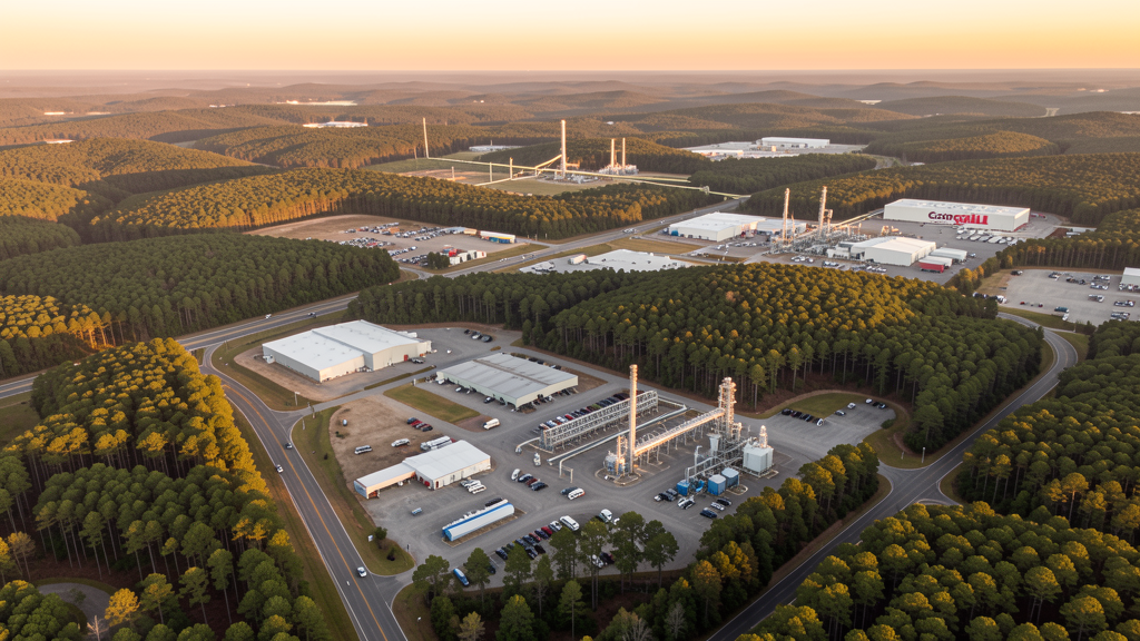
Get Matched With a Local Surveyor
Drone Survey Services Available in Longview, TX
Longview sits in Gregg County along I-20 in the heart of the East Texas oil and gas industry. The city has 82,000 residents and serves as the commercial hub for the Haynesville Shale and East Texas Oil Field. Major construction includes pipeline infrastructure, oil/gas processing facilities, and industrial warehouse development. The Longview Economic Development Corporation actively attracts manufacturing and logistics companies. Residential construction is steady in the Spring Hill area and south Longview.
Drone Surveys for Longview's Construction Market
Longview is the regional commercial hub of the East Texas oil and gas industry. The city serves as a service center for the Haynesville Shale natural gas formation and the East Texas Oil Field. Major construction includes pipeline infrastructure, oil and gas processing facilities, and industrial warehouse construction along I-20. The Longview Economic Development Corporation has been active in attracting manufacturing and logistics companies, including recent expansions at the Longview Business Park. Residential construction is steady, with the Spring Hill area and south Longview seeing new subdivisions. The city has maintained stable population growth to 82,000 residents.
Active Developers in the Area:
Typical Project Costs in Texas
Cost ranges are based on market data for Longview-Marshall. Actual pricing depends on site size, complexity, and deliverables.
| Service Type | Low End | High End |
|---|---|---|
| Topographic Survey | $1,800 | $4,500 |
| Drone Inspection | $250 | $850 |
| LiDAR Scanning | $2,800 | $8,000 |
| Environmental Monitoring | $800 | $3,000 |
| Aerial Imagery | $175 | $500 |
| Construction Monitoring | $1,100 | $3,200 |
| Real Estate Photography | $150 | $450 |
| Roof Inspection | $200 | $750 |
Local Airspace & Regulations in Longview, TX
FAA Part 107 Requirements
All commercial drone operations in Texas require the pilot to hold an active FAA Part 107 Remote Pilot Certificate. Our network surveyors are verified Part 107 holders.
State Drone Laws
Texas Government Code Chapter 423 restricts drone use over critical infrastructure facilities, including oil and gas pipelines, refineries, power plants, and water treatment facilities. HB 1484 (2023) added protections for agricultural operations and expanded penalties for drone surveillance of private property. Commercial operators must hold a valid FAA Part 107 Remote Pilot Certificate. Texas does not require a separate state drone license, but operators flying near critical infrastructure must obtain authorization from the facility owner. The Texas Department of Public Safety maintains additional guidelines for drone operations near state facilities.
Local Ordinances
Longview follows Gregg County regulations and FAA Part 107 rules. No city-specific drone permit is required for operations from private property. East Texas Regional Airport (GGG) is a Class E airport 8 miles south. The city is the commercial hub of the East Texas oil and gas industry, with pipeline inspection and industrial facility surveys being primary use cases. Longview parks prohibit drone takeoff/landing without a permit. The Haynesville Shale and East Texas Oil Field operations drive demand for pipeline and infrastructure aerial surveys.
Restricted Airspace
- East Texas Regional Airport (GGG) is Class E airspace — no LAANC required but pilots must notify the airport when operating within 5 miles.
- Class C airspace around Shreveport Regional (SHV) extends 20 nautical miles. The eastern edge of the Longview area may require LAANC authorization at higher altitudes.
- Class D airspace around Tyler Pounds Regional (TYR) — requires LAANC authorization within 4 nautical miles. TYR is 35 miles west.
- Longview city parks prohibit drone takeoff/landing without a special use permit. The Cargill Longview industrial area has active oil/gas service facilities.
Airports in the area: undefined (undefined), undefined (undefined), undefined (undefined), undefined (undefined)
Why Hire Through Aerius View in Longview, TX?
FAA-Certified
Every surveyor holds an active Part 107 Remote Pilot Certificate.
Local to Longview
Surveyors who know the Texas airspace and local permitting.
No Cost to Quote
Submit your project at no charge. Pay the surveyor directly if you proceed.
Fast Turnaround
A local surveyor contacts you within 2 business days.
How Our Longview Matching Process Works
We're actively building our network of FAA-certified drone operators in Longview, TX. Here's exactly what happens when you submit a project request.
Submit Your Project
Tell us your site location, acreage, and what you need (topographic survey, LiDAR, inspection, etc.). Takes 60 seconds. No cost, no obligation.
We Match & Vet
We identify Part 107-certified operators in Texas with the right equipment for your project. Every pilot is verified for active certification, insurance, and relevant experience in Texas airspace.
You Get Quotes
Matched surveyors contact you within 2 business days with quotes. You compare pricing, timelines, and deliverables, then choose the right fit. You pay the surveyor directly, no markup.
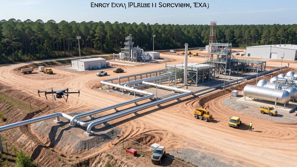
What Deliverables Do You Get?
Every project includes professional-grade deliverables compatible with standard construction and engineering software:
- Orthomosaic maps (GeoTIFF) for site overview and documentation
- Point clouds (LAS/LAZ) for 3D modeling and volumetric analysis
- DEM/DSM terrain models for cut/fill and grade analysis
- Contour lines (DXF/DWG, CAD-ready) for Civil 3D and Revit
- Progress reports with side-by-side comparisons for construction monitoring
- Coordinate systems matched to your project datum (State Plane, UTM, or local)
Insurance & Liability Protection
Pilot Insurance Required
Every operator in our network must carry active liability insurance. Minimum coverage: $1,000,000 general liability. Proof of insurance is verified before any pilot joins the network.
FAA Part 107 Verified
We confirm each pilot's Remote Pilot Certificate is active and in good standing through the FAA Airmen Inquiry system. Expired certificates are flagged automatically.
Equipment Documentation
Pilots list their drone models, sensors (RGB, LiDAR, thermal, multispectral), and payload specs so we can match the right equipment to your project requirements.
Site Safety Coordination
Pilots coordinate with your site superintendent for safe operations on active construction sites, including flight plans that avoid worker areas and equipment zones.
Longview, TX Drone Survey FAQs
Do I need a permit for a drone survey in Longview?
No city-specific permit is required for commercial drone operations from private property in Longview. All flights must comply with FAA Part 107 rules. East Texas Regional Airport is 8 miles south, and pilots should notify the airport when operating nearby. Takeoff/landing in city parks requires a special use permit.
How much does a drone survey cost in Longview, TX?
Topographic surveys in Gregg County typically range from $1,800 to $4,500. Roof inspections run $200-$750. LiDAR scanning for pipeline corridors or industrial sites costs $2,800-$8,000. Pipeline inspection services start at $800. Real estate drone photography starts at $150.
Can I fly a drone near East Texas Regional Airport?
East Texas Regional Airport (GGG) is Class E airspace, so no LAANC authorization is required. However, pilots must notify the airport when operating within 5 miles. The airport has significant cargo and general aviation traffic. Our surveyors coordinate with GGG tower for safe operations.
What construction projects need drone surveys in Longview?
Pipeline infrastructure construction, oil and gas processing facility expansion, Longview Business Park development, and residential subdivisions in Spring Hill and south Longview all require aerial surveys. The Haynesville Shale and East Texas Oil Field operations drive pipeline inspection demand.
How long does a topographic survey take in Longview?
A standard 50-acre site can be flown in under an hour. Deliverables including DEM, contour maps, orthomosaic, and point cloud are ready within 3-5 business days. Pipeline corridor surveys may require multiple flights over several days. East Texas terrain is forested and rolling, requiring experienced pilots for canopy penetration.
Nearby Cities
Are You a Drone Surveyor in Longview?
Get pre-qualified leads in your service area. No membership fees, no monthly minimums. First lead free.
Ready to Start Your Project in Longview, TX?
Get matched with a local, FAA-certified surveyor. No cost, no obligation.
Request a Free Quote