Drone Survey Services in Ruidoso, NM
Sacramento Mountains resort village at 6,900 feet with pine forests and Ski Apache terrain
Serving Lincoln County & the Ruidoso Micropolitan Area area
Request a Free Quote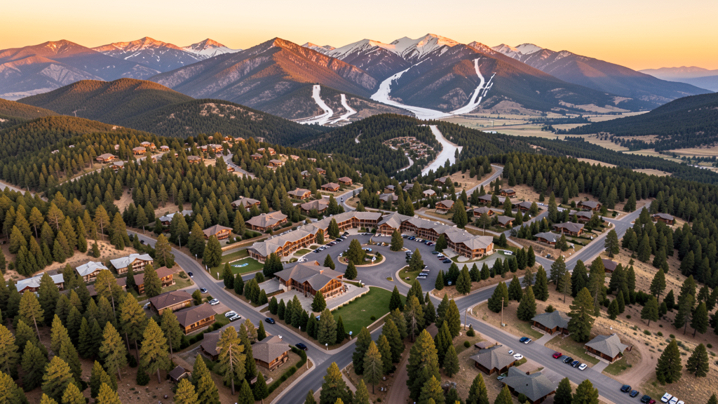
Get Matched With a Local Surveyor
Drone Survey Services Available in Ruidoso, NM
Ruidoso is a mountain resort community driven by tourism, second-home development, and wildfire recovery rebuilding. The 2024 South Fork fire damage created significant reconstruction demand, with Lincoln National Forest surrounding the village adding operational constraints.
Drone Surveys for Ruidoso's Construction Market
Ruidoso construction is driven by tourism infrastructure, second-home development, and wildfire recovery rebuilding. The village is a mountain resort community with ongoing cabin and lodge construction. The 2024 South Fork wildfire damage created significant rebuilding demand. Ski Apache resort maintenance creates seasonal construction work.
Active Developers in the Area:
- Ski Apache Resort — Ski facility maintenance and improvement
- Ruidoso Downs — Racetrack facility upgrades and hospitality development
- Private developers — Cabin and second-home construction and wildfire recovery rebuilding

Typical Project Costs in New Mexico
Cost ranges are based on market data for Ruidoso Micropolitan Area. Actual pricing depends on site size, complexity, and deliverables.
| Service Type | Low End | High End |
|---|---|---|
| Topographic Survey | $1,200 | $6,000 |
| Drone Inspection | $450 | $2,500 |
| LiDAR Scanning | $2,000 | $10,000 |
| Environmental Monitoring | $1,000 | $5,000 |
| Aerial Imagery | $250 | $1,500 |
| Construction Monitoring | $550 | $2,800 |
| Real Estate Photography | $200 | $1,000 |
| Roof Inspection | $250 | $1,200 |
Local Airspace & Regulations in Ruidoso, NM
FAA Part 107 Requirements
All commercial drone operations in New Mexico require the pilot to hold an active FAA Part 107 Remote Pilot Certificate. Our network surveyors are verified Part 107 holders.
State Drone Laws
New Mexico enacted SB 240 (2021), the UAS Act, which established a state UAS Advisory Commission under the New Mexico Department of Transportation and preempted local municipalities from enacting their own drone flight regulations. The law prohibits weaponization of drones and restricts surveillance of private property without consent. New Mexico hosts extensive restricted military airspace — including White Sands Missile Range, Kirtland Air Force Base, Cannon Air Force Base (home to the 27th Special Operations Wing MQ-9 Reaper drone operations), Holloman Air Force Base (F-16 and MQ-9 training), and Los Alamos National Laboratory — each with active no-drone zones. Spaceport America near Truth or Consequences has restricted airspace during launch operations. Commercial operators must hold a valid FAA Part 107 Remote Pilot Certificate. The state does not require a separate state drone license, but operators flying near military installations, national laboratories, or tribal lands must coordinate with the controlling agency. New Mexico's high desert terrain and density altitude considerations affect drone performance at elevations above 5,000 feet.
Local Ordinances
Ruidoso follows FAA Part 107 regulations. The village is surrounded by Lincoln National Forest, which requires US Forest Service permits for commercial drone flights. The mountain terrain and forest canopy create challenging operating conditions. Ruidoso Downs race track area may have event-specific restrictions during racing season.
Restricted Airspace
- Class D airspace around Sierra Blanca Regional Airport (SRR)
- Lincoln National Forest flight restrictions surrounding the area
- White Sands Missile Range restricted airspace to the southwest (distance)
- Mountain terrain creates challenging wind patterns
Airports in the area: Sierra Blanca Regional Airport (SRR)
Why Hire Through Aerius View in Ruidoso, NM?
FAA-Certified
Every surveyor holds an active Part 107 Remote Pilot Certificate.
Local to Ruidoso
Surveyors who know the New Mexico airspace and local permitting.
No Cost to Quote
Submit your project at no charge. Pay the surveyor directly if you proceed.
Fast Turnaround
A local surveyor contacts you within 2 business days.
How Our Ruidoso Matching Process Works
We're actively building our network of FAA-certified drone operators in Ruidoso, NM. Here's exactly what happens when you submit a project request.
Submit Your Project
Tell us your site location, acreage, and what you need (topographic survey, LiDAR, inspection, etc.). Takes 60 seconds. No cost, no obligation.
We Match & Vet
We identify Part 107-certified operators in New Mexico with the right equipment for your project. Every pilot is verified for active certification, insurance, and relevant experience in New Mexico airspace.
You Get Quotes
Matched surveyors contact you within 2 business days with quotes. You compare pricing, timelines, and deliverables, then choose the right fit. You pay the surveyor directly, no markup.
What Deliverables Do You Get?
Every project includes professional-grade deliverables compatible with standard construction and engineering software:
- Orthomosaic maps (GeoTIFF) for site overview and documentation
- Point clouds (LAS/LAZ) for 3D modeling and volumetric analysis
- DEM/DSM terrain models for cut/fill and grade analysis
- Contour lines (DXF/DWG, CAD-ready) for Civil 3D and Revit
- Progress reports with side-by-side comparisons for construction monitoring
- Coordinate systems matched to your project datum (State Plane, UTM, or local)
Insurance & Liability Protection
Pilot Insurance Required
Every operator in our network must carry active liability insurance. Minimum coverage: $1,000,000 general liability. Proof of insurance is verified before any pilot joins the network.
FAA Part 107 Verified
We confirm each pilot's Remote Pilot Certificate is active and in good standing through the FAA Airmen Inquiry system. Expired certificates are flagged automatically.
Equipment Documentation
Pilots list their drone models, sensors (RGB, LiDAR, thermal, multispectral), and payload specs so we can match the right equipment to your project requirements.
Site Safety Coordination
Pilots coordinate with your site superintendent for safe operations on active construction sites, including flight plans that avoid worker areas and equipment zones.
Ruidoso, NM Drone Survey FAQs
Can I fly a drone in Lincoln National Forest near Ruidoso?
Ruidoso is surrounded by Lincoln National Forest. Commercial drone flights require a special use permit from the US Forest Service. The forested mountain terrain creates challenging conditions. Recreational flights in non-wilderness areas must follow FAA guidelines and avoid wildlife disturbance.
What drone services are most needed in Ruidoso?
Wildfire damage assessment and rebuilding documentation are critical needs following the 2024 South Fork fire. Second-home and cabin construction monitoring creates steady demand. Tourism infrastructure survey for ski resort and racetrack facilities provides seasonal work. Environmental monitoring of burn scars is a specialized service.
Does Ruidoso have controlled airspace?
Sierra Blanca Regional Airport (SRR) has Class D airspace. Drone operators flying within the Class D radius need LAANC authorization. The airport serves general aviation and seasonal tourist traffic.
How does Ruidoso mountain elevation affect drone flying?
Ruidoso sits at approximately 6,900 feet elevation in the Sacramento Mountains. The high elevation significantly reduces drone lift capacity. Mountain terrain creates unpredictable wind patterns, including strong afternoon downslope winds. Operators should use drones with strong lift margins and plan for very short flight times in summer conditions.
Are there wildfire-related drone survey opportunities near Ruidoso?
The 2024 South Fork and Salt wildfires burned significant areas near Ruidoso, creating demand for damage assessment, burn scar monitoring, erosion prediction, and rebuilding documentation. Environmental monitoring of post-fire vegetation recovery is a specialized service area requiring coordination with forest service and emergency management agencies.
What are the seasonal considerations for drone work in Ruidoso?
Ruidoso has distinct seasons. Winter brings snow and cold temperatures affecting battery performance. Spring brings wind. Summer monsoon season brings thunderstorms. Fall is generally the best operating season with stable conditions. Ski season creates tourism traffic but also limits some access. Wildfire season (May-July) may create TFRs.
Nearby Cities
Are You a Drone Surveyor in Ruidoso?
Get pre-qualified leads in your service area. No membership fees, no monthly minimums. First lead free.
Ready to Start Your Project in Ruidoso, NM?
Get matched with a local, FAA-certified surveyor. No cost, no obligation.
Request a Free Quote