Drone Survey Services in Pueblo, CO
Pueblo industrial and energy sector growth, from steel mill modernization to wind farm expansion, creates strong demand for aerial inspection and lidar survey services with less local competition than the Denver metro.
Serving Pueblo County & the Pueblo MSA area
Request a Free Quote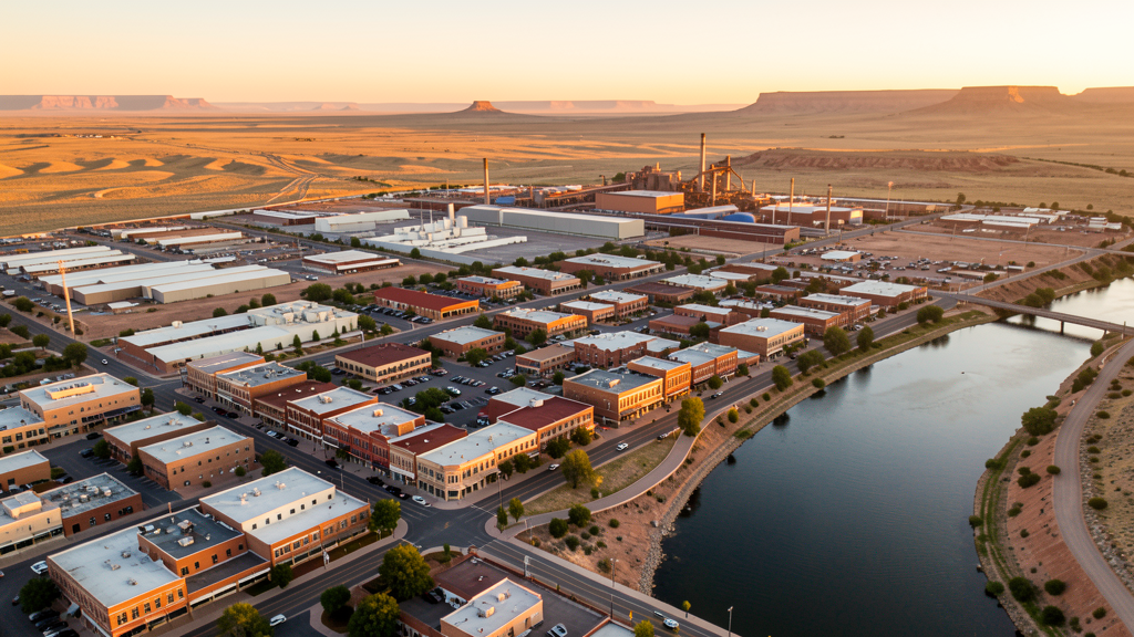
Get Matched With a Local Surveyor
Drone Survey Services Available in Pueblo, CO
Pueblo is a historic steel and industrial city anchored by the Evraz Pueblo steel mill and a growing renewable energy sector with multiple wind farm developments in the surrounding region. The Pueblo Memorial Airport area and the Pueblo Chemical Depot drive specialized industrial construction activity. Lower drone service provider density compared to the Denver metro creates opportunity for firms willing to serve this market.
Drone Surveys for Pueblo's Construction Market
Pueblo construction market is driven by industrial modernization at the Evraz steel mill, Xcel Energy infrastructure projects, and renewable energy development including wind farms across the surrounding plains. The Pueblo Riverwalk district continues to see mixed-use development, and the Pueblo Memorial Airport industrial park is expanding to support manufacturing and logistics tenants. Growth is moderate but steady, with lower competition for drone survey services than the Denver metro.
Active Developers in the Area:

Typical Project Costs in Colorado
Cost ranges are based on market data for Pueblo MSA. Actual pricing depends on site size, complexity, and deliverables.
| Service Type | Low End | High End |
|---|---|---|
| Topographic Survey | $1,500 | $3,800 |
| Drone Inspection | $1,000 | $3,000 |
| LiDAR Scanning | $3,000 | $7,500 |
| Environmental Monitoring | $1,700 | $5,000 |
| Aerial Imagery | $600 | $2,200 |
| Construction Monitoring | $1,200 | $4,200 |
| Real Estate Photography | $350 | $1,000 |
| Roof Inspection | $500 | $1,700 |
Local Airspace & Regulations in Pueblo, CO
FAA Part 107 Requirements
All commercial drone operations in Colorado require the pilot to hold an active FAA Part 107 Remote Pilot Certificate. Our network surveyors are verified Part 107 holders.
State Drone Laws
Colorado HB 1070 (2023) aligns state drone law with federal FAA Part 107 requirements. The law prohibits local municipalities from regulating drone flight paths or airspace, but allows cities to regulate takeoff and landing on public property. Colorado does not require a separate state-level drone license. Commercial drone operators must hold a valid FAA Part 107 Remote Pilot Certificate and comply with all federal regulations. The Colorado Department of Transportation has additional guidelines for drone operations near state highways and infrastructure.
Local Ordinances
City of Pueblo Parks and Recreation Department requires permission for drone takeoff and landing in city parks. Commercial operators must provide proof of FAA Part 107 certification. No formal permit fee schedule published. Colorado HB 1070 (2023) preempts local regulation of drone navigation and airspace. Pueblo has no additional city drone licensing requirement. Evraz Pueblo steel mill, Xcel Energy facilities, and Pueblo Chemical Depot are private or government industrial properties where operators should coordinate with facility security for low-altitude inspection flights.
Restricted Airspace
- KPUB Class D airspace (approximately 4.4 nm radius, surface to 8,000 MSL). All drone operations within this area require LAANC authorization via FAA UAS Data Commons.
- Pueblo Chemical Depot — located approximately 15 nm east of Pueblo. Restricted airspace and security zones. Drone operations near the depot are prohibited without DoD coordination. The depot houses the US Army Pueblo Chemical Agent-Destruction Pilot Plant (PCAPP).
- Pinon Canyon Maneuver Site MOA and restricted areas (R-3711, R-3712) lie to the south and southeast. Check for active military scheduling via FAA SUA schedule before flights in southern Pueblo County.
- Temporary Flight Restrictions may be issued for Colorado State University Pueblo ThunderBowl during large events. Verify active TFRs before flight.
Airports in the area: undefined (undefined), undefined (undefined), undefined (undefined)
Why Hire Through Aerius View in Pueblo, CO?
FAA-Certified
Every surveyor holds an active Part 107 Remote Pilot Certificate.
Local to Pueblo
Surveyors who know the Colorado airspace and local permitting.
No Cost to Quote
Submit your project at no charge. Pay the surveyor directly if you proceed.
Fast Turnaround
A local surveyor contacts you within 2 business days.
How Our Pueblo Matching Process Works
We're actively building our network of FAA-certified drone operators in Pueblo, CO. Here's exactly what happens when you submit a project request.
Submit Your Project
Tell us your site location, acreage, and what you need (topographic survey, LiDAR, inspection, etc.). Takes 60 seconds. No cost, no obligation.
We Match & Vet
We identify Part 107-certified operators in Colorado with the right equipment for your project. Every pilot is verified for active certification, insurance, and relevant experience in Colorado airspace.
You Get Quotes
Matched surveyors contact you within 2 business days with quotes. You compare pricing, timelines, and deliverables, then choose the right fit. You pay the surveyor directly, no markup.
What Deliverables Do You Get?
Every project includes professional-grade deliverables compatible with standard construction and engineering software:
- Orthomosaic maps (GeoTIFF) for site overview and documentation
- Point clouds (LAS/LAZ) for 3D modeling and volumetric analysis
- DEM/DSM terrain models for cut/fill and grade analysis
- Contour lines (DXF/DWG, CAD-ready) for Civil 3D and Revit
- Progress reports with side-by-side comparisons for construction monitoring
- Coordinate systems matched to your project datum (State Plane, UTM, or local)
Insurance & Liability Protection
Pilot Insurance Required
Every operator in our network must carry active liability insurance. Minimum coverage: $1,000,000 general liability. Proof of insurance is verified before any pilot joins the network.
FAA Part 107 Verified
We confirm each pilot's Remote Pilot Certificate is active and in good standing through the FAA Airmen Inquiry system. Expired certificates are flagged automatically.
Equipment Documentation
Pilots list their drone models, sensors (RGB, LiDAR, thermal, multispectral), and payload specs so we can match the right equipment to your project requirements.
Site Safety Coordination
Pilots coordinate with your site superintendent for safe operations on active construction sites, including flight plans that avoid worker areas and equipment zones.
Pueblo, CO Drone Survey FAQs
Do I need LAANC authorization to fly a drone in Pueblo?
If you are flying within the KPUB Class D airspace (approximately 4.4 nm radius of Pueblo Memorial Airport, surface to 8,000 MSL), yes, LAANC authorization is required. Areas outside the Class D may not require LAANC, but always check the FAA UAS Data Commons for current airspace designations.
Are there military airspace restrictions near Pueblo?
Yes. The Pueblo Chemical Depot, located approximately 15 nm east of Pueblo, has restricted airspace and security zones. Drone operations near the depot are prohibited without DoD coordination. Additionally, the Pinon Canyon Maneuver Site MOA (R-3711, R-3712) lies to the south and may be active during military training. Check the FAA SUA schedule before flying in southern Pueblo County.
Can I survey wind farms with a drone in the Pueblo area?
Yes, and there is strong demand for it. Multiple wind energy projects operate in the Pueblo region. Operators must hold FAA Part 107 certification, fly below 400 ft AGL, and coordinate with wind farm operators for site access. Turbine inspection flights typically require specialized equipment and careful flight planning to maintain safe distances from rotating blades.
Why is Pueblo attractive for drone survey businesses?
Pueblo has lower drone service provider density compared to the Denver metro, creating a competitive gap. The industrial base including Evraz steel mill, Xcel Energy, and Pueblo Chemical Depot PCAPP plus the growing renewable energy sector generates steady demand for inspection, environmental, and lidar survey work. Pricing is slightly lower than Denver metro, but reduced competition improves win rates.
Does Colorado require a separate state drone license for Pueblo operations?
No. Colorado HB 1070 (2023) aligns state law with FAA Part 107 and preempts local drone licensing. A valid FAA Remote Pilot Certificate is the only credential required for commercial drone operations in Pueblo. The city has no additional permit or license requirement beyond FAA Part 107.
Nearby Cities
Are You a Drone Surveyor in Pueblo?
Get pre-qualified leads in your service area. No membership fees, no monthly minimums. First lead free.
Ready to Start Your Project in Pueblo, CO?
Get matched with a local, FAA-certified surveyor. No cost, no obligation.
Request a Free Quote