Drone Survey Services in Fountain Hills, AZ
From Eagle Ridge and FireRock luxury residential development to resort renovations and Shea Boulevard commercial growth, Fountain Hills is an affluent community east of Scottsdale where the landmark fountain, McDowell Mountain park, and Fort McDowell tribal lands shape every survey mission.
Serving Maricopa County & the Phoenix area
Request a Free Quote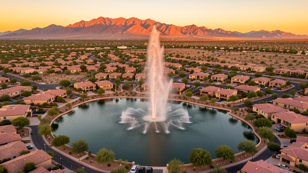
Get Matched With a Local Surveyor
Drone Survey Services Available in Fountain Hills, AZ
Fountain Hills is an affluent community driven by luxury residential development in Eagle Ridge, FireRock, and SunRidge Canyon. Resort and golf course community expansion generates construction demand. The town benefits from proximity to Scottsdale while maintaining a small-town feel. Fort McDowell Yavapai Nation lands and McDowell Mountain Regional Park create airspace constraints.
Drone Surveys for Fountain Hills's Construction Market
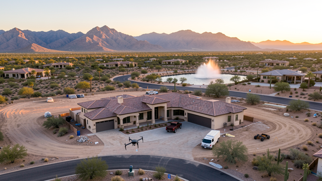
Fountain Hills is an affluent community east of Scottsdale in Maricopa County with a construction market driven by luxury residential development, resort renovations, and golf course community expansion. The town has seen high-end residential development in Eagle Ridge, FireRock Country Club, and the SunRidge Canyon area. Resort and hospitality infrastructure including the Golden Eagle Resort area generates periodic renovation and expansion projects. Commercial development along the Avenue of the Fountains and Shea Boulevard corridor continues. The town benefits from its proximity to Scottsdale and Phoenix while maintaining a small-town feel with the landmark fountain and mountain views. The nearby Fort McDowell Yavapai Nation has gaming and entertainment development projects.
Active Developers in the Area:
Typical Project Costs in Arizona
Cost ranges are based on market data for Phoenix. Actual pricing depends on site size, complexity, and deliverables.
| Service Type | Low End | High End |
|---|---|---|
| Topographic Survey | $1,800 | $4,500 |
| Drone Inspection | $250 | $850 |
| LiDAR Scanning | $2,800 | $8,500 |
| Environmental Monitoring | $800 | $3,200 |
| Aerial Imagery | $175 | $500 |
| Construction Monitoring | $1,200 | $3,200 |
| Real Estate Photography | $175 | $450 |
| Roof Inspection | $225 | $800 |
Local Airspace & Regulations in Fountain Hills, AZ
FAA Part 107 Requirements
All commercial drone operations in Arizona require the pilot to hold an active FAA Part 107 Remote Pilot Certificate. Our network surveyors are verified Part 107 holders.
State Drone Laws
Arizona SB 1449 (2016) was the first state law regulating drone use, prohibiting drone operations that interfere with law enforcement, emergency responders, or wildfire suppression efforts. The law prohibits drone flights within 3 miles of a wildfire or prescribed burn and makes violation a class 1 misdemeanor. ARS Title 13 Chapter 29 Article 3 restricts drone surveillance of private property and weaponization of drones. Commercial operators must hold a valid FAA Part 107 Remote Pilot Certificate. Arizona does not require a separate state drone license, but operators must comply with FAA Part 107 rules and any local ordinances. The Arizona Department of Public Safety maintains guidelines for drone operations near critical infrastructure including power plants, dams, and military installations.
Local Ordinances
Fountain Hills follows Maricopa County regulations for drone operations. Commercial operators must hold FAA Part 107 certification. The town does not have a specific drone ordinance but McDowell Mountain Regional Park prohibits drone takeoff and landing. Flights from private property with owner permission do not require a town permit but must comply with FAA Part 107 rules. The town prohibits drone flights over large public gatherings at Fountain Park during events like the Fountain Hills Great Fair and the St. Patrick Day fountain greening without specific authorization. Fort McDowell Yavapai Nation reservation lands to the east require tribal government permission for drone overflights. The town affluent character means privacy concerns are heightened. HOAs in Fountain Hills, particularly in Eagle Ridge, FireRock, and Fountain Hills Azdlan, may have their own guidelines.
Restricted Airspace
- Class B airspace around Phoenix Sky Harbor (PHX) extends into the western edge of Fountain Hills. LAANC authorization required for commercial drone flights in this zone.
- Class D airspace around Phoenix-Mesa Gateway (IWA) extends into southern Fountain Hills. LAANC authorization required for commercial drone flights in this zone.
- McDowell Mountain Regional Park, directly north of Fountain Hills, prohibits drone takeoff and landing within park boundaries under Maricopa County Parks regulations.
- Fort McDowell Yavapai Nation reservation lands to the east. Drone flights over tribal land require permission from the tribal government.
- The Fountain Hills fountain, one of the world tallest fountains, is a prominent landmark. Drone flights over the fountain lake and Fountain Park during public events require authorization.
Airports in the area: undefined (undefined), undefined (undefined), undefined (undefined)
Why Hire Through Aerius View in Fountain Hills, AZ?
FAA-Certified
Every surveyor holds an active Part 107 Remote Pilot Certificate.
Local to Fountain Hills
Surveyors who know the Arizona airspace and local permitting.
No Cost to Quote
Submit your project at no charge. Pay the surveyor directly if you proceed.
Fast Turnaround
A local surveyor contacts you within 2 business days.
How Our Fountain Hills Matching Process Works
We're actively building our network of FAA-certified drone operators in Fountain Hills, AZ. Here's exactly what happens when you submit a project request.
Submit Your Project
Tell us your site location, acreage, and what you need (topographic survey, LiDAR, inspection, etc.). Takes 60 seconds. No cost, no obligation.
We Match & Vet
We identify Part 107-certified operators in Arizona with the right equipment for your project. Every pilot is verified for active certification, insurance, and relevant experience in Arizona airspace.
You Get Quotes
Matched surveyors contact you within 2 business days with quotes. You compare pricing, timelines, and deliverables, then choose the right fit. You pay the surveyor directly, no markup.
What Deliverables Do You Get?
Every project includes professional-grade deliverables compatible with standard construction and engineering software:
- Orthomosaic maps (GeoTIFF) for site overview and documentation
- Point clouds (LAS/LAZ) for 3D modeling and volumetric analysis
- DEM/DSM terrain models for cut/fill and grade analysis
- Contour lines (DXF/DWG, CAD-ready) for Civil 3D and Revit
- Progress reports with side-by-side comparisons for construction monitoring
- Coordinate systems matched to your project datum (State Plane, UTM, or local)
Insurance & Liability Protection
Pilot Insurance Required
Every operator in our network must carry active liability insurance. Minimum coverage: $1,000,000 general liability. Proof of insurance is verified before any pilot joins the network.
FAA Part 107 Verified
We confirm each pilot's Remote Pilot Certificate is active and in good standing through the FAA Airmen Inquiry system. Expired certificates are flagged automatically.
Equipment Documentation
Pilots list their drone models, sensors (RGB, LiDAR, thermal, multispectral), and payload specs so we can match the right equipment to your project requirements.
Site Safety Coordination
Pilots coordinate with your site superintendent for safe operations on active construction sites, including flight plans that avoid worker areas and equipment zones.
Fountain Hills, AZ Drone Survey FAQs
Do I need a permit for a drone survey in Fountain Hills?
Fountain Hills follows Maricopa County regulations. You need a permit only for flights on public property. Surveys from private property with owner permission do not require a town permit. All commercial operations require FAA Part 107 certification. McDowell Mountain Regional Park prohibits drone takeoff and landing.
Can I fly drones near the Fountain Hills fountain?
The fountain is a prominent landmark at Fountain Park. Drone flights over the fountain lake and park during public events require authorization. The town prohibits drone flights over large public gatherings at the Great Fair and St. Patrick Day events. Always coordinate with the town for any survey work near Fountain Park.
Are there tribal land restrictions near Fountain Hills?
The Fort McDowell Yavapai Nation reservation is to the east of Fountain Hills. Drone flights over tribal land require permission from the Fort McDowell Yavapai tribal government. The reservation has gaming and entertainment development projects. Always verify reservation boundaries before flying.
What are the main construction survey needs in Fountain Hills?
Luxury residential development in Eagle Ridge, FireRock, and SunRidge Canyon, resort renovations, and commercial development along Shea Boulevard are the primary drivers. Golf course community expansion also generates survey demand. The affluent character creates a strong market for high-end real estate aerial photography.
How much does a drone survey cost in Fountain Hills?
Topographic surveys range from $1,800 to $4,500. Roof inspections run $225-$800. Real estate drone photography starts at $175. Luxury home aerial photography in Eagle Ridge and FireRock may command premium pricing. LiDAR scanning for larger or mountainous sites can cost $2,800-$8,500.
Nearby Cities
Are You a Drone Surveyor in Fountain Hills?
Get pre-qualified leads in your service area. No membership fees, no monthly minimums. First lead free.
Ready to Start Your Project in Fountain Hills, AZ?
Get matched with a local, FAA-certified surveyor. No cost, no obligation.
Request a Free Quote