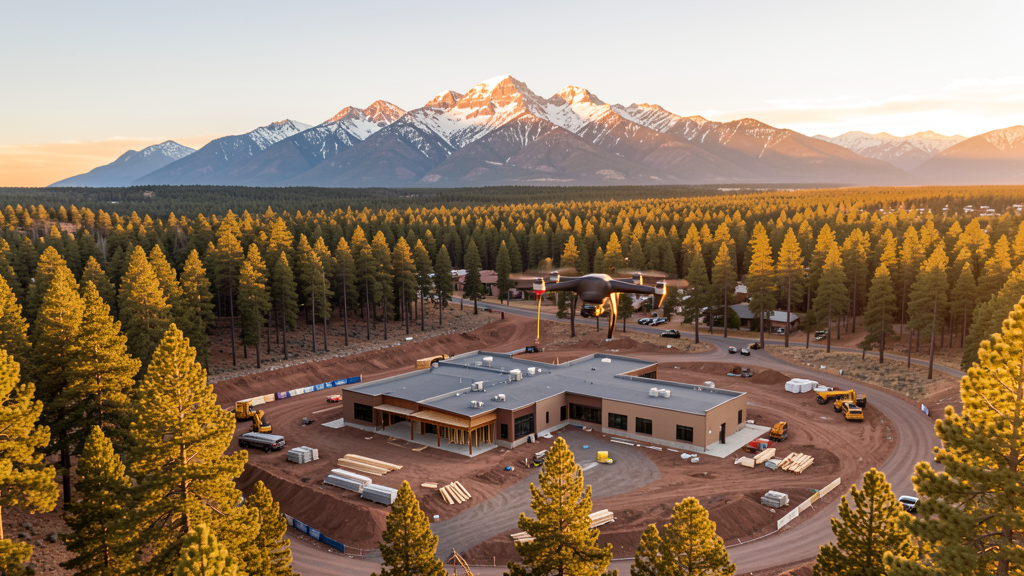
Drone Survey Services in Flagstaff, AZ
From NAU campus expansion and Rio de Flag flood control to downtown revitalization and forest-edge residential development, Flagstaff is a high-altitude mountain city at 6,910 feet where thin air and wilderness boundaries shape every survey mission.
Serving Coconino County & the Flagstaff area
Request a Free Quote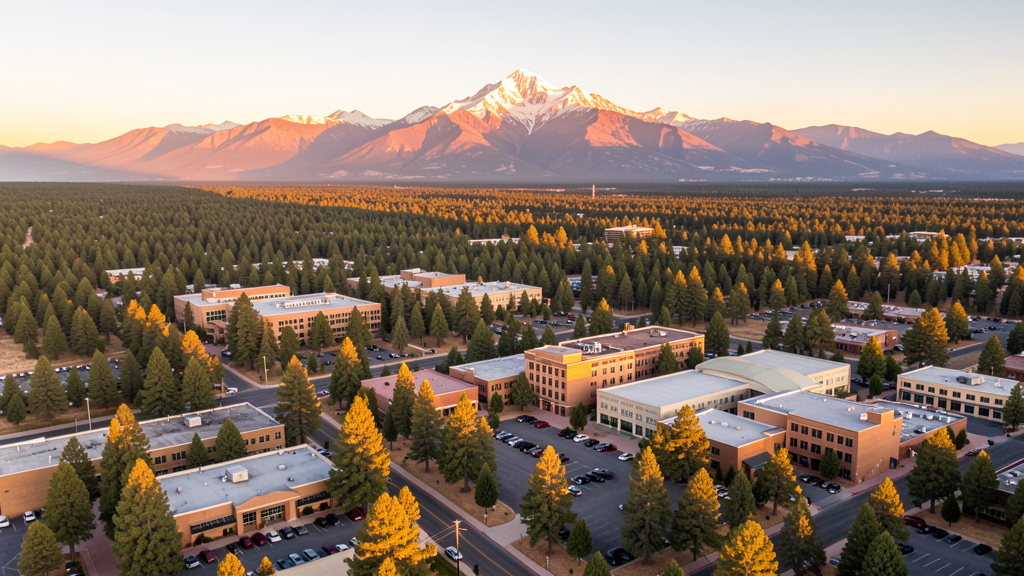
Get Matched With a Local Surveyor
Drone Survey Services Available in Flagstaff, AZ
Flagstaff is driven by Northern Arizona University expansion, tourism infrastructure, and the Flagstaff Medical Center campus. The Rio de Flag flood control project and downtown streetscape improvements are active. High altitude at 6,910 ft significantly impacts drone performance and survey planning.
Drone Surveys for Flagstaff's Construction Market
Flagstaff is a high-altitude mountain city with a construction market driven by Northern Arizona University expansion, tourism infrastructure, and the Flagstaff Medical Center campus. The city has invested in downtown revitalization including the Rio de Flag flood control project and Beaver Street streetscape improvements. Residential development is constrained by forest service land and steep terrain, creating demand for precise topographic surveys. The ski resort and recreation industry drives seasonal construction. Coconino County is investing in water infrastructure and wildfire mitigation projects that require aerial survey and mapping.
Active Developers in the Area:
Typical Project Costs in Arizona
Cost ranges are based on market data for Flagstaff. Actual pricing depends on site size, complexity, and deliverables.
| Service Type | Low End | High End |
|---|---|---|
| Topographic Survey | $2,200 | $5,500 |
| Drone Inspection | $300 | $950 |
| LiDAR Scanning | $3,200 | $9,500 |
| Environmental Monitoring | $900 | $3,800 |
| Aerial Imagery | $200 | $600 |
| Construction Monitoring | $1,400 | $3,800 |
| Real Estate Photography | $200 | $550 |
| Roof Inspection | $275 | $900 |
Local Airspace & Regulations in Flagstaff, AZ
FAA Part 107 Requirements
All commercial drone operations in Arizona require the pilot to hold an active FAA Part 107 Remote Pilot Certificate. Our network surveyors are verified Part 107 holders.
State Drone Laws
Arizona SB 1449 (2016) was the first state law regulating drone use, prohibiting drone operations that interfere with law enforcement, emergency responders, or wildfire suppression efforts. The law prohibits drone flights within 3 miles of a wildfire or prescribed burn and makes violation a class 1 misdemeanor. ARS Title 13 Chapter 29 Article 3 restricts drone surveillance of private property and weaponization of drones. Commercial operators must hold a valid FAA Part 107 Remote Pilot Certificate. Arizona does not require a separate state drone license, but operators must comply with FAA Part 107 rules and any local ordinances. The Arizona Department of Public Safety maintains guidelines for drone operations near critical infrastructure including power plants, dams, and military installations.
Local Ordinances
Flagstaff requires a commercial drone permit for operations taking off or landing on city-owned property, including parks and recreation areas. The Flagstaff Parks and Recreation Department issues permits for commercial drone flights. Flights from private property with owner permission do not require a city permit but must comply with FAA Part 107 rules. Flagstaff Pulliam Airport airspace coordination is managed through LAANC. The city prohibits drone flights over large public gatherings at Northern Arizona University events and the Coconino County Fairgrounds without specific authorization. Winter operations require additional planning for snow and cold temperatures affecting battery performance.
Restricted Airspace
- Class D airspace around Flagstaff Pulliam Airport (FLG) — extends 4 nautical miles, surface to 8,000 ft MSL. LAANC authorization required for commercial drone flights within this zone.
- San Francisco Peaks Wilderness Area — designated wilderness where drone flights are prohibited by the US Forest Service. Includes Humphreys Peak, the highest point in Arizona at 12,633 ft.
- Coconino National Forest surrounds Flagstaff. While not all forest areas prohibit drones, designated wilderness areas within the forest do. Operators should verify boundaries before flying.
- Navajo Army Depot and Camp Navajo military installation, 10 miles west of Flagstaff, has restricted military airspace. Drone flights within 5 miles require coordination with base operations.
- High-altitude operations: Flagstaff sits at 6,910 ft elevation. Drone performance is significantly reduced due to thinner air. Flight times are typically 20-25% shorter than at sea level, and payload capacity is reduced. Density altitude calculations are critical.
Airports in the area: undefined (undefined), undefined (undefined), undefined (undefined)
Why Hire Through Aerius View in Flagstaff, AZ?
FAA-Certified
Every surveyor holds an active Part 107 Remote Pilot Certificate.
Local to Flagstaff
Surveyors who know the Arizona airspace and local permitting.
No Cost to Quote
Submit your project at no charge. Pay the surveyor directly if you proceed.
Fast Turnaround
A local surveyor contacts you within 2 business days.
How Our Flagstaff Matching Process Works
We're actively building our network of FAA-certified drone operators in Flagstaff, AZ. Here's exactly what happens when you submit a project request.
Submit Your Project
Tell us your site location, acreage, and what you need (topographic survey, LiDAR, inspection, etc.). Takes 60 seconds. No cost, no obligation.
We Match & Vet
We identify Part 107-certified operators in Arizona with the right equipment for your project. Every pilot is verified for active certification, insurance, and relevant experience in Arizona airspace.
You Get Quotes
Matched surveyors contact you within 2 business days with quotes. You compare pricing, timelines, and deliverables, then choose the right fit. You pay the surveyor directly, no markup.
What Deliverables Do You Get?
Every project includes professional-grade deliverables compatible with standard construction and engineering software:
- Orthomosaic maps (GeoTIFF) for site overview and documentation
- Point clouds (LAS/LAZ) for 3D modeling and volumetric analysis
- DEM/DSM terrain models for cut/fill and grade analysis
- Contour lines (DXF/DWG, CAD-ready) for Civil 3D and Revit
- Progress reports with side-by-side comparisons for construction monitoring
- Coordinate systems matched to your project datum (State Plane, UTM, or local)
Insurance & Liability Protection
Pilot Insurance Required
Every operator in our network must carry active liability insurance. Minimum coverage: $1,000,000 general liability. Proof of insurance is verified before any pilot joins the network.
FAA Part 107 Verified
We confirm each pilot's Remote Pilot Certificate is active and in good standing through the FAA Airmen Inquiry system. Expired certificates are flagged automatically.
Equipment Documentation
Pilots list their drone models, sensors (RGB, LiDAR, thermal, multispectral), and payload specs so we can match the right equipment to your project requirements.
Site Safety Coordination
Pilots coordinate with your site superintendent for safe operations on active construction sites, including flight plans that avoid worker areas and equipment zones.
Flagstaff, AZ Drone Survey FAQs
Do I need a permit for a drone survey in Flagstaff?
You need a commercial drone permit only if you plan to take off or land on city-owned property, including parks. Surveys conducted from private property with owner permission do not require a Flagstaff city permit. All commercial drone operations require an FAA Part 107 Remote Pilot Certificate.
How does Flagstaff high altitude affect drone operations?
Flagstaff sits at 6,910 feet elevation, meaning significantly thinner air than sea level. Flight times are typically 20-25% shorter, payload capacity is reduced, and density altitude calculations are critical. Our local surveyors select equipment rated for high-altitude operations and plan missions accordingly.
Can drones fly near Northern Arizona University?
Drone flights over NAU campus and large public gatherings at university events require specific authorization. The campus is within 5 miles of downtown Flagstaff. Commercial operators should coordinate with NAU security for any survey work adjacent to campus property.
Are there wilderness area restrictions near Flagstaff?
Yes. The San Francisco Peaks Wilderness Area, including Humphreys Peak, prohibits drone flights. Coconino National Forest surrounds Flagstaff, and designated wilderness areas within the forest prohibit drone operations. Operators must verify Forest Service boundaries before flying.
Can I fly drones near Camp Navajo military installation?
Camp Navajo, 10 miles west of Flagstaff, has restricted military airspace. Drone flights within 5 miles of the installation require prior coordination with base operations. The Arizona Army National Guard maintains active training operations at this facility.
How much does a drone survey cost in Flagstaff?
Costs are slightly higher than Phoenix or Tucson due to altitude and terrain challenges. Topographic surveys range from $2,200 to $5,500. LiDAR scanning for mountainous sites can cost $3,200-$9,500. Roof inspections run $275-$900. The high altitude and forested terrain increase operational complexity.
Nearby Cities
Are You a Drone Surveyor in Flagstaff?
Get pre-qualified leads in your service area. No membership fees, no monthly minimums. First lead free.
Ready to Start Your Project in Flagstaff, AZ?
Get matched with a local, FAA-certified surveyor. No cost, no obligation.
Request a Free Quote